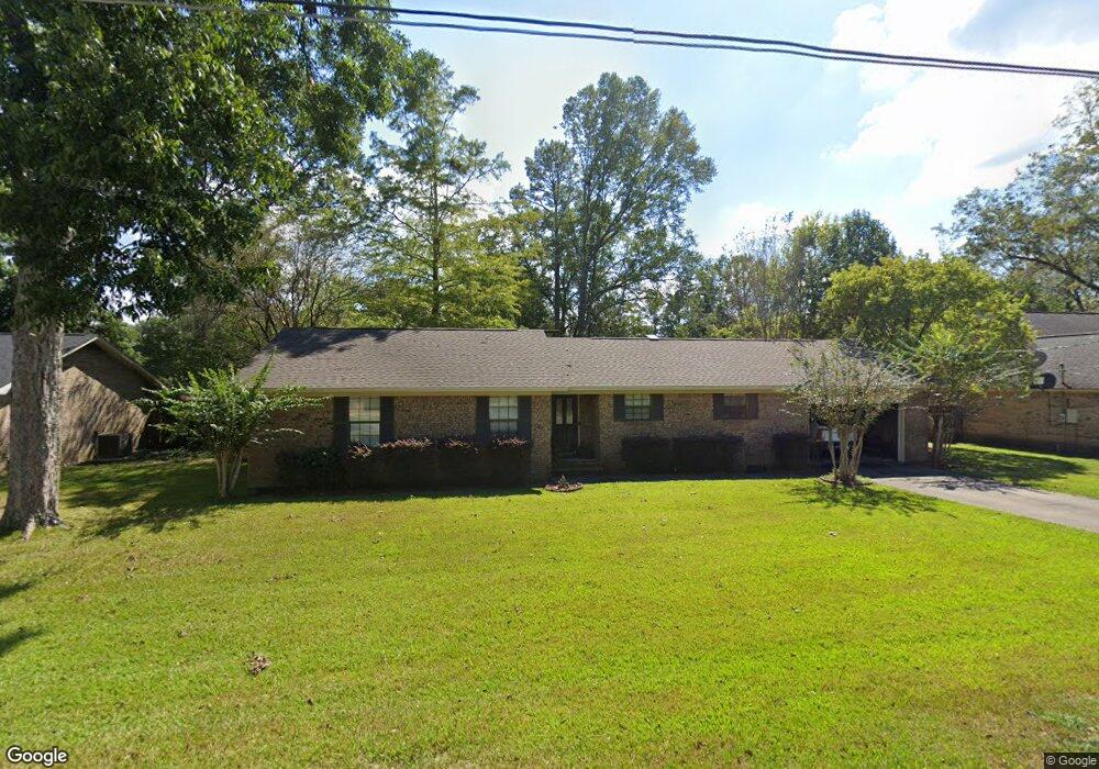
302 Briarwood Dr Brewton, AL 36426
Estimated Value: $186,227 - $245,000
3
Beds
2
Baths
1,800
Sq Ft
$117/Sq Ft
Est. Value
About This Home
This home is located at 302 Briarwood Dr, Brewton, AL 36426 and is currently estimated at $211,057, approximately $117 per square foot. 302 Briarwood Dr is a home located in Escambia County with nearby schools including Brewton Elementary School, Brewton Middle School, and TR Miller High School.
Ownership History
Date
Name
Owned For
Owner Type
Purchase Details
Closed on
Jul 28, 2021
Sold by
Holmes Philip A
Bought by
Pebbles Billy Beth
Current Estimated Value
Purchase Details
Closed on
Dec 2, 2015
Sold by
Secretary Of Housing And Urban Developme
Bought by
Holmes Philip A and Holmes Stefanie
Home Financials for this Owner
Home Financials are based on the most recent Mortgage that was taken out on this home.
Original Mortgage
$84,800
Interest Rate
3.91%
Mortgage Type
New Conventional
Purchase Details
Closed on
Jul 15, 2015
Sold by
Regions Bank Dba Regions Mortgage
Bought by
Secretary Of Housing And Urban Developme
Purchase Details
Closed on
Apr 23, 2008
Sold by
Ellis Donna Huff
Bought by
Mullen Harry E and Mullen Susie M
Home Financials for this Owner
Home Financials are based on the most recent Mortgage that was taken out on this home.
Original Mortgage
$144,728
Interest Rate
5.82%
Create a Home Valuation Report for This Property
The Home Valuation Report is an in-depth analysis detailing your home's value as well as a comparison with similar homes in the area
Home Values in the Area
Average Home Value in this Area
Purchase History
| Date | Buyer | Sale Price | Title Company |
|---|---|---|---|
| Pebbles Billy Beth | $155,000 | -- | |
| Holmes Philip A | $106,000 | -- | |
| Secretary Of Housing And Urban Developme | $107,940 | -- | |
| Mullen Harry E | -- | -- |
Source: Public Records
Mortgage History
| Date | Status | Borrower | Loan Amount |
|---|---|---|---|
| Previous Owner | Holmes Philip A | $84,800 | |
| Previous Owner | Mullen Harry E | $144,728 |
Source: Public Records
Tax History Compared to Growth
Tax History
| Year | Tax Paid | Tax Assessment Tax Assessment Total Assessment is a certain percentage of the fair market value that is determined by local assessors to be the total taxable value of land and additions on the property. | Land | Improvement |
|---|---|---|---|---|
| 2024 | $1,353 | $27,060 | $0 | $0 |
| 2023 | $1,353 | $36,420 | $0 | $0 |
| 2022 | $1,353 | $25,780 | $0 | $0 |
| 2021 | $596 | $12,900 | $0 | $0 |
| 2020 | $545 | $11,880 | $0 | $0 |
| 2019 | $545 | $11,880 | $0 | $0 |
| 2018 | $545 | $11,880 | $0 | $0 |
| 2017 | $563 | $12,240 | $0 | $0 |
| 2015 | -- | $12,290 | $1,500 | $10,790 |
| 2014 | -- | $12,570 | $1,500 | $11,070 |
Source: Public Records
Map
Nearby Homes
- 110 Lynbrook Dr
- 104 Rosemary Ave
- 105 Avalon St
- 1612 Brookwood Dr
- 106 Terry Dr
- 1606 Bonita Ave
- 700 Liles Blvd Unit LOTS 1,2,3BLK8
- 1400 Belleville Ave
- 104 Fairway Dr
- 110 Woodmere Dr
- 2103 Wildwood Dr
- 0 Martin Luther King Dr
- 1508 Poplar Ave
- 105 Longleaf Ln
- 1515 Poplar Ave
- 1415 Poplar Ave
- 3051 U S Highway 31
- 698 Garrett St
- 1132 Saint Nicholas Ave
- 722 Conoley Ave