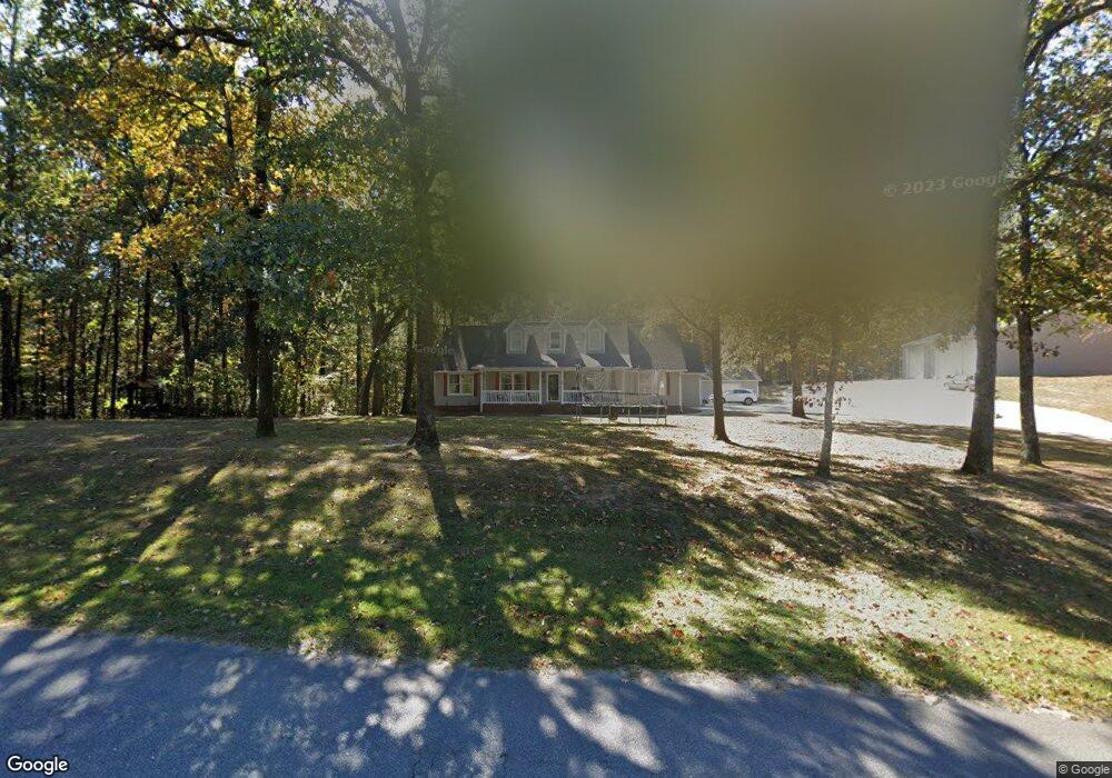
302 Chestnut Ln Alabaster, AL 35007
Estimated Value: $392,012 - $482,000
Studio
2
Baths
2,242
Sq Ft
$191/Sq Ft
Est. Value
About This Home
This home is located at 302 Chestnut Ln, Alabaster, AL 35007 and is currently estimated at $427,253, approximately $190 per square foot. 302 Chestnut Ln is a home located in Shelby County with nearby schools including Thompson Intermediate School, Thompson Middle School, and Thompson High School.
Ownership History
Date
Name
Owned For
Owner Type
Purchase Details
Closed on
Dec 23, 2003
Sold by
Smith Victor L and Smith Deborah W
Bought by
Sutton Randall E and Sutton Teenya N
Current Estimated Value
Home Financials for this Owner
Home Financials are based on the most recent Mortgage that was taken out on this home.
Original Mortgage
$152,000
Interest Rate
6.05%
Mortgage Type
Unknown
Purchase Details
Closed on
Jan 23, 2003
Sold by
Smith Victor L
Bought by
Smith Deborah W
Home Financials for this Owner
Home Financials are based on the most recent Mortgage that was taken out on this home.
Original Mortgage
$141,600
Interest Rate
5.95%
Purchase Details
Closed on
Dec 16, 1999
Sold by
Smith Victor L and Milstead Deborah W
Bought by
Smith Victor L and Milstead Deborah W
Home Financials for this Owner
Home Financials are based on the most recent Mortgage that was taken out on this home.
Original Mortgage
$33,000
Interest Rate
7.67%
Mortgage Type
Stand Alone Second
Create a Home Valuation Report for This Property
The Home Valuation Report is an in-depth analysis detailing your home's value as well as a comparison with similar homes in the area
Home Values in the Area
Average Home Value in this Area
Purchase History
| Date | Buyer | Sale Price | Title Company |
|---|---|---|---|
| Sutton Randall E | $190,000 | -- | |
| Smith Deborah W | -- | Central Alabama Title | |
| Smith Victor L | -- | -- |
Source: Public Records
Mortgage History
| Date | Status | Borrower | Loan Amount |
|---|---|---|---|
| Closed | Sutton Randall E | $152,000 | |
| Closed | Smith Deborah W | $141,600 | |
| Closed | Smith Victor L | $33,000 |
Source: Public Records
Tax History
| Year | Tax Paid | Tax Assessment Tax Assessment Total Assessment is a certain percentage of the fair market value that is determined by local assessors to be the total taxable value of land and additions on the property. | Land | Improvement |
|---|---|---|---|---|
| 2024 | $2,137 | $39,580 | $0 | $0 |
| 2023 | $1,914 | $36,200 | $0 | $0 |
| 2022 | $1,345 | $25,660 | $0 | $0 |
| 2021 | $1,231 | $23,560 | $0 | $0 |
| 2020 | $1,206 | $23,100 | $0 | $0 |
| 2019 | $1,155 | $22,140 | $0 | $0 |
| 2017 | $1,025 | $19,740 | $0 | $0 |
| 2015 | $987 | $19,040 | $0 | $0 |
| 2014 | $964 | $18,620 | $0 | $0 |
Source: Public Records
Map
Nearby Homes
- 101 Forest Hills Terrace
- 314 Forest Hills Ln
- 100 Riviera Run
- 145 Chestnut Dr
- 200 Riviera Run
- 300 Lenoir Place
- 140 Riviera Run
- 150 Chestnut Dr
- 123 Wooten Rd
- 770 Highway 31 S
- 1009 Canvasback Way
- 1507 Mitch Ln
- 307 Fran Ln
- 1509 Mitch Ln
- 1511 Mitch Ln
- 1513 Mitch Ln
- 420 Harless Ln
- 2041 Lonesome Hen Ln
- 1718 Fulton Springs Rd
- 1052 Gadwall Dr
- 304 Chestnut Ln
- 305 Chestnut Ln
- 117 Chestnut Dr
- 307 Chestnut Ln
- 202 Chestnut Cir
- 308 Chestnut Ln
- 200 Chestnut Cir
- 119 Chestnut Dr
- 310 Chestnut Ln
- 309 Chestnut Ln
- 301 Chestnut Ln
- 312 Chestnut Ln
- 203 Chestnut Cir
- 112 Chestnut Dr
- 205 Chestnut Cir
- 201 Chestnut Cir
- 110 Chestnut Dr
- 207 Chestnut Cir
- 314 Chestnut Ln
- 206 Chestnut Cir
Your Personal Tour Guide
Ask me questions while you tour the home.