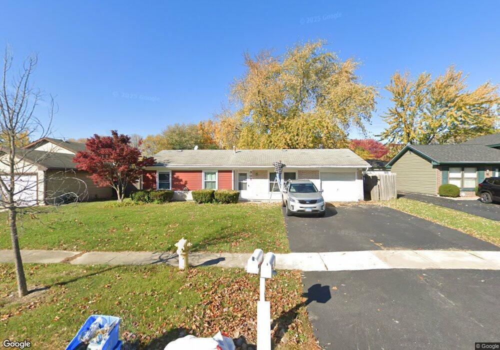
302 Dean Cir Bolingbrook, IL 60440
East Bolingbrook NeighborhoodEstimated Value: $255,158 - $302,000
3
Beds
1
Bath
1,133
Sq Ft
$251/Sq Ft
Est. Value
About This Home
This home is located at 302 Dean Cir, Bolingbrook, IL 60440 and is currently estimated at $284,290, approximately $250 per square foot. 302 Dean Cir is a home located in Will County with nearby schools including Oak View Elementary School, Bolingbrook High School, and Midwest Christian Montessori Academy.
Ownership History
Date
Name
Owned For
Owner Type
Purchase Details
Closed on
Jun 6, 2003
Sold by
Klekamp Janet M
Bought by
Signore Rick and Sosseur Richelle
Current Estimated Value
Home Financials for this Owner
Home Financials are based on the most recent Mortgage that was taken out on this home.
Original Mortgage
$119,900
Outstanding Balance
$52,408
Interest Rate
5.75%
Mortgage Type
Purchase Money Mortgage
Estimated Equity
$231,882
Purchase Details
Closed on
May 26, 2000
Sold by
Klekamp Thomas
Bought by
Klekamp Janet
Create a Home Valuation Report for This Property
The Home Valuation Report is an in-depth analysis detailing your home's value as well as a comparison with similar homes in the area
Home Values in the Area
Average Home Value in this Area
Purchase History
| Date | Buyer | Sale Price | Title Company |
|---|---|---|---|
| Signore Rick | $150,000 | -- | |
| Klekamp Janet | -- | -- |
Source: Public Records
Mortgage History
| Date | Status | Borrower | Loan Amount |
|---|---|---|---|
| Open | Signore Rick | $119,900 | |
| Closed | Signore Rick | $30,000 |
Source: Public Records
Tax History
| Year | Tax Paid | Tax Assessment Tax Assessment Total Assessment is a certain percentage of the fair market value that is determined by local assessors to be the total taxable value of land and additions on the property. | Land | Improvement |
|---|---|---|---|---|
| 2024 | $6,612 | $79,598 | $18,115 | $61,483 |
| 2023 | $6,612 | $71,619 | $16,299 | $55,320 |
| 2022 | $5,664 | $63,302 | $14,406 | $48,896 |
| 2021 | $5,355 | $59,189 | $13,470 | $45,719 |
| 2020 | $5,183 | $57,243 | $13,027 | $44,216 |
| 2019 | $5,006 | $54,517 | $12,407 | $42,110 |
| 2018 | $4,637 | $50,649 | $11,526 | $39,123 |
| 2017 | $4,403 | $48,008 | $10,925 | $37,083 |
| 2016 | $4,263 | $45,700 | $10,400 | $35,300 |
| 2015 | $4,017 | $43,900 | $10,000 | $33,900 |
| 2014 | $4,017 | $42,200 | $9,600 | $32,600 |
| 2013 | $4,017 | $44,400 | $10,100 | $34,300 |
Source: Public Records
Map
Nearby Homes
- 13 Marywood Ln Unit C
- 230 Delaware Dr
- 265 Cobb Cir
- 369 Lakeview Cir
- 3 Merrimack Ct
- 419 Lakeview Cir
- 141 W Robinhood Way Unit 141
- 336 Ozark Dr
- 112 Brook Ct
- 226 Grant Dr
- 151 E Boughton Rd
- 228 Elkhorn Ct Unit B
- 227 Elkhorn Ct Unit D
- 127 Monticello Cir
- BUILDING 14 Ridge Ln
- 456 Ridge Ln
- 460 Ridge Ln
- 462 Ridge Ln
- 130 Jerome Ln Unit 3
- 153 Camelot Way
- 300 Dean Cir
- 306 Dean Cir
- 303 Dean Cir
- 301 Dean Cir
- 305 Dean Cir
- 401 Delaware Cir
- 308 Dean Cir
- 8C Marywood Ln
- 307 Dean Cir
- 11C Marywood Ln
- 11 Marywood Ln Unit C
- 7C Marywood Ln Unit 1
- 6 Roanoke Ct
- 9C Marywood Ln Unit C
- 9C Marywood Ln
- 9C Marywood Ln Unit 2
- 12C Marywood Ln Unit 6
- 10C Marywood Ln
- 330 Dean Cir
- 328 Dean Cir
Your Personal Tour Guide
Ask me questions while you tour the home.