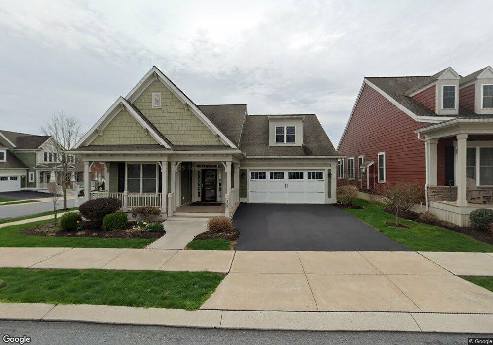
302 Declaration Ave Ephrata, PA 17522
Estimated Value: $513,220 - $622,000
2
Beds
2
Baths
2,362
Sq Ft
$245/Sq Ft
Est. Value
About This Home
This home is located at 302 Declaration Ave, Ephrata, PA 17522 and is currently estimated at $578,305, approximately $244 per square foot. 302 Declaration Ave is a home with nearby schools including Ephrata Intermediate School, Clay Elementary School, and Ephrata Senior High School.
Ownership History
Date
Name
Owned For
Owner Type
Purchase Details
Closed on
Aug 25, 2014
Sold by
Lincoln Land Group Inc
Bought by
Mailey Margaret A and Rombach Rhonda L
Current Estimated Value
Home Financials for this Owner
Home Financials are based on the most recent Mortgage that was taken out on this home.
Original Mortgage
$125,000
Outstanding Balance
$40,395
Interest Rate
4.12%
Mortgage Type
New Conventional
Estimated Equity
$537,910
Create a Home Valuation Report for This Property
The Home Valuation Report is an in-depth analysis detailing your home's value as well as a comparison with similar homes in the area
Home Values in the Area
Average Home Value in this Area
Purchase History
| Date | Buyer | Sale Price | Title Company |
|---|---|---|---|
| Mailey Margaret A | $305,333 | None Available |
Source: Public Records
Mortgage History
| Date | Status | Borrower | Loan Amount |
|---|---|---|---|
| Open | Mailey Margaret A | $125,000 |
Source: Public Records
Tax History
| Year | Tax Paid | Tax Assessment Tax Assessment Total Assessment is a certain percentage of the fair market value that is determined by local assessors to be the total taxable value of land and additions on the property. | Land | Improvement |
|---|---|---|---|---|
| 2025 | $7,308 | $319,100 | $87,300 | $231,800 |
| 2024 | $7,308 | $319,100 | $87,300 | $231,800 |
| 2023 | $7,119 | $319,100 | $87,300 | $231,800 |
| 2022 | $6,957 | $319,100 | $87,300 | $231,800 |
| 2021 | $6,807 | $319,100 | $87,300 | $231,800 |
| 2020 | $6,807 | $319,100 | $87,300 | $231,800 |
| 2019 | $6,711 | $319,100 | $87,300 | $231,800 |
| 2018 | $5,281 | $319,100 | $87,300 | $231,800 |
| 2017 | $6,639 | $260,500 | $42,200 | $218,300 |
| 2016 | $6,639 | $260,500 | $42,200 | $218,300 |
| 2015 | $1,312 | $260,500 | $42,200 | $218,300 |
| 2014 | $745 | $38,000 | $38,000 | $0 |
Source: Public Records
Map
Nearby Homes
- 308 Liberty St
- 00 Morning Dr
- 120 Morning Dr
- 517 Foggy Bottom Rd
- 131 Sunrise Ln
- 144 Sunrise Ln
- 154 Sunrise Ln
- 239 Kimberly Ln
- 202 Roosevelt Cir
- 56 Tyler Dr
- 5 Moccasin Dr
- 85 Wissler Rd
- 2002 W Main St Unit 74
- 2002 W Main St Unit 63
- 147 Fieldcrest Ln Unit 105
- 129 Meadow Valley Rd Unit 11
- 637 W Main St
- 105 Martin Ave
- 100 Lilly Dr
- 46 Mollie Dr
- 306 Declaration Ave
- 560 Constitution Dr
- 310 Declaration Ave
- 0 Harmony Dr Unit 10 1004574655
- 0 Harmony Dr Unit 153961
- 573 Constitution Dr Unit 13
- 573 Constitution Dr Unit 4
- 301 Declaration Ave
- 556 Constitution Dr
- 569 Constitution Dr
- 314 Declaration Ave
- 314 Declaration Ave Unit 96
- 305 Declaration Ave
- 565 Constitution Dr
- 501 Nathan Dr
- 552 Constitution Dr
- 309 Declaration Ave
- 505 Nathan Dr
- 313 Declaration Ave
- 561 Constitution Dr
Your Personal Tour Guide
Ask me questions while you tour the home.