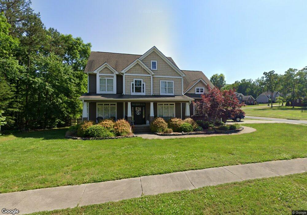
302 Delancy St Locust, NC 28097
Estimated Value: $485,357 - $610,000
4
Beds
3
Baths
2,850
Sq Ft
$191/Sq Ft
Est. Value
About This Home
This home is located at 302 Delancy St, Locust, NC 28097 and is currently estimated at $543,589, approximately $190 per square foot. 302 Delancy St is a home located in Stanly County with nearby schools including Locust Elementary School, West Stanly Middle School, and West Stanly High School.
Ownership History
Date
Name
Owned For
Owner Type
Purchase Details
Closed on
Dec 18, 2012
Sold by
Huneycutt Bradley S and Huneycutt Cynthia
Bought by
Graves Anthony W
Current Estimated Value
Purchase Details
Closed on
Jul 21, 2006
Sold by
Country Homes Llc
Bought by
American General Development Llc
Home Financials for this Owner
Home Financials are based on the most recent Mortgage that was taken out on this home.
Original Mortgage
$236,700
Interest Rate
6.54%
Mortgage Type
Future Advance Clause Open End Mortgage
Create a Home Valuation Report for This Property
The Home Valuation Report is an in-depth analysis detailing your home's value as well as a comparison with similar homes in the area
Home Values in the Area
Average Home Value in this Area
Purchase History
| Date | Buyer | Sale Price | Title Company |
|---|---|---|---|
| Graves Anthony W | $280,000 | None Available | |
| American General Development Llc | $60,000 | None Available |
Source: Public Records
Mortgage History
| Date | Status | Borrower | Loan Amount |
|---|---|---|---|
| Previous Owner | American General Development Llc | $236,700 |
Source: Public Records
Tax History
| Year | Tax Paid | Tax Assessment Tax Assessment Total Assessment is a certain percentage of the fair market value that is determined by local assessors to be the total taxable value of land and additions on the property. | Land | Improvement |
|---|---|---|---|---|
| 2025 | $4,105 | $446,151 | $65,000 | $381,151 |
| 2024 | $3,366 | $308,792 | $35,000 | $273,792 |
| 2023 | $3,486 | $308,792 | $35,000 | $273,792 |
| 2022 | $3,455 | $308,792 | $35,000 | $273,792 |
| 2021 | $3,424 | $308,792 | $35,000 | $273,792 |
| 2020 | $3,138 | $269,877 | $23,000 | $246,877 |
| 2019 | $3,170 | $269,877 | $23,000 | $246,877 |
| 2018 | $3,050 | $269,877 | $23,000 | $246,877 |
| 2017 | $3,050 | $269,877 | $23,000 | $246,877 |
| 2016 | $2,940 | $260,198 | $21,500 | $238,698 |
| 2015 | $3,050 | $260,198 | $21,500 | $238,698 |
| 2014 | $3,095 | $260,198 | $21,500 | $238,698 |
Source: Public Records
Map
Nearby Homes
- 206 Delancy St
- 213 Delancy St
- 319 N Central Ave
- 111 Amber Glen Dr
- 201 Amber Glen Dr
- 117 Danita Dr
- 106 Marlwood Dr
- 205 Amber Glen Dr
- 211 Amber Glen Dr
- 201 N Beverly Dr
- 217 Amber Glen Dr
- 226 Amber Glen Dr
- 221 Amber Glen Dr
- 225 Amber Glen Dr
- 230 Amber Glen Dr
- 229 Amber Glen Dr
- 234 Amber Glen Dr
- 233 Amber Glen Dr
- 238 Amber Glen Dr
- 237 Amber Glen Dr
- 120 Vanderbilt Cir
- 0000 Vanderbilt Blvd
- 306 Delancy St Unit 17
- 118 Vanderbilt Cir Unit 13
- 202 Vanderbilt Cir
- 303 Delancy St
- 303 Delancy St Unit 20
- 212 Delancy St Unit 60
- 212 Delancy St
- 305 Delancy St
- 305 Delancy St Unit 19
- 109 Vanderbilt Cir
- 116 Vanderbilt Cir
- 307 Delancy St
- 210 Delancy St
- 204 Vanderbilt Blvd
- 203 Vanderbilt Cir
- 208 Vanderbilt Cir Unit 24
- 211 Delancy St
- 201 Vanderbilt Blvd Unit 39
Your Personal Tour Guide
Ask me questions while you tour the home.