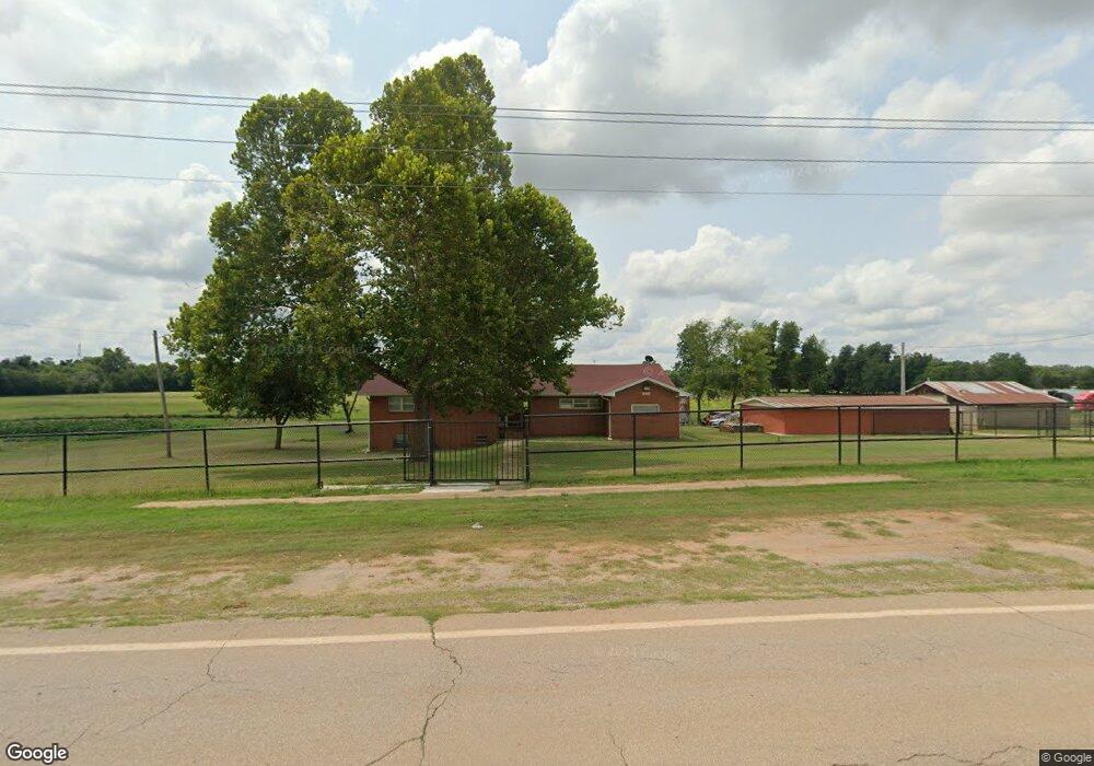
302 E Franklin Rd Norman, OK 73071
Northeast Norman NeighborhoodEstimated Value: $455,000 - $594,000
3
Beds
3
Baths
3,000
Sq Ft
$177/Sq Ft
Est. Value
About This Home
This home is located at 302 E Franklin Rd, Norman, OK 73071 and is currently estimated at $531,012, approximately $177 per square foot. 302 E Franklin Rd is a home located in Cleveland County with nearby schools including Eisenhower Elementary School, Longfellow Middle School, and Norman North High School.
Ownership History
Date
Name
Owned For
Owner Type
Purchase Details
Closed on
Mar 17, 2021
Sold by
Stuart Fred W and Stuart Patricia A
Bought by
Sandhu Ramzan and Sandhu Nasreen
Current Estimated Value
Purchase Details
Closed on
Jun 9, 2006
Sold by
Pugh Parolee
Bought by
Stuart Fred W and Stuart Patricia A
Home Financials for this Owner
Home Financials are based on the most recent Mortgage that was taken out on this home.
Original Mortgage
$34,200
Interest Rate
6.56%
Mortgage Type
Stand Alone Second
Create a Home Valuation Report for This Property
The Home Valuation Report is an in-depth analysis detailing your home's value as well as a comparison with similar homes in the area
Home Values in the Area
Average Home Value in this Area
Purchase History
| Date | Buyer | Sale Price | Title Company |
|---|---|---|---|
| Sandhu Ramzan | $430,000 | First Rate Title Llc | |
| Stuart Fred W | $228,000 | None Available | |
| Stuart Fred W | -- | None Available |
Source: Public Records
Mortgage History
| Date | Status | Borrower | Loan Amount |
|---|---|---|---|
| Previous Owner | Stuart Fred W | $34,200 | |
| Previous Owner | Stuart Fred W | $182,400 |
Source: Public Records
Tax History Compared to Growth
Tax History
| Year | Tax Paid | Tax Assessment Tax Assessment Total Assessment is a certain percentage of the fair market value that is determined by local assessors to be the total taxable value of land and additions on the property. | Land | Improvement |
|---|---|---|---|---|
| 2024 | $1,405 | $13,042 | $576 | $12,466 |
| 2023 | $1,362 | $12,662 | $830 | $11,832 |
| 2022 | $1,360 | $12,662 | $830 | $11,832 |
| 2021 | $928 | $8,489 | $556 | $7,933 |
| 2020 | $909 | $8,241 | $540 | $7,701 |
| 2019 | $891 | $8,001 | $524 | $7,477 |
| 2018 | $832 | $7,769 | $510 | $7,259 |
| 2017 | $810 | $12,663 | $0 | $0 |
| 2016 | $779 | $7,322 | $480 | $6,842 |
| 2015 | $755 | $7,109 | $466 | $6,643 |
| 2014 | $726 | $6,902 | $452 | $6,450 |
Source: Public Records
Map
Nearby Homes
- 614 Little River Rd
- 4001 Yellowstone Dr
- 3923 Yellowstone Dr
- 3919 Yellowstone Dr
- 717 Havasu Dr
- 601 Havasu Dr
- 708 Havasu Dr
- Preston Plan at Pine Creek
- Collin Plan at Pine Creek
- Drew Plan at Pine Creek
- Nellie Plan at Pine Creek
- Charli Plan at Pine Creek
- Teagan Plan at Pine Creek
- Baker Plan at Pine Creek
- Colt Plan at Pine Creek
- 411 Campfire Ln
- 1009 Mount Irving Way
- 3804 Mesa
- 3805 Yellowstone Dr
- 3807 Mesa
- 4701 N Porter Ave
- 703 Little River Rd
- 603 Little River Rd
- 713 Little River Rd
- 704 Little River Rd
- 810 Little River Rd
- 4208 8th Ave NE
- 4702 N Porter Ave
- 4710 N Porter Ave
- 811 Little River Rd
- 4500 12th Ave NE
- 201 W Franklin Rd
- 5000 N Porter Ave
- 200 W Franklin Rd
- 4114 8th Avenue Ave NE
- 821 River View Dr
- 5194 N Porter Ave
- 815 River View Dr
- 805 River View Dr