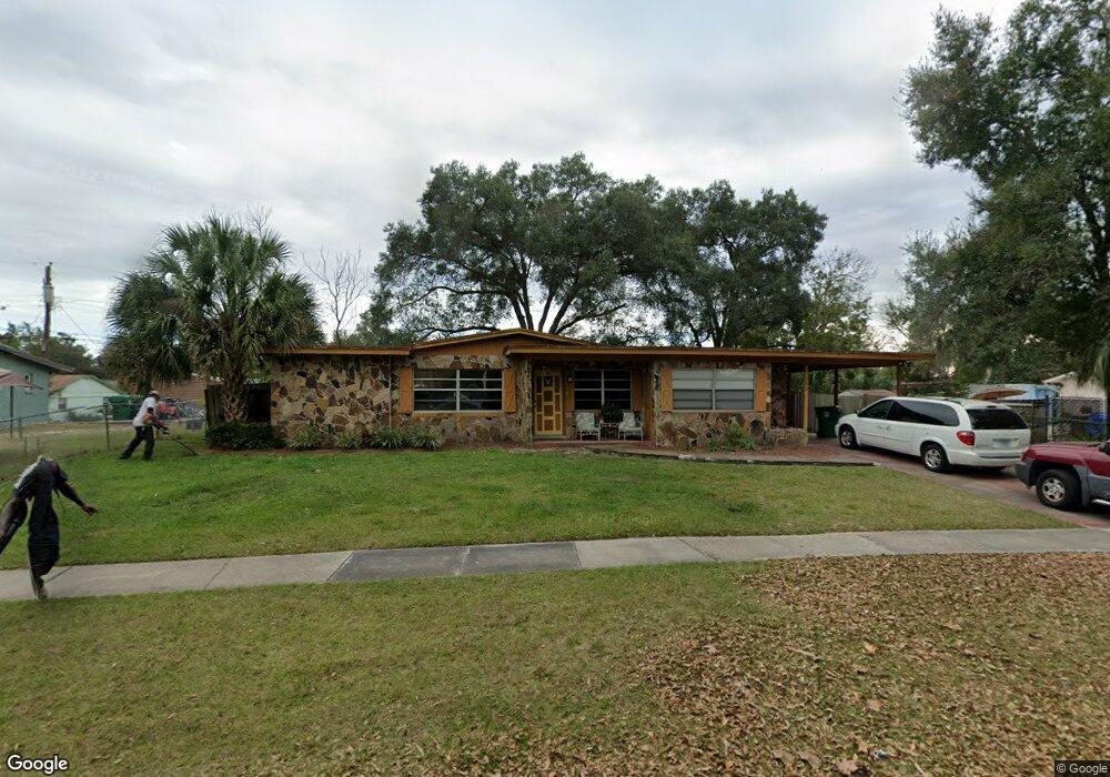
302 E Hubbard Ave Deland, FL 32724
Estimated Value: $189,000 - $255,489
3
Beds
2
Baths
1,436
Sq Ft
$148/Sq Ft
Est. Value
About This Home
This home is located at 302 E Hubbard Ave, Deland, FL 32724 and is currently estimated at $212,622, approximately $148 per square foot. 302 E Hubbard Ave is a home located in Volusia County with nearby schools including Deland High School, Freedom Elementary School, and Deland Middle School.
Ownership History
Date
Name
Owned For
Owner Type
Purchase Details
Closed on
Jun 27, 2025
Sold by
Highpoint Holdings Group Llc
Bought by
Goldstein & Young Enterprises Llc
Current Estimated Value
Home Financials for this Owner
Home Financials are based on the most recent Mortgage that was taken out on this home.
Original Mortgage
$147,750
Outstanding Balance
$147,500
Interest Rate
6.86%
Mortgage Type
New Conventional
Estimated Equity
$65,122
Purchase Details
Closed on
Nov 25, 2005
Sold by
Goodwin Gregory L
Bought by
Fulmore Ron
Home Financials for this Owner
Home Financials are based on the most recent Mortgage that was taken out on this home.
Original Mortgage
$144,000
Interest Rate
1.95%
Mortgage Type
Negative Amortization
Purchase Details
Closed on
Nov 11, 2005
Sold by
Meyer Goodwin Rhonda G and Meyer Goodwin Rhonda C
Bought by
Goodwin Gregory L
Home Financials for this Owner
Home Financials are based on the most recent Mortgage that was taken out on this home.
Original Mortgage
$144,000
Interest Rate
1.95%
Mortgage Type
Negative Amortization
Purchase Details
Closed on
May 23, 2001
Sold by
Lasalle Natl Bk
Bought by
Goodwin Gregory L and Meyergoodwin Rhonda C
Home Financials for this Owner
Home Financials are based on the most recent Mortgage that was taken out on this home.
Original Mortgage
$64,889
Interest Rate
7.14%
Mortgage Type
Purchase Money Mortgage
Purchase Details
Closed on
Jul 28, 2000
Sold by
Court Clerk Circuit
Bought by
Lasalle Natl Bk
Create a Home Valuation Report for This Property
The Home Valuation Report is an in-depth analysis detailing your home's value as well as a comparison with similar homes in the area
Home Values in the Area
Average Home Value in this Area
Purchase History
| Date | Buyer | Sale Price | Title Company |
|---|---|---|---|
| Goldstein & Young Enterprises Llc | $197,000 | Akw Title Group | |
| Goldstein & Young Enterprises Llc | $197,000 | Akw Title Group | |
| Highpoint Holdings Group Llc | $178,000 | Akw Title | |
| Highpoint Holdings Group Llc | $178,000 | Akw Title | |
| Fulmore Ron | $160,000 | Westside Title Services Inc | |
| Goodwin Gregory L | -- | Westside Title Services Inc | |
| Goodwin Gregory L | $43,000 | -- | |
| Lasalle Natl Bk | -- | -- |
Source: Public Records
Mortgage History
| Date | Status | Borrower | Loan Amount |
|---|---|---|---|
| Open | Goldstein & Young Enterprises Llc | $147,750 | |
| Closed | Goldstein & Young Enterprises Llc | $147,750 | |
| Previous Owner | Fulmore Ron | $144,000 | |
| Previous Owner | Goodwin Gregory L | $64,889 |
Source: Public Records
Tax History Compared to Growth
Tax History
| Year | Tax Paid | Tax Assessment Tax Assessment Total Assessment is a certain percentage of the fair market value that is determined by local assessors to be the total taxable value of land and additions on the property. | Land | Improvement |
|---|---|---|---|---|
| 2025 | $2,092 | $171,886 | $30,225 | $141,661 |
| 2024 | $2,092 | $173,229 | $30,225 | $143,004 |
| 2023 | $2,092 | $157,925 | $22,884 | $135,041 |
| 2022 | $2,003 | $155,974 | $22,884 | $133,090 |
| 2021 | $1,894 | $131,677 | $14,681 | $116,996 |
| 2020 | $1,634 | $103,126 | $11,227 | $91,899 |
| 2019 | $1,555 | $94,122 | $9,500 | $84,622 |
| 2018 | $1,441 | $80,593 | $8,636 | $71,957 |
| 2017 | $1,328 | $68,667 | $8,607 | $60,060 |
| 2016 | $1,130 | $52,960 | $0 | $0 |
| 2015 | $1,094 | $52,682 | $0 | $0 |
| 2014 | $1,008 | $46,465 | $0 | $0 |
Source: Public Records
Map
Nearby Homes
- 614 S Amelia Ave
- 338 E Volusia Ave
- 13 Villa Villar Ct Unit 130
- 9 Villa Villar Ct
- 0 S Garfield Ave Unit MFRV4945071
- 35 Villa Villar Ct Unit 35
- 333 E Beresford Ave
- 127 Alexandria Cir
- 590 E Division St
- 47 Villa Villar Ct Unit 470
- 0 Deland Unit MFRV4942835
- 0 Deland Unit 1213697
- 0 Deland Unit R11052053
- 233 Elmwood Ave Unit 290
- 0 U S 92
- 610 E Euclid Ave
- 205 E Voorhis Ave
- 215 E Voorhis Ave Unit 2D
- 138 W Volusia Ave
- 205 W Division St
- 0 Barbara Ct Unit S4852699
- 300 E Hubbard Ave
- 304 E Hubbard Ave
- 609 Larry Dr
- 607 Larry Dr
- 602 S Amelia Ave
- 611 Larry Dr
- 605 Larry Dr
- 308 E Hubbard Ave
- 303 E Hubbard Ave
- 604 S Amelia Ave
- 301 E Hubbard Ave
- 305 E Hubbard Ave
- 613 Larry Dr
- 603 Larry Dr
- 608 Larry Dr
- 312 E Hubbard Ave
- 606 S Amelia Ave
- 604 Larry Dr
- 508 S Amelia Ave