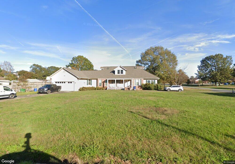
302 E Main St Carlisle, AR 72024
Estimated Value: $193,736 - $246,000
Studio
--
Bath
3,557
Sq Ft
$62/Sq Ft
Est. Value
About This Home
This home is located at 302 E Main St, Carlisle, AR 72024 and is currently estimated at $221,934, approximately $62 per square foot. 302 E Main St is a home with nearby schools including Carlisle Elementary School and Carlisle High School.
Ownership History
Date
Name
Owned For
Owner Type
Purchase Details
Closed on
Sep 4, 2015
Sold by
Loncar Joseph and Loncar Kimberly
Bought by
Heien Leonard Wayne
Current Estimated Value
Purchase Details
Closed on
Apr 16, 2009
Sold by
Secretary Of Veterans Affairs An Officer
Bought by
Loncar Joseph and Loncar Kimberly
Home Financials for this Owner
Home Financials are based on the most recent Mortgage that was taken out on this home.
Original Mortgage
$51,918
Interest Rate
4.72%
Mortgage Type
VA
Purchase Details
Closed on
Feb 12, 2004
Bought by
Mayher and Mayher Wf
Purchase Details
Closed on
Feb 2, 1998
Bought by
Jones and Jones Wf
Purchase Details
Closed on
Sep 26, 1986
Bought by
Mcarthur and Wife Kathy
Purchase Details
Closed on
Sep 23, 1986
Bought by
First American Bank
Purchase Details
Closed on
Apr 20, 1983
Bought by
Raper
Create a Home Valuation Report for This Property
The Home Valuation Report is an in-depth analysis detailing your home's value as well as a comparison with similar homes in the area
Purchase History
| Date | Buyer | Sale Price | Title Company |
|---|---|---|---|
| Heien Leonard Wayne | $61,000 | Professional Land Title | |
| Loncar Joseph | -- | -- | |
| Mayher | $150,000 | -- | |
| Mayher | $150,000 | -- | |
| Jones | $95,000 | -- | |
| Mcarthur | $60,000 | -- | |
| First American Bank | -- | -- | |
| Raper | $33,000 | -- |
Source: Public Records
Mortgage History
| Date | Status | Borrower | Loan Amount |
|---|---|---|---|
| Previous Owner | Loncar Joseph | $51,918 |
Source: Public Records
Tax History
| Year | Tax Paid | Tax Assessment Tax Assessment Total Assessment is a certain percentage of the fair market value that is determined by local assessors to be the total taxable value of land and additions on the property. | Land | Improvement |
|---|---|---|---|---|
| 2025 | $1,408 | $34,330 | $2,400 | $31,930 |
| 2024 | $1,408 | $34,330 | $2,400 | $31,930 |
| 2023 | $1,408 | $34,330 | $2,400 | $31,930 |
| 2022 | $1,416 | $34,330 | $2,400 | $31,930 |
| 2021 | $1,335 | $34,330 | $2,400 | $31,930 |
| 2020 | $1,254 | $30,500 | $2,400 | $28,100 |
| 2019 | $1,254 | $30,500 | $2,400 | $28,100 |
| 2018 | $1,279 | $30,500 | $2,400 | $28,100 |
| 2017 | $1,629 | $30,500 | $2,400 | $28,100 |
| 2016 | $1,279 | $30,500 | $2,400 | $28,100 |
| 2015 | $944 | $17,670 | $2,400 | $15,270 |
| 2014 | $594 | $17,670 | $2,400 | $15,270 |
Source: Public Records
Map
Nearby Homes
- 68 Eastwood Dr
- 620 N Brinkley
- 404 W 5th St
- 56 and 60 Schafer Dr
- 50 Schafer Dr
- 602 S Greenlaw Ave
- 00 Jackson St
- 0 Circle Dr
- 1595 Blue Point Rd
- 53 Summer Ln
- 0 Two Prairie Bayou Unit 21612964
- 0 Two Prairie Bayou Unit 25000732
- 155 John Mason Bayou Rd
- 2802 S Walters Chapel Rd
- NW 1/4 SE 1/4 S 3 T2n R 6w
- 1081 Tomlinson Rd
- W Melkovitz Rd
- 3166 Highway 31 N
- 110 Lynn Ln
- 7721 Walters Chapel Rd
Your Personal Tour Guide
Ask me questions while you tour the home.