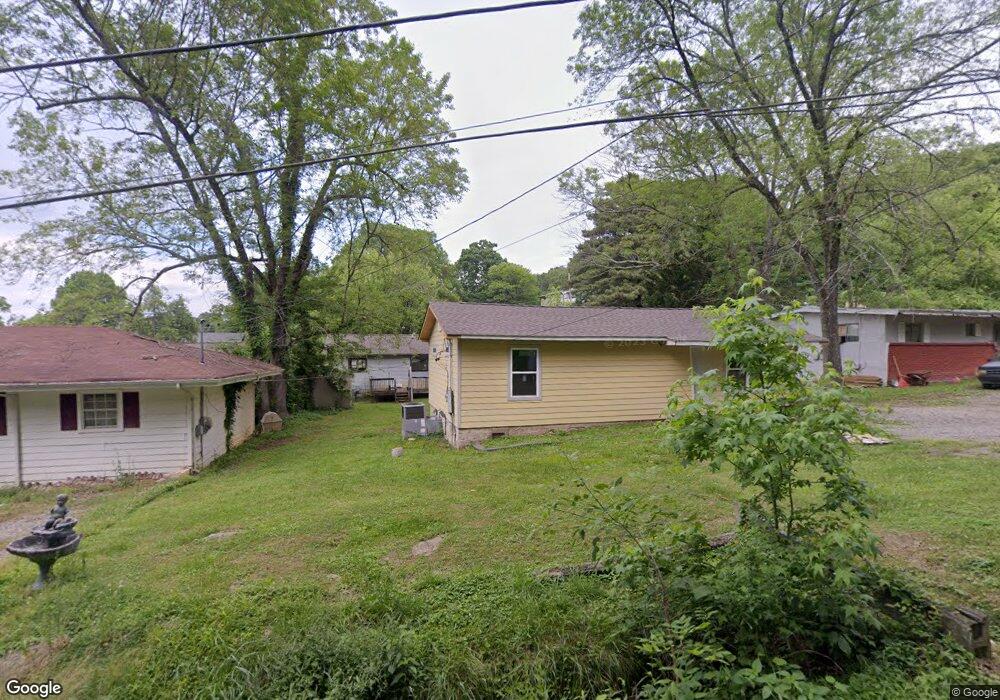
302 E Oak St Rossville, GA 30741
Estimated Value: $101,000 - $174,000
2
Beds
1
Bath
960
Sq Ft
$143/Sq Ft
Est. Value
About This Home
This home is located at 302 E Oak St, Rossville, GA 30741 and is currently estimated at $136,822, approximately $142 per square foot. 302 E Oak St is a home located in Walker County with nearby schools including Rossville Elementary School, Rossville Middle School, and Ridgeland High School.
Ownership History
Date
Name
Owned For
Owner Type
Purchase Details
Closed on
Oct 10, 2019
Sold by
Watkins Mike
Bought by
Lynn David
Current Estimated Value
Purchase Details
Closed on
Oct 10, 2000
Sold by
Taylor Melinda D
Bought by
Watkins Mike and Wf Ashley N
Purchase Details
Closed on
Dec 8, 1977
Sold by
Taylor Bobbie Joe and Anna Sue
Bought by
Taylor Melinda D
Purchase Details
Closed on
Sep 12, 1975
Sold by
Logan Ruby M
Bought by
Taylor Bobbie Joe and Anna Sue
Purchase Details
Closed on
Dec 29, 1971
Sold by
Baughn Rick
Bought by
Logan Ruby M
Purchase Details
Closed on
Dec 22, 1969
Bought by
Baughn Rick
Create a Home Valuation Report for This Property
The Home Valuation Report is an in-depth analysis detailing your home's value as well as a comparison with similar homes in the area
Home Values in the Area
Average Home Value in this Area
Purchase History
| Date | Buyer | Sale Price | Title Company |
|---|---|---|---|
| Lynn David | $37,176 | -- | |
| Watkins Mike | $12,000 | -- | |
| Taylor Melinda D | -- | -- | |
| Taylor Bobbie Joe | -- | -- | |
| Logan Ruby M | -- | -- | |
| Baughn Rick | -- | -- |
Source: Public Records
Tax History Compared to Growth
Tax History
| Year | Tax Paid | Tax Assessment Tax Assessment Total Assessment is a certain percentage of the fair market value that is determined by local assessors to be the total taxable value of land and additions on the property. | Land | Improvement |
|---|---|---|---|---|
| 2024 | $1,074 | $32,890 | $3,276 | $29,614 |
| 2023 | $1,220 | $36,946 | $3,276 | $33,670 |
| 2022 | $538 | $20,448 | $3,276 | $17,172 |
| 2021 | $370 | $12,588 | $2,184 | $10,404 |
| 2020 | $337 | $10,975 | $2,184 | $8,791 |
| 2019 | $520 | $16,940 | $2,184 | $14,756 |
| 2018 | $504 | $16,940 | $2,184 | $14,756 |
| 2017 | $563 | $16,940 | $2,184 | $14,756 |
| 2016 | $303 | $10,990 | $2,184 | $8,806 |
| 2015 | $417 | $14,412 | $1,272 | $13,140 |
| 2014 | $402 | $14,412 | $1,272 | $13,140 |
| 2013 | -- | $14,412 | $1,272 | $13,140 |
Source: Public Records
Map
Nearby Homes
- 405 Miami Ave
- 189 Leinbach Rd
- 806 Mcfarland Ave
- 136 Summit St
- Lot 81 Battle Bluff Dr
- Lot 80 Battle Bluff Dr
- Lot 79 Battle Bluff Dr
- 1204 Wooden Ave
- 115 Beech St
- 105 Elm St
- 0 Dempsey Ln Unit 1504691
- 916 Logan Ave
- 164 S Mission Ridge Dr
- 200 W Oak St
- 141 Hogan Rd
- 39 Clift Trail
- 4 Carroll Ln
- 301 Dempsey Ln
- 1014 Lee Ave
- 300 E Oak St
- 304 E Oak St
- 303 Cave St
- 303 E Oak St
- 301 Cave St
- 108 Meadowview Dr
- 207 Cave St
- 106 Mount View Dr
- 106 Mountain View Dr Unit Ptlts 68 & 69
- 106 Meadowview Dr
- 106 Mountain View Dr
- 305 Cave St
- 106 Mountain View Dr
- 205 Cave St
- 307 Cave St
- 104 Meadowview Dr
- 203 Cave St
- 102 Mountain View Dr
- 210 Cave St
- 212 Cave St