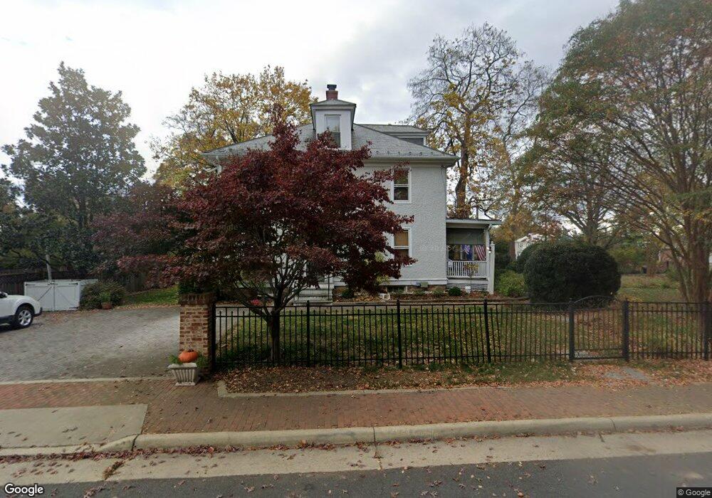
302 Edwards Ferry Rd NE Leesburg, VA 20176
Estimated Value: $944,000 - $1,005,000
4
Beds
4
Baths
2,856
Sq Ft
$343/Sq Ft
Est. Value
About This Home
This home is located at 302 Edwards Ferry Rd NE, Leesburg, VA 20176 and is currently estimated at $978,959, approximately $342 per square foot. 302 Edwards Ferry Rd NE is a home located in Loudoun County with nearby schools including Leesburg Elementary School, Smart's Mill Middle School, and Tuscarora High School.
Ownership History
Date
Name
Owned For
Owner Type
Purchase Details
Closed on
Feb 1, 2021
Sold by
Kemp Living Trust and Kemp Curtis A
Bought by
Kemp Curtis A and Kemp Ann P
Current Estimated Value
Home Financials for this Owner
Home Financials are based on the most recent Mortgage that was taken out on this home.
Original Mortgage
$503,000
Outstanding Balance
$449,645
Interest Rate
2.67%
Mortgage Type
New Conventional
Estimated Equity
$529,314
Purchase Details
Closed on
Jan 8, 2021
Sold by
Kemp Curtis A and Kemp Ann P
Bought by
Kemp Curtis A and Kemp Ann P
Home Financials for this Owner
Home Financials are based on the most recent Mortgage that was taken out on this home.
Original Mortgage
$503,000
Outstanding Balance
$449,645
Interest Rate
2.67%
Mortgage Type
New Conventional
Estimated Equity
$529,314
Purchase Details
Closed on
Jul 20, 2007
Sold by
Galler Michelle I
Bought by
Kemp Curtis A
Home Financials for this Owner
Home Financials are based on the most recent Mortgage that was taken out on this home.
Original Mortgage
$652,000
Interest Rate
6.73%
Mortgage Type
New Conventional
Purchase Details
Closed on
May 21, 2004
Sold by
Stebbins Donald A
Bought by
Galler Michelle I
Home Financials for this Owner
Home Financials are based on the most recent Mortgage that was taken out on this home.
Original Mortgage
$234,600
Interest Rate
5.75%
Mortgage Type
New Conventional
Purchase Details
Closed on
Jul 1, 1996
Sold by
F & M Bank Winchester
Bought by
Stebbins Donald A
Home Financials for this Owner
Home Financials are based on the most recent Mortgage that was taken out on this home.
Original Mortgage
$145,600
Interest Rate
8.05%
Purchase Details
Closed on
Apr 29, 1996
Sold by
Reinhardt Judith T
Bought by
Stebbins Donald A
Home Financials for this Owner
Home Financials are based on the most recent Mortgage that was taken out on this home.
Original Mortgage
$187,900
Interest Rate
7.81%
Create a Home Valuation Report for This Property
The Home Valuation Report is an in-depth analysis detailing your home's value as well as a comparison with similar homes in the area
Home Values in the Area
Average Home Value in this Area
Purchase History
| Date | Buyer | Sale Price | Title Company |
|---|---|---|---|
| Kemp Curtis A | -- | Boston National Title | |
| Kemp Curtis A | -- | None Available | |
| Kemp Curtis A | $815,000 | -- | |
| Galler Michelle I | $642,500 | -- | |
| Stebbins Donald A | $182,000 | -- | |
| Stebbins Donald A | $234,900 | -- |
Source: Public Records
Mortgage History
| Date | Status | Borrower | Loan Amount |
|---|---|---|---|
| Open | Kemp Curtis A | $503,000 | |
| Previous Owner | Kemp Curtis A | $652,000 | |
| Previous Owner | Galler Michelle I | $234,600 | |
| Previous Owner | Stebbins Donald A | $145,600 | |
| Previous Owner | Stebbins Donald A | $187,900 |
Source: Public Records
Tax History Compared to Growth
Tax History
| Year | Tax Paid | Tax Assessment Tax Assessment Total Assessment is a certain percentage of the fair market value that is determined by local assessors to be the total taxable value of land and additions on the property. | Land | Improvement |
|---|---|---|---|---|
| 2025 | $7,297 | $906,420 | $269,000 | $637,420 |
| 2024 | $6,873 | $794,530 | $249,000 | $545,530 |
| 2023 | $6,287 | $718,530 | $234,000 | $484,530 |
| 2022 | $5,778 | $649,260 | $209,000 | $440,260 |
| 2021 | $5,976 | $609,800 | $201,200 | $408,600 |
| 2020 | $6,004 | $580,110 | $181,200 | $398,910 |
| 2019 | $5,541 | $530,260 | $181,200 | $349,060 |
| 2018 | $5,701 | $525,410 | $151,200 | $374,210 |
| 2017 | $5,774 | $513,210 | $151,200 | $362,010 |
| 2016 | $5,731 | $500,560 | $0 | $0 |
| 2015 | $944 | $364,780 | $0 | $364,780 |
| 2014 | $918 | $350,390 | $0 | $350,390 |
Source: Public Records
Map
Nearby Homes
- 216 Wildman St NE
- 276 Ariel Dr NE
- 293 Ariel Dr NE
- BIRKHALL Plan at Brickyard
- HIGHGROVE Plan at Brickyard
- BALMORAL Plan at Brickyard
- 202 Murdoch Square SE
- 5 Stationmaster St SE Unit 202
- 2 Stationmaster St SE Unit 302
- 710 North St NE
- 3 Stationmaster St SE Unit 402
- 265 High Rail Terrace SE
- 411 Bicksler Square SE
- 459 Kornblau Terrace SE
- 222 Wirt St NW
- 414 Madison Ct SE
- 135 Oak View Dr SE
- 118 Fort Evans Rd SE Unit C
- 125 Chesterfield Place SW
- 214 Shenandoah St SE
- 304 Edwards Ferry Rd NE
- 248 Edwards Ferry Rd NE
- 111 Woodberry Rd NE
- 306 Edwards Ferry Rd NE
- 116 Woodberry Rd NE
- 303 Edwards Ferry Rd NE
- 117 Woodberry Rd NE
- 308 Edwards Ferry Rd NE
- 242 Edwards Ferry Rd NE
- 247 Edwards Ferry Rd NE
- 310 Edwards Ferry Rd NE
- 118 Woodberry Rd NE
- 119 Woodberry Rd NE
- 245 Edwards Ferry Rd NE
- 307 Edwards Ferry Rd NE
- 240 Edwards Ferry Rd NE
- 311 Edwards Ferry Rd NE
- 241 Edwards Ferry Rd NE
- 312 Edwards Ferry Rd NE
- 121 Woodberry Rd NE