Estimated Value: $122,897 - $150,000
--
Bed
1
Bath
1,738
Sq Ft
$81/Sq Ft
Est. Value
About This Home
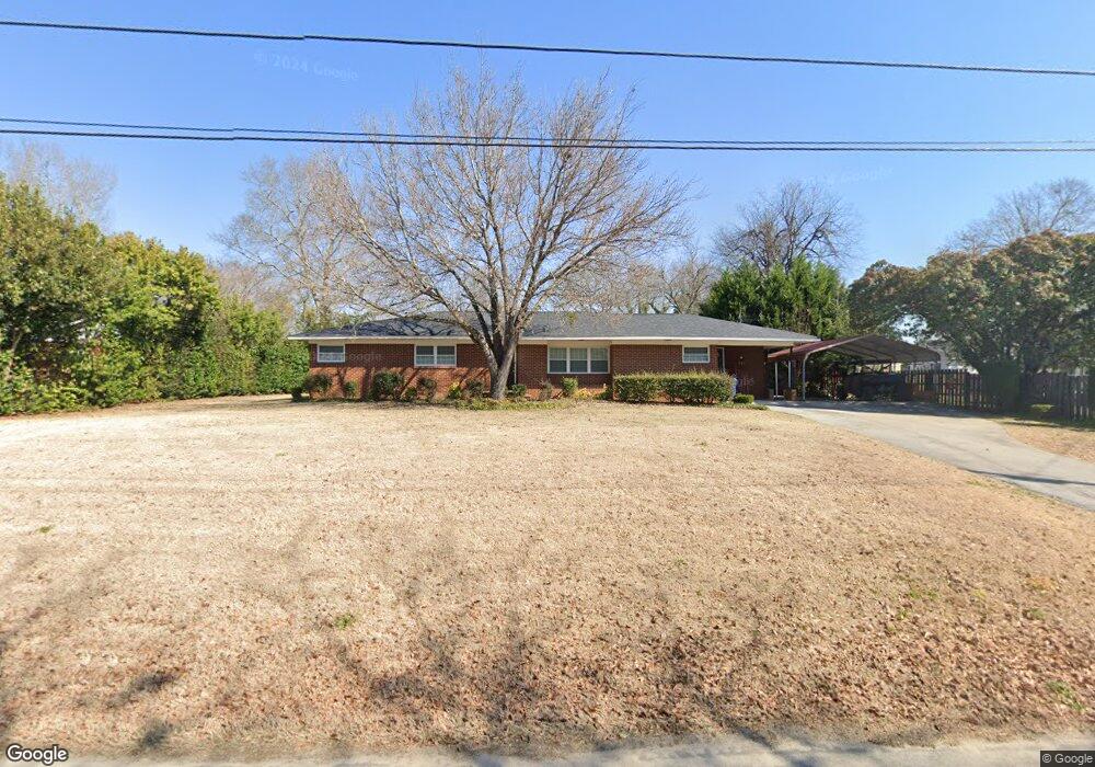
This home is located at 302 Ellis St, Wrens, GA 30833 and is currently estimated at $140,724, approximately $80 per square foot. 302 Ellis St is a home located in Jefferson County with nearby schools including Jefferson County High School.
Ownership History
Date
Name
Owned For
Owner Type
Purchase Details
Closed on
Nov 21, 2014
Sold by
Roberson Massey G
Bought by
Kitchens Shawn P and Kitchens Courtney B
Current Estimated Value
Home Financials for this Owner
Home Financials are based on the most recent Mortgage that was taken out on this home.
Original Mortgage
$71,250
Outstanding Balance
$24,178
Interest Rate
3.95%
Mortgage Type
New Conventional
Estimated Equity
$116,546
Purchase Details
Closed on
Dec 29, 2005
Sold by
Roberson M G
Bought by
Roberson M G and Roberson Sybil T
Create a Home Valuation Report for This Property
The Home Valuation Report is an in-depth analysis detailing your home's value as well as a comparison with similar homes in the area
Home Values in the Area
Average Home Value in this Area
Purchase History
| Date | Buyer | Sale Price | Title Company |
|---|---|---|---|
| Kitchens Shawn P | $75,000 | -- | |
| Roberson Massey G | -- | -- | |
| Roberson M G | -- | -- |
Source: Public Records
Mortgage History
| Date | Status | Borrower | Loan Amount |
|---|---|---|---|
| Open | Roberson Massey G | $71,250 | |
| Closed | Kitchens Shawn P | $71,250 |
Source: Public Records
Tax History Compared to Growth
Tax History
| Year | Tax Paid | Tax Assessment Tax Assessment Total Assessment is a certain percentage of the fair market value that is determined by local assessors to be the total taxable value of land and additions on the property. | Land | Improvement |
|---|---|---|---|---|
| 2024 | $1,485 | $33,627 | $3,360 | $30,267 |
| 2023 | $1,477 | $31,963 | $3,360 | $28,603 |
| 2022 | $881 | $28,136 | $3,360 | $24,776 |
| 2021 | $772 | $23,617 | $3,360 | $20,257 |
| 2020 | $777 | $23,704 | $3,360 | $20,344 |
| 2019 | $800 | $23,956 | $3,360 | $20,596 |
| 2018 | $799 | $23,538 | $3,360 | $20,178 |
| 2017 | $824 | $24,230 | $3,360 | $20,870 |
| 2016 | $735 | $23,784 | $3,360 | $20,424 |
| 2015 | -- | $23,803 | $3,360 | $20,443 |
| 2014 | -- | $24,724 | $3,360 | $21,364 |
| 2013 | -- | $25,287 | $3,360 | $21,927 |
Source: Public Records
Map
Nearby Homes
- 205 Williams St
- 0 Quaker Rd Unit 11562124
- 80 Georgia 80
- 404 King St
- 0 U S Route 1
- 0 Hwy 80 and Old Stapleton Rd Unit 10622530
- 0 Broad St
- 102 Peachtree St
- 304 S Fleming St
- 0 Young St
- 1280 Old Lucky Bridge Rd
- 0 Howard St Unit 548508
- 309 Terrace Hill Rd
- 319 Terrace Hill Rd
- 321 Terrace Hill Rd
- 207 Old Thomson Rd
- 201 Ramsgate Dr
- 401 Waynesboro Rd
- 103 Ohio St
- 0 Holley Rd
- 304 Ellis St
- 502 Braswell St
- 501 Phillips St
- 503 Phillips St
- 303 Ellis St
- 402 Ellis St
- 303 N Thompson St
- 301 Ellis St
- 504 Braswell St
- 301 N Thompson St
- 403 Phillips St
- 205 Ellis St
- 404 Ellis St
- 401 N Thompson St
- 403 Ellis St
- 502 Phillips St
- 406 Phillips St
- 202 Ellis St
- 403 N Thompson St
- 504 Phillips St