Estimated Value: $556,000 - $645,000
6
Beds
4
Baths
3,745
Sq Ft
$165/Sq Ft
Est. Value
About This Home
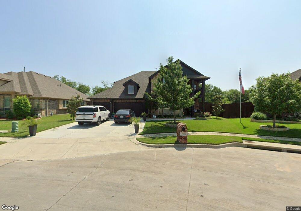
This home is located at 302 Hawthorn Dr, Wylie, TX 75098 and is currently estimated at $618,912, approximately $165 per square foot. 302 Hawthorn Dr is a home with nearby schools including P M Akin Elementary School, AB Harrison Intermediate School, and Grady Burnett J High School.
Ownership History
Date
Name
Owned For
Owner Type
Purchase Details
Closed on
Dec 23, 2016
Sold by
Bloomfield Homes Lp
Bought by
Staffeld Heath and Staffeld Cynthia L
Current Estimated Value
Home Financials for this Owner
Home Financials are based on the most recent Mortgage that was taken out on this home.
Original Mortgage
$325,000
Outstanding Balance
$262,836
Interest Rate
3.57%
Mortgage Type
New Conventional
Estimated Equity
$356,076
Create a Home Valuation Report for This Property
The Home Valuation Report is an in-depth analysis detailing your home's value as well as a comparison with similar homes in the area
Home Values in the Area
Average Home Value in this Area
Purchase History
| Date | Buyer | Sale Price | Title Company |
|---|---|---|---|
| Staffeld Heath | -- | None Available |
Source: Public Records
Mortgage History
| Date | Status | Borrower | Loan Amount |
|---|---|---|---|
| Open | Staffeld Heath | $325,000 |
Source: Public Records
Tax History Compared to Growth
Tax History
| Year | Tax Paid | Tax Assessment Tax Assessment Total Assessment is a certain percentage of the fair market value that is determined by local assessors to be the total taxable value of land and additions on the property. | Land | Improvement |
|---|---|---|---|---|
| 2025 | $10,283 | $638,405 | $164,450 | $473,955 |
| 2024 | $10,283 | $589,633 | $164,450 | $479,657 |
| 2023 | $10,283 | $536,030 | $139,150 | $491,342 |
| 2022 | $10,691 | $487,300 | $139,150 | $424,945 |
| 2021 | $10,423 | $443,000 | $101,200 | $341,800 |
| 2020 | $10,741 | $432,557 | $101,200 | $331,357 |
| 2019 | $11,957 | $455,023 | $105,600 | $349,423 |
| 2018 | $12,032 | $446,775 | $105,600 | $341,175 |
| 2017 | $11,860 | $440,398 | $105,600 | $334,798 |
| 2016 | $1,537 | $55,320 | $55,320 | $0 |
Source: Public Records
Map
Nearby Homes
- 304 Hawthorn Dr
- 310 Hawthorn Dr
- 114 Liberty Dr
- 213 N West A Allen Blvd
- 207 Spence Dr
- 409 Cedar Ridge Dr
- 1056 Fairview Dr
- 216 Cedar Ridge St
- 104 Rushcreek Dr
- 825 Foxwood Ln
- 820 Foxwood Ln
- 104 N 5th St
- 1209 Surrey Cir
- 107 Windy Knoll Ln
- 306 Foxwood Ct
- 825 Forest Edge Ln
- 811 Forest Edge Ln
- 306 Woodhollow Ct
- 300 Woodhollow Ct
- 312 Maltese Cir
- 300 Hawthorn Dr
- 306 Hawthorn Dr
- 916 Birchwood Dr
- 303 Birchwood Dr
- 308 Hawthorn Dr
- 914 Birchwood Dr
- 921 Redwood Ct
- 919 Redwood Ct
- 305 Hawthorn Dr
- 917 Redwood Ct
- 930 E Brown St
- 307 Hawthorn Dr
- 915 Birchwood Dr
- 912 Birchwood Dr
- 915 Redwood Ct
- 309 Hawthorn Dr
- 910 Birchwood Dr
- 913 Birchwood Dr
- 913 Redwood Ct
- 109 Carriage Run Dr