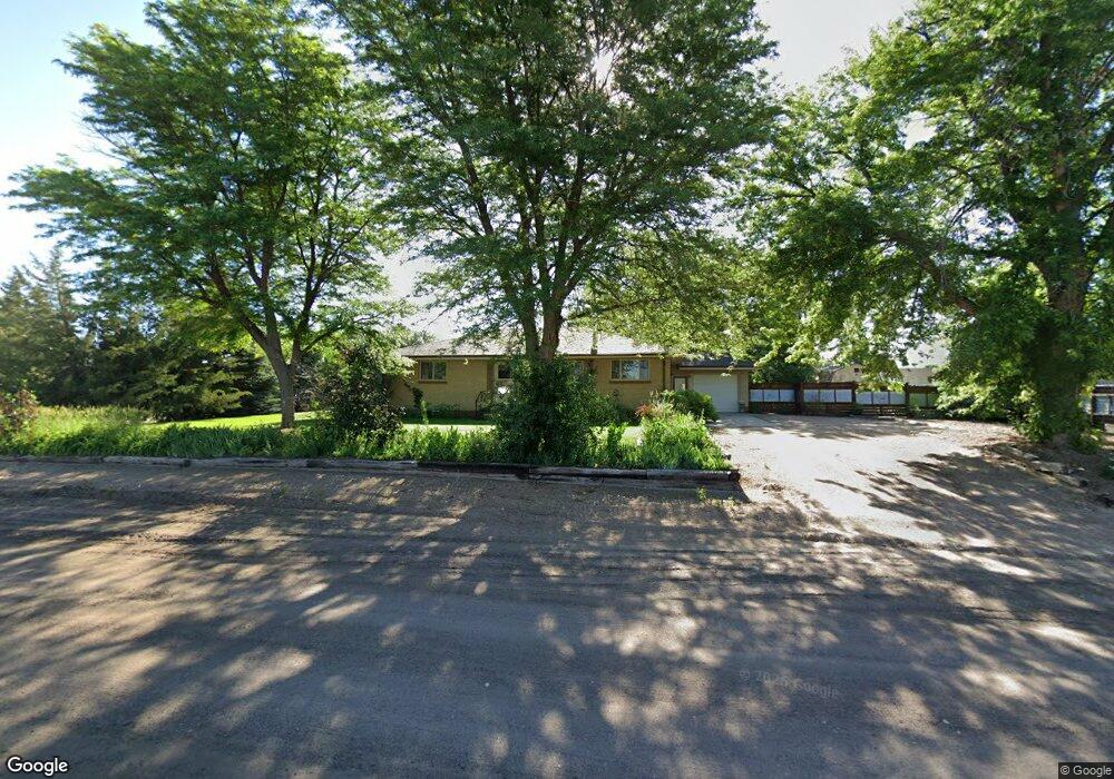
302 High St Wiggins, CO 80654
Estimated Value: $369,000 - $385,000
5
Beds
2
Baths
2,576
Sq Ft
$146/Sq Ft
Est. Value
About This Home
This home is located at 302 High St, Wiggins, CO 80654 and is currently estimated at $376,858, approximately $146 per square foot. 302 High St is a home located in Morgan County with nearby schools including Wiggins Elementary School, Wiggins Middle School, and Wiggins High School.
Ownership History
Date
Name
Owned For
Owner Type
Purchase Details
Closed on
Jul 31, 2009
Sold by
Federal Home Loan Mortgage Corporation
Bought by
Bailey Travis J and Bailey Virginia R
Current Estimated Value
Home Financials for this Owner
Home Financials are based on the most recent Mortgage that was taken out on this home.
Original Mortgage
$109,600
Outstanding Balance
$71,823
Interest Rate
5.31%
Mortgage Type
New Conventional
Estimated Equity
$305,035
Purchase Details
Closed on
Feb 27, 2009
Sold by
Gilliland Sherri and Gilliland Michael H
Bought by
Federal Home Loan Mortgage Corporation
Purchase Details
Closed on
Dec 27, 2004
Sold by
Gilliland Michael H
Bought by
Gilliland Michael H and Gilliland Sherri
Home Financials for this Owner
Home Financials are based on the most recent Mortgage that was taken out on this home.
Original Mortgage
$111,000
Interest Rate
5.74%
Mortgage Type
New Conventional
Create a Home Valuation Report for This Property
The Home Valuation Report is an in-depth analysis detailing your home's value as well as a comparison with similar homes in the area
Purchase History
| Date | Buyer | Sale Price | Title Company |
|---|---|---|---|
| Bailey Travis J | $137,000 | Security Title | |
| Federal Home Loan Mortgage Corporation | -- | None Available | |
| Gilliland Michael H | -- | None Available |
Source: Public Records
Mortgage History
| Date | Status | Borrower | Loan Amount |
|---|---|---|---|
| Open | Bailey Travis J | $109,600 | |
| Previous Owner | Gilliland Michael H | $111,000 |
Source: Public Records
Tax History
| Year | Tax Paid | Tax Assessment Tax Assessment Total Assessment is a certain percentage of the fair market value that is determined by local assessors to be the total taxable value of land and additions on the property. | Land | Improvement |
|---|---|---|---|---|
| 2024 | $2,097 | $20,180 | $3,190 | $16,990 |
| 2023 | $2,134 | $23,860 | $3,770 | $20,090 |
| 2022 | $1,924 | $17,820 | $3,300 | $14,520 |
| 2021 | $1,979 | $18,340 | $3,400 | $14,940 |
| 2020 | $1,612 | $15,580 | $2,000 | $13,580 |
| 2019 | $1,664 | $15,580 | $2,000 | $13,580 |
| 2018 | $1,303 | $11,890 | $2,020 | $9,870 |
| 2017 | $1,279 | $11,890 | $2,020 | $9,870 |
| 2016 | $1,168 | $11,040 | $2,090 | $8,950 |
| 2015 | $1,088 | $11,040 | $2,090 | $8,950 |
| 2014 | $974 | $9,670 | $2,090 | $7,580 |
| 2013 | -- | $9,670 | $2,090 | $7,580 |
Source: Public Records
Map
Nearby Homes
- 419 E 3rd Ave
- 118 Dickson St
- 316 Curry St
- 717 3rd Ave
- 105 7 Ave
- 0 Sixth Ave Unit Lot 3
- 0 Sixth Ave Unit Lot 5
- 0 Sixth Ave Unit Lot 2
- 0 Sixth Ave Unit Lot 4
- 3699 County Road 5
- 5 Tract
- 4 Tract Lot 5
- 4 Tract Lot 4
- 100 11th Ave
- 4 Tract Lot 6
- 4 Tract Lot 3
- 101 Primrose Ct
- 4 Tract Lot 7
- 4 Tract Lot 2
- 403 11th Ave
- 304 High St
- 0 Tbdsw Unit 7064804
- 308 3rd Ave
- 214 High St
- 308 E 3rd Ave
- 303 Ridge St
- 0 Tbd (Parcel 6-7-9-10-12) Unit 878584
- 0 Tbd (Parcel 1) Unit 6197647
- 0 Tbd (Parcel 1) Unit 878579
- 0 Tbd(parc 7) Unit 7691241
- 0 Tbd (Parcel 10) Unit 6769221
- 0 Tbd (Parcel 6) Unit 869571
- 0 Tbd (Parcel 10) Unit 869570
- 0 Tbd (Parcel 7) Unit 869568
- 301 High St
- 215 Ridge St
- 211 3rd Ave
- 303 High St
- 212 High St
- 312 High St
Your Personal Tour Guide
Ask me questions while you tour the home.