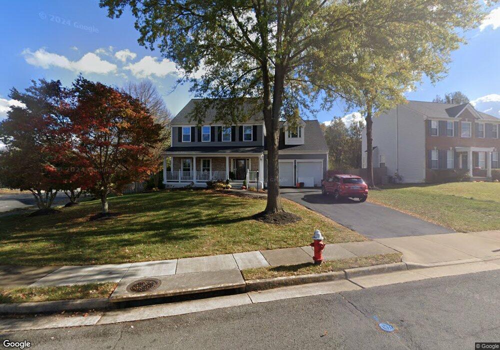
302 Higham Ct NE Leesburg, VA 20176
Estimated Value: $851,765 - $913,000
4
Beds
4
Baths
2,674
Sq Ft
$328/Sq Ft
Est. Value
About This Home
This home is located at 302 Higham Ct NE, Leesburg, VA 20176 and is currently estimated at $875,941, approximately $327 per square foot. 302 Higham Ct NE is a home located in Loudoun County with nearby schools including Leesburg Elementary School, Smart's Mill Middle School, and Tuscarora High School.
Ownership History
Date
Name
Owned For
Owner Type
Purchase Details
Closed on
Jun 18, 1999
Sold by
K Hovnanian At Exeter Hil
Bought by
Boehret Christopher R
Current Estimated Value
Home Financials for this Owner
Home Financials are based on the most recent Mortgage that was taken out on this home.
Original Mortgage
$183,000
Outstanding Balance
$48,025
Interest Rate
6.99%
Estimated Equity
$827,916
Create a Home Valuation Report for This Property
The Home Valuation Report is an in-depth analysis detailing your home's value as well as a comparison with similar homes in the area
Home Values in the Area
Average Home Value in this Area
Purchase History
| Date | Buyer | Sale Price | Title Company |
|---|---|---|---|
| Boehret Christopher R | $222,000 | -- |
Source: Public Records
Mortgage History
| Date | Status | Borrower | Loan Amount |
|---|---|---|---|
| Open | Boehret Christopher R | $183,000 |
Source: Public Records
Tax History Compared to Growth
Tax History
| Year | Tax Paid | Tax Assessment Tax Assessment Total Assessment is a certain percentage of the fair market value that is determined by local assessors to be the total taxable value of land and additions on the property. | Land | Improvement |
|---|---|---|---|---|
| 2025 | $6,556 | $814,350 | $261,500 | $552,850 |
| 2024 | $6,230 | $720,200 | $241,500 | $478,700 |
| 2023 | $6,363 | $727,190 | $226,500 | $500,690 |
| 2022 | $5,923 | $665,500 | $201,500 | $464,000 |
| 2021 | $5,592 | $570,620 | $180,200 | $390,420 |
| 2020 | $5,496 | $531,040 | $180,200 | $350,840 |
| 2019 | $5,304 | $507,550 | $180,200 | $327,350 |
| 2018 | $5,401 | $497,820 | $150,200 | $347,620 |
| 2017 | $5,315 | $472,470 | $150,200 | $322,270 |
| 2016 | $5,383 | $470,090 | $0 | $0 |
| 2015 | $901 | $342,320 | $0 | $342,320 |
| 2014 | $864 | $322,130 | $0 | $322,130 |
Source: Public Records
Map
Nearby Homes
- 216 Wildman St NE
- 293 Ariel Dr NE
- 412 Blue Ridge Ave NE
- 276 Ariel Dr NE
- 710 North St NE
- 111 Washington St NE
- 514 Covington Terrace NE
- BIRKHALL Plan at Brickyard
- BALMORAL Plan at Brickyard
- HIGHGROVE Plan at Brickyard
- 523 Currant Terrace NE
- 503 Richmond Square NE
- 108 Stoneledge Place NE
- 222 Wirt St NW
- 1102 Huntmaster Terrace NE Unit 301
- 1106 Huntmaster Terrace NE Unit 202
- 706 Amber Ct NE
- 1129 Huntmaster Terrace NE Unit 301
- 1117 Huntmaster Terrace NE Unit 101
- 239 Old Waterford Rd NW
- 304 Higham Ct NE
- 522 Marshall Dr NE
- 306 Higham Ct NE
- 301 Higham Ct NE
- 601 Marshall Dr NE
- 520 Marshall Dr NE
- 303 Higham Ct NE
- 624 Newington Place NE
- 602 Marshall Dr NE
- 315 Chaucer Place NE
- 308 Higham Ct NE
- 517 Marshall Dr NE
- 518 Marshall Dr NE
- 305 Higham Ct NE
- 313 Chaucer Place NE
- 626 Newington Place NE
- 603 Marshall Dr NE
- 604 Marshall Dr NE
- 314 Chaucer Place NE
- 307 Higham Ct NE