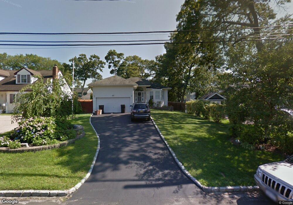
302 Independence Ave West Islip, NY 11795
Estimated Value: $681,377 - $892,000
--
Bed
--
Bath
--
Sq Ft
8,712
Sq Ft Lot
About This Home
This home is located at 302 Independence Ave, West Islip, NY 11795 and is currently estimated at $781,844. 302 Independence Ave is a home located in Suffolk County with nearby schools including Paul J Bellew Elementary School, Udall Road Middle School, and West Islip Senior High School.
Ownership History
Date
Name
Owned For
Owner Type
Purchase Details
Closed on
Mar 9, 2006
Sold by
Kosin William
Bought by
Lidonnici Larry
Current Estimated Value
Purchase Details
Closed on
Jun 16, 2003
Sold by
Chiarelli Edward and Chiarelli Rose
Bought by
Kosin William J and Kosin Bonnie M
Home Financials for this Owner
Home Financials are based on the most recent Mortgage that was taken out on this home.
Original Mortgage
$50,000
Interest Rate
4.8%
Mortgage Type
Purchase Money Mortgage
Purchase Details
Closed on
May 22, 1995
Sold by
Rinaldi Anna M
Bought by
Chiarelli Edward and Chiarelli Rose
Create a Home Valuation Report for This Property
The Home Valuation Report is an in-depth analysis detailing your home's value as well as a comparison with similar homes in the area
Home Values in the Area
Average Home Value in this Area
Purchase History
| Date | Buyer | Sale Price | Title Company |
|---|---|---|---|
| Lidonnici Larry | $565,000 | Christopher Bechtle | |
| Kosin William J | $419,900 | -- | |
| Chiarelli Edward | $64,000 | -- |
Source: Public Records
Mortgage History
| Date | Status | Borrower | Loan Amount |
|---|---|---|---|
| Previous Owner | Kosin William J | $50,000 |
Source: Public Records
Tax History Compared to Growth
Tax History
| Year | Tax Paid | Tax Assessment Tax Assessment Total Assessment is a certain percentage of the fair market value that is determined by local assessors to be the total taxable value of land and additions on the property. | Land | Improvement |
|---|---|---|---|---|
| 2024 | -- | $46,500 | $8,100 | $38,400 |
| 2023 | -- | $46,500 | $8,100 | $38,400 |
| 2022 | $11,689 | $46,500 | $8,100 | $38,400 |
| 2021 | $11,689 | $46,500 | $8,100 | $38,400 |
| 2020 | $12,272 | $46,500 | $8,100 | $38,400 |
| 2019 | $11,689 | $46,500 | $8,100 | $38,400 |
| 2018 | -- | $46,500 | $8,100 | $38,400 |
| 2017 | $11,398 | $46,500 | $8,100 | $38,400 |
| 2016 | $11,451 | $46,500 | $8,100 | $38,400 |
| 2015 | -- | $46,500 | $8,100 | $38,400 |
| 2014 | -- | $46,500 | $8,100 | $38,400 |
Source: Public Records
Map
Nearby Homes
- 8 Gerek Ave
- 170 Wickfield Ln
- 14 Gerek Ave
- 409 Capri Rd
- 43 Hitherdell Ln
- 274 Edmunton Dr Unit K8
- 134 Veronica Ln
- 265 Edmunton Dr Unit I-12
- 205 Edmunton Dr Unit H17
- 214 Edmunton Dr Unit J3
- 192 Edmunton Dr Unit D1
- 182 Edmunton Dr Unit D3
- 15 Anthony Dr
- 47 Village Line Rd
- 72 Edmunton Dr Unit B-7
- 62 Edmunton Dr Unit B11
- 71 Edmunton Dr Unit F10
- 372 Hamilton Place
- 1280 Sunrise Hwy
- 144 Scott Ave
- 304 Independence Ave
- 300 Independence Ave
- 333 Madison St
- 306 Independence Ave
- 307 Monroe Ave
- 309 Monroe Ave
- 305 Monroe Ave
- 311 Monroe Ave Unit 311
- 308 Independence Ave
- 301 Independence Ave
- 303 Independence Ave
- 303 Monroe Ave
- 305 Independence Ave
- 315 Monroe Ave
- 310 Independence Ave
- 301 Monroe Ave
- 307 Independence Ave
- 312 Independence Ave
- 321 Monroe Ave
- 302 Henry Ave