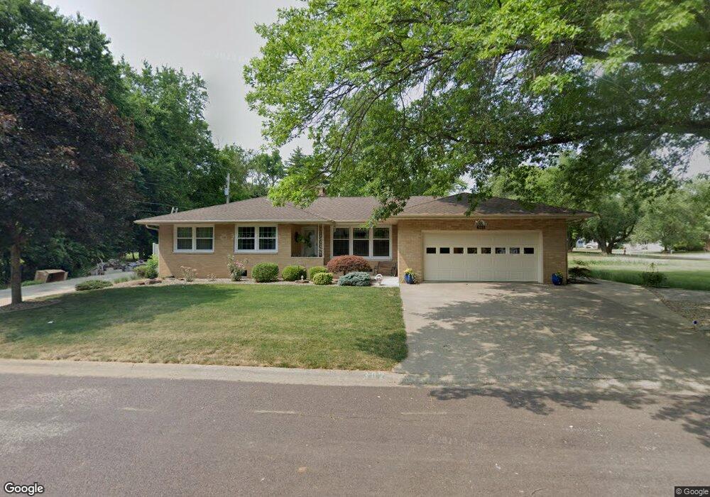
302 John Ln MacKinaw, IL 61755
Estimated Value: $179,000 - $191,187
3
Beds
1
Bath
1,485
Sq Ft
$124/Sq Ft
Est. Value
About This Home
This home is located at 302 John Ln, MacKinaw, IL 61755 and is currently estimated at $183,797, approximately $123 per square foot. 302 John Ln is a home located in Tazewell County with nearby schools including Dee-Mack Primary/Junior High School, Dee-Mack Intermediate School, and Dee-Mack High School.
Ownership History
Date
Name
Owned For
Owner Type
Purchase Details
Closed on
Aug 27, 2010
Sold by
Foster Louis A and Estate Of Clarence W Foster
Bought by
Gillespie Jimmy M and Gillespie Linda F
Current Estimated Value
Home Financials for this Owner
Home Financials are based on the most recent Mortgage that was taken out on this home.
Original Mortgage
$110,000
Outstanding Balance
$72,821
Interest Rate
4.49%
Mortgage Type
New Conventional
Estimated Equity
$110,976
Create a Home Valuation Report for This Property
The Home Valuation Report is an in-depth analysis detailing your home's value as well as a comparison with similar homes in the area
Home Values in the Area
Average Home Value in this Area
Purchase History
| Date | Buyer | Sale Price | Title Company |
|---|---|---|---|
| Gillespie Jimmy M | $138,000 | None Available |
Source: Public Records
Mortgage History
| Date | Status | Borrower | Loan Amount |
|---|---|---|---|
| Open | Gillespie Jimmy M | $110,000 |
Source: Public Records
Tax History Compared to Growth
Tax History
| Year | Tax Paid | Tax Assessment Tax Assessment Total Assessment is a certain percentage of the fair market value that is determined by local assessors to be the total taxable value of land and additions on the property. | Land | Improvement |
|---|---|---|---|---|
| 2024 | $3,016 | $60,870 | $5,790 | $55,080 |
| 2023 | $3,016 | $56,000 | $5,330 | $50,670 |
| 2022 | $3,089 | $51,600 | $4,910 | $46,690 |
| 2021 | $3,118 | $49,610 | $4,720 | $44,890 |
| 2020 | $3,148 | $48,160 | $4,580 | $43,580 |
| 2019 | $3,159 | $48,160 | $4,580 | $43,580 |
| 2018 | $3,127 | $48,160 | $4,580 | $43,580 |
| 2017 | $3,081 | $47,680 | $4,530 | $43,150 |
| 2016 | $3,084 | $47,680 | $4,530 | $43,150 |
| 2015 | $2,720 | $0 | $0 | $0 |
| 2013 | $2,916 | $48,920 | $4,410 | $44,510 |
Source: Public Records
Map
Nearby Homes
- 103 S Monroe St
- 111 W Fast Ave
- 0 Illinois 9
- 204 Tulip Dr
- 988 Heritage Dr
- 29724 Allentown Rd
- 10 Summit Dr
- 801 Heritage Dr
- 6 Raleigh Ave
- 29875 White Oak Dr
- 11283 Illinois 9
- 30403 Hancock Rd
- 16555 Mclean Rd
- 18196 River Rd
- 118 Bryant St
- 1209 Whippoorwill Dr
- 1263 Wheatfield Dr
- 101 N Oregon Ave
- 1156 Brentwood Rd
- 324 S Kansas Ave
- 302 John Ln
- 303 John Ln
- 301 John Ln
- 208 S Tazewell Ave
- 305 S Tazewell Ave
- 307 S Tazewell Ave
- 307 S Tazewell St
- 302 W 4th St
- 306 W 4th St
- 309 S Tazewell Ave
- 209 S Tazewell Ave
- 300 W Fourth St
- 300 W Fourth St
- 400 W Fourth St
- 200 John Ln
- 206 S Tazewell Ave
- 207 S Tazewell Ave
- 311 S Tazewell St
- 311 S Tazewell Ave
- 201 John Ln