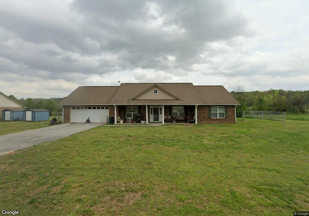
302 Larkspur Dr SW Calhoun, GA 30701
Estimated Value: $295,289 - $313,000
3
Beds
2
Baths
1,780
Sq Ft
$171/Sq Ft
Est. Value
About This Home
This home is located at 302 Larkspur Dr SW, Calhoun, GA 30701 and is currently estimated at $305,072, approximately $171 per square foot. 302 Larkspur Dr SW is a home located in Gordon County with nearby schools including Calhoun Primary School, Calhoun Elementary School, and Calhoun Middle School.
Ownership History
Date
Name
Owned For
Owner Type
Purchase Details
Closed on
May 29, 2015
Sold by
Powell & Stewart Inc
Bought by
Elliott Casey Natalie and Stover Michael David
Current Estimated Value
Home Financials for this Owner
Home Financials are based on the most recent Mortgage that was taken out on this home.
Original Mortgage
$117,727
Outstanding Balance
$93,247
Interest Rate
4.4%
Mortgage Type
FHA
Estimated Equity
$211,825
Create a Home Valuation Report for This Property
The Home Valuation Report is an in-depth analysis detailing your home's value as well as a comparison with similar homes in the area
Home Values in the Area
Average Home Value in this Area
Purchase History
| Date | Buyer | Sale Price | Title Company |
|---|---|---|---|
| Elliott Casey Natalie | $119,900 | -- |
Source: Public Records
Mortgage History
| Date | Status | Borrower | Loan Amount |
|---|---|---|---|
| Open | Elliott Casey Natalie | $117,727 |
Source: Public Records
Tax History Compared to Growth
Tax History
| Year | Tax Paid | Tax Assessment Tax Assessment Total Assessment is a certain percentage of the fair market value that is determined by local assessors to be the total taxable value of land and additions on the property. | Land | Improvement |
|---|---|---|---|---|
| 2024 | $2,728 | $97,040 | $4,760 | $92,280 |
| 2023 | $2,539 | $90,320 | $4,760 | $85,560 |
| 2022 | $800 | $84,120 | $4,760 | $79,360 |
| 2021 | $2,055 | $69,040 | $4,760 | $64,280 |
| 2020 | $2,092 | $69,720 | $4,760 | $64,960 |
| 2019 | $2,089 | $69,720 | $4,760 | $64,960 |
| 2018 | $531 | $55,120 | $4,760 | $50,360 |
| 2017 | $513 | $52,160 | $4,760 | $47,400 |
| 2016 | $473 | $52,160 | $4,760 | $47,400 |
| 2015 | $527 | $52,800 | $4,760 | $48,040 |
| 2014 | -- | $43,286 | $4,760 | $38,526 |
Source: Public Records
Map
Nearby Homes
- 261 Liberty Ln SW
- 490 McDaniel Station Rd SW
- 506 McDaniel Station Rd SW
- 458 McDaniel Station Rd SW
- 474 McDaniel Station Rd SW
- 0 Highway 53 Spur SW Unit 7529096
- 00 Belmont Dr
- 121 Foxhall Dr SW
- 0 Reeves Station Rd SW Unit 10548197
- 0 Reeves Station Rd SW Unit 7601645
- 1401 U S 41
- 1311 Us Highway 41
- 0 W Belmont Dr Unit 10489910
- 271 Old Belwood Rd SE
- 130 Brookstone Dr SW
- 137 Regency Row SW
- 0 Richardson Rd SE Unit 10474273
- 0 Richardson Rd SE Unit 7537183
- 201 Porch Loop SE
- The Pearson Plan at Creekview
- 302 Larkspur Dr SW
- 300 Larkspur Dr SW
- 305 Larkspur Dr SW
- 303 Larkspur Dr SW
- 301 Larkspur Dr SW
- 307 Larkspur Dr SW
- 0 Larkspur Dr SW Unit 7493537
- 0 Larkspur Dr SW Unit 7192307
- 0 Larkspur Dr SW
- 309 Larkspur Dr SW
- 218 Larkspur Dr SW
- 156 Iris Way SW
- 311 Larkspur Dr SW
- 216 Larkspur Dr SW
- 313 Larkspur Dr SW
- 217 Larkspur Dr SW
- 214 Larkspur Dr SW
- 153 Iris Way SW
- 215 Larkspur Dr SW
- 315 Larkspur Dr SW