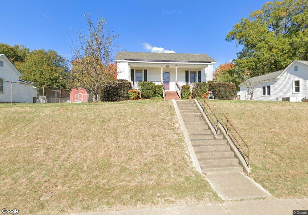
302 Loop Rd N Kannapolis, NC 28081
Estimated Value: $246,000 - $307,000
--
Bed
1
Bath
1,473
Sq Ft
$183/Sq Ft
Est. Value
About This Home
This home is located at 302 Loop Rd N, Kannapolis, NC 28081 and is currently estimated at $269,434, approximately $182 per square foot. 302 Loop Rd N is a home located in Rowan County with nearby schools including North Kannapolis Elementary School, Kannapolis Middle, and A.L. Brown High School.
Ownership History
Date
Name
Owned For
Owner Type
Purchase Details
Closed on
Jan 4, 2018
Sold by
Koloff Nikita S and Wood Shelley R
Bought by
Koloff Nikita S
Current Estimated Value
Purchase Details
Closed on
Dec 13, 2016
Sold by
Koloff Nikita S
Bought by
Koloff Nikita S and Wood Shelley R
Purchase Details
Closed on
Aug 15, 2008
Sold by
Koloff Victoria T and Laktash George Steven
Bought by
Koloff Nikita S
Create a Home Valuation Report for This Property
The Home Valuation Report is an in-depth analysis detailing your home's value as well as a comparison with similar homes in the area
Home Values in the Area
Average Home Value in this Area
Purchase History
| Date | Buyer | Sale Price | Title Company |
|---|---|---|---|
| Koloff Nikita S | -- | None Available | |
| Koloff Nikita S | -- | None Available | |
| Koloff Nikita S | -- | None Available |
Source: Public Records
Tax History Compared to Growth
Tax History
| Year | Tax Paid | Tax Assessment Tax Assessment Total Assessment is a certain percentage of the fair market value that is determined by local assessors to be the total taxable value of land and additions on the property. | Land | Improvement |
|---|---|---|---|---|
| 2025 | $2,386 | $197,176 | $57,420 | $139,756 |
| 2024 | $2,386 | $197,176 | $57,420 | $139,756 |
| 2023 | $2,386 | $197,176 | $57,420 | $139,756 |
| 2022 | $1,543 | $119,808 | $47,850 | $71,958 |
| 2021 | $1,543 | $119,808 | $47,850 | $71,958 |
| 2020 | $1,543 | $119,808 | $47,850 | $71,958 |
| 2019 | $1,543 | $119,808 | $47,850 | $71,958 |
| 2018 | $1,388 | $109,040 | $47,850 | $61,190 |
| 2017 | $1,388 | $109,040 | $47,850 | $61,190 |
| 2016 | $1,388 | $109,040 | $47,850 | $61,190 |
| 2015 | $1,409 | $109,040 | $47,850 | $61,190 |
| 2014 | $1,297 | $103,800 | $39,600 | $64,200 |
Source: Public Records
Map
Nearby Homes
- 510 W 9th St
- 203 Allen St
- 409 Oak Cir
- 519 N Rose Ave
- 504 Locust St
- 303 E 4th St
- 1560 Solitude Ct Unit 11
- 450 Contentment Ct
- 1540 Solitude Ct
- 911 Elm St
- 445 Contentment Ct Unit 19
- 465 Contentment Ct
- 502 Helen St
- 100 N Ridge Ave
- 212 Kimball St
- 304 S Walnut St
- 1204 W A St
- 0 Goble Ave
- 1001 N Cannon Blvd
- 601 E 13th St
- 304 W 6th St
- 300 W 6th St
- 603 N Walnut St
- 306 Loop Rd N
- 306 W 6th St
- 604 Poplar Ave
- 605 N Walnut St
- 602 N Walnut St
- 606 Poplar Ave
- 604 N Walnut St
- 607 N Walnut St
- 606 N Walnut St
- 608 Poplar Ave
- 603 Poplar Ave
- 605 Poplar Ave
- 609 N Walnut St
- 608 N Walnut St
- 610 Poplar Ave
- 607 Poplar Ave
- 610 N Walnut St