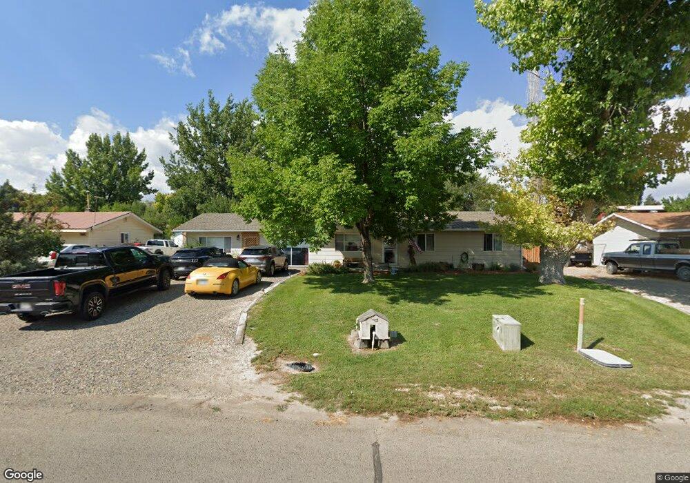
302 Maple Dr Hotchkiss, CO 81419
Estimated Value: $341,000 - $428,000
4
Beds
2
Baths
1,776
Sq Ft
$216/Sq Ft
Est. Value
About This Home
This home is located at 302 Maple Dr, Hotchkiss, CO 81419 and is currently estimated at $384,023, approximately $216 per square foot. 302 Maple Dr is a home located in Delta County with nearby schools including Hotchkiss Elementary School and North Fork High School.
Ownership History
Date
Name
Owned For
Owner Type
Purchase Details
Closed on
Oct 24, 2017
Sold by
Lewis Leah M and Estate Of Michael Francis Cros
Bought by
Smith Charles Barry and Patterson Christina
Current Estimated Value
Purchase Details
Closed on
Apr 16, 2007
Sold by
Robinson Gail
Bought by
Kaiser Shirls and Francis Michael
Purchase Details
Closed on
Mar 19, 2004
Sold by
Dillehay Paul E
Bought by
Smith Charles Barry and Robinson Gail
Purchase Details
Closed on
Jul 10, 1998
Sold by
Beard
Bought by
Smith Charles Barry and Smith Dillehay
Purchase Details
Closed on
May 30, 1997
Sold by
Gagnon
Bought by
Beard Smith Charles Barry and Beard Smith
Purchase Details
Closed on
Jul 1, 1988
Sold by
Fha
Bought by
Smith Charles Barry and Hull Betty Jo
Create a Home Valuation Report for This Property
The Home Valuation Report is an in-depth analysis detailing your home's value as well as a comparison with similar homes in the area
Home Values in the Area
Average Home Value in this Area
Purchase History
| Date | Buyer | Sale Price | Title Company |
|---|---|---|---|
| Smith Charles Barry | $135,000 | None Available | |
| Kaiser Shirls | $202,500 | Fahtco | |
| Smith Charles Barry | $116,900 | -- | |
| Smith Charles Barry | $106,000 | -- | |
| Beard Smith Charles Barry | $82,500 | -- | |
| Smith Charles Barry | $30,000 | -- |
Source: Public Records
Tax History Compared to Growth
Tax History
| Year | Tax Paid | Tax Assessment Tax Assessment Total Assessment is a certain percentage of the fair market value that is determined by local assessors to be the total taxable value of land and additions on the property. | Land | Improvement |
|---|---|---|---|---|
| 2024 | $1,393 | $18,348 | $2,120 | $16,228 |
| 2023 | $1,393 | $18,348 | $2,120 | $16,228 |
| 2022 | $1,145 | $15,430 | $2,433 | $12,997 |
| 2021 | $1,149 | $15,874 | $2,503 | $13,371 |
| 2020 | $1,002 | $13,634 | $2,646 | $10,988 |
| 2019 | $788 | $10,920 | $2,646 | $8,274 |
| 2018 | $950 | $12,661 | $2,664 | $9,997 |
| 2017 | $850 | $12,650 | $2,664 | $9,986 |
| 2016 | $770 | $11,912 | $2,388 | $9,524 |
| 2014 | -- | $13,571 | $2,866 | $10,705 |
Source: Public Records
Map
Nearby Homes
- 0 Maple St Unit 719012
- 226 Maple Dr
- 0 Maple Dr
- 310 Maple Dr
- 303 Poplar Way
- 227 Poplar Way
- 218 Maple Dr
- 311 Poplar Way
- 634 Cottonwood Ln
- 635 Cottonwood Ln
- 219 Poplar Way
- 210 Maple Dr
- 342 Poplar Way
- 626 Cottonwood Ln
- 627 Cottonwood Ln
- 211 Poplar Way
- 302 Poplar Way
- 334 Poplar Way
- 226 Poplar Way
- 310 Poplar Way