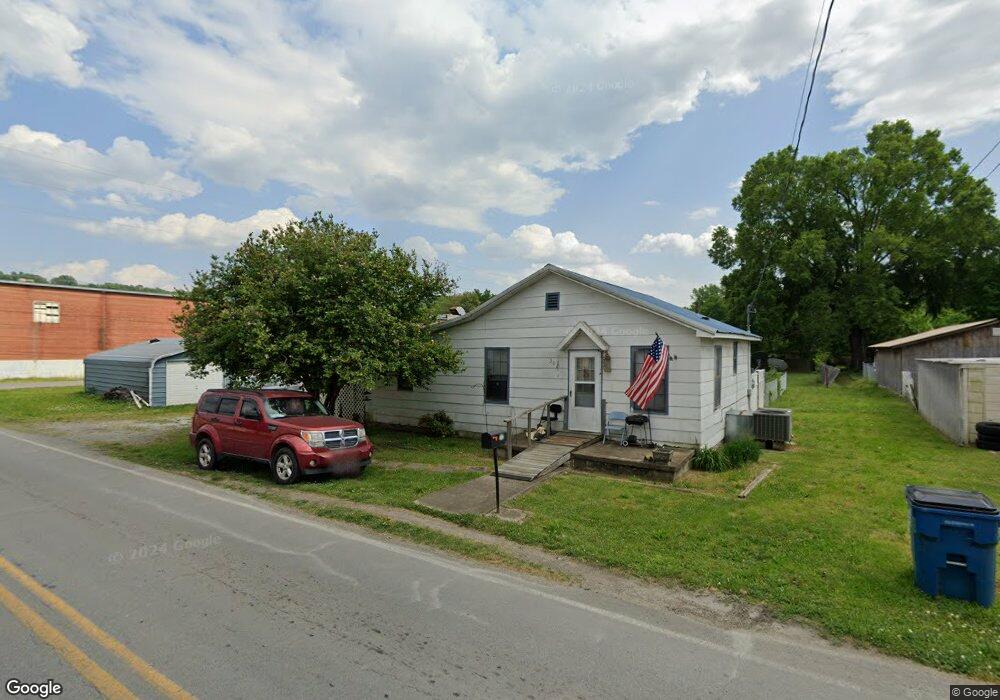
302 Maple St Rossville, GA 30741
Estimated Value: $162,000 - $180,000
3
Beds
1
Bath
1,120
Sq Ft
$156/Sq Ft
Est. Value
About This Home
This home is located at 302 Maple St, Rossville, GA 30741 and is currently estimated at $175,106, approximately $156 per square foot. 302 Maple St is a home located in Walker County with nearby schools including Rossville Elementary School, Rossville Middle School, and Ridgeland High School.
Ownership History
Date
Name
Owned For
Owner Type
Purchase Details
Closed on
Feb 7, 1994
Sold by
Smith Richard J
Bought by
Knight Sherry Dean
Current Estimated Value
Purchase Details
Closed on
Oct 20, 1993
Sold by
Smith Charles T and Smith Brady E
Bought by
Smith Richard J
Purchase Details
Closed on
Mar 5, 1980
Sold by
William R Smith
Bought by
Smith Charles T and Smith Brady E
Purchase Details
Closed on
Jan 1, 1972
Bought by
William R Smith
Create a Home Valuation Report for This Property
The Home Valuation Report is an in-depth analysis detailing your home's value as well as a comparison with similar homes in the area
Home Values in the Area
Average Home Value in this Area
Purchase History
| Date | Buyer | Sale Price | Title Company |
|---|---|---|---|
| Knight Sherry Dean | -- | -- | |
| Smith Richard J | -- | -- | |
| Smith Charles T | -- | -- | |
| William R Smith | -- | -- |
Source: Public Records
Tax History Compared to Growth
Tax History
| Year | Tax Paid | Tax Assessment Tax Assessment Total Assessment is a certain percentage of the fair market value that is determined by local assessors to be the total taxable value of land and additions on the property. | Land | Improvement |
|---|---|---|---|---|
| 2024 | $1,377 | $47,614 | $4,050 | $43,564 |
| 2023 | $1,318 | $45,352 | $4,050 | $41,302 |
| 2022 | $554 | $28,768 | $4,050 | $24,718 |
| 2021 | $398 | $21,118 | $4,050 | $17,068 |
| 2020 | $364 | $19,271 | $4,050 | $15,221 |
| 2019 | $364 | $19,271 | $4,050 | $15,221 |
| 2018 | $573 | $19,271 | $4,050 | $15,221 |
| 2017 | $422 | $19,271 | $4,050 | $15,221 |
| 2016 | $321 | $19,271 | $4,050 | $15,221 |
| 2015 | $485 | $23,569 | $3,888 | $19,681 |
| 2014 | $462 | $23,569 | $3,888 | $19,681 |
| 2013 | -- | $23,569 | $3,888 | $19,681 |
Source: Public Records
Map
Nearby Homes
- 200 W Oak St
- 916 Logan Ave
- 1014 Lee Ave
- 816 Indian Ave
- 806 Mcfarland Ave
- 115 Beech St
- 527 W Gordon Ave
- 509 W Gordon Ave
- 105 Elm St
- 126 S Liner St
- 1204 Wooden Ave
- 1410 E 50th St
- 1403 E 49th St
- 1405 E 49th St
- 0 Dempsey Ln Unit 1504691
- 405 Miami Ave
- 4 Carroll Ln
- 301 Dempsey Ln
- 136 Summit St
- Lot 81 Battle Bluff Dr