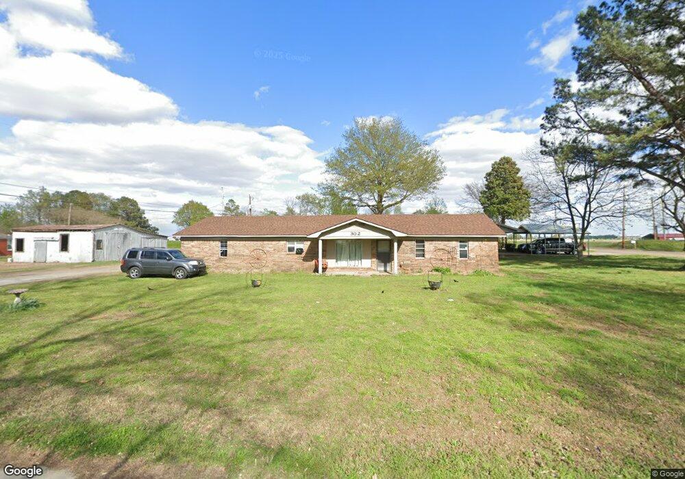
302 Marchand St Newport, AR 72112
Estimated Value: $111,000 - $147,000
--
Bed
2
Baths
1,530
Sq Ft
$82/Sq Ft
Est. Value
About This Home
This home is located at 302 Marchand St, Newport, AR 72112 and is currently estimated at $125,308, approximately $81 per square foot. 302 Marchand St is a home located in Jackson County with nearby schools including Newport Elementary School and Newport High School.
Ownership History
Date
Name
Owned For
Owner Type
Purchase Details
Closed on
Dec 19, 2005
Bought by
Barnhill Willie D and Barnhill Kimberly D
Current Estimated Value
Purchase Details
Closed on
Jun 13, 2005
Bought by
Chase Home Finance Llc and Attn
Purchase Details
Closed on
Sep 24, 2004
Bought by
Emery Christopher L
Purchase Details
Closed on
Jan 1, 1983
Bought by
Wright Gerald W and Wright Hilda J
Create a Home Valuation Report for This Property
The Home Valuation Report is an in-depth analysis detailing your home's value as well as a comparison with similar homes in the area
Home Values in the Area
Average Home Value in this Area
Purchase History
| Date | Buyer | Sale Price | Title Company |
|---|---|---|---|
| Barnhill Willie D | -- | -- | |
| Chase Home Finance Llc | -- | -- | |
| Emery Christopher L | -- | -- | |
| Wright Gerald W | $48,000 | -- |
Source: Public Records
Tax History Compared to Growth
Tax History
| Year | Tax Paid | Tax Assessment Tax Assessment Total Assessment is a certain percentage of the fair market value that is determined by local assessors to be the total taxable value of land and additions on the property. | Land | Improvement |
|---|---|---|---|---|
| 2024 | $24 | $19,860 | $3,200 | $16,660 |
| 2023 | $46 | $9,060 | $1,920 | $7,140 |
| 2022 | $120 | $9,060 | $1,920 | $7,140 |
| 2021 | $111 | $9,060 | $1,920 | $7,140 |
| 2020 | $111 | $9,060 | $1,920 | $7,140 |
| 2019 | $111 | $9,060 | $1,920 | $7,140 |
| 2018 | $137 | $9,540 | $1,600 | $7,940 |
| 2017 | $137 | $9,540 | $1,600 | $7,940 |
| 2015 | -- | $9,540 | $1,600 | $7,940 |
| 2014 | -- | $9,540 | $1,600 | $7,940 |
| 2013 | -- | $10,980 | $1,600 | $9,380 |
| 2012 | -- | $10,980 | $1,600 | $9,380 |
Source: Public Records
Map
Nearby Homes
- 2600 Hollywood St
- 2708 Robinson St
- 1217 Cherokee Dr
- 1212 Graceland Dr
- 1900 Hines St
- 1714 Dill St
- 1801 Hines St
- 203 Alice Ct
- 504 S State St
- 1407 Dill St
- 1311 Dill St
- 1105 Josephine St
- 2208 John Cir
- 0 Holmes St Unit 25033630
- 0 Holmes St Unit 25-486
- 910 & 914 Dill St
- 4 Virginia Rd
- 0 Robinson Rd
- 900 Josephine St
- 900 Dill St
- 2909 Stegall Rd
- 2813 Stegall Rd
- 2904 Phillips St
- 2820 Phillips St
- 2904 Stegall Rd
- 2816 Phillips St
- 2809 Stegall Rd
- 2816 Stegall Rd
- 2918 Phillips St
- 2915 Stegall Rd
- 2905 Phillips St
- 2901 Phillips St
- 2807 Stegall Rd
- 2917 Stegall Rd
- 2920 Phillips St
- 2817 Phillips St
- 2815 Phillips St
- 315 James St
- 2809 Phillips St
- 2908 Stegall Rd