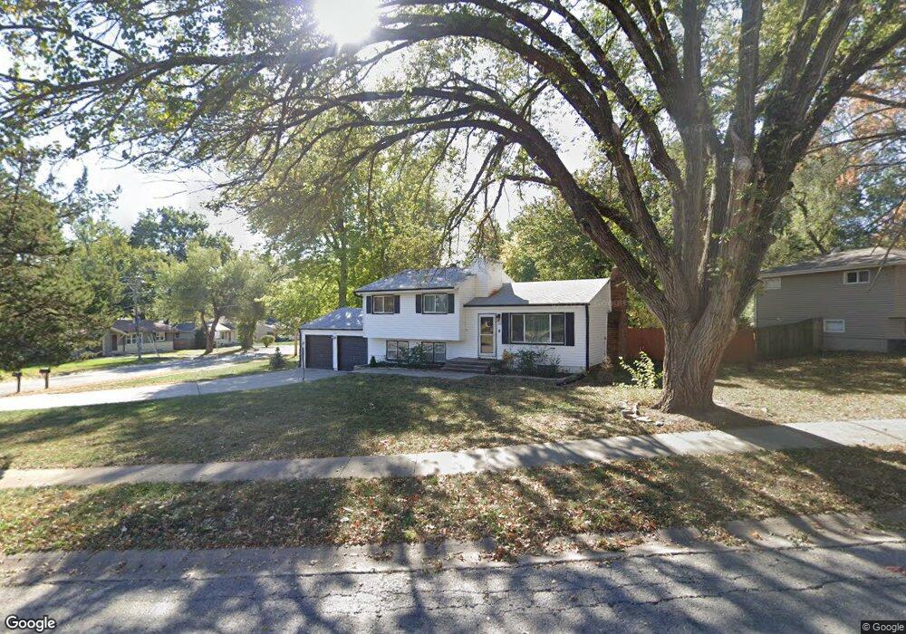
302 Melrose Ln Liberty, MO 64068
Estimated Value: $262,682 - $296,000
3
Beds
2
Baths
1,026
Sq Ft
$270/Sq Ft
Est. Value
About This Home
This home is located at 302 Melrose Ln, Liberty, MO 64068 and is currently estimated at $276,671, approximately $269 per square foot. 302 Melrose Ln is a home located in Clay County with nearby schools including Alexander Doniphan Elementary School, Discovery Middle School, and Liberty High School.
Ownership History
Date
Name
Owned For
Owner Type
Purchase Details
Closed on
Dec 10, 2020
Sold by
Hilt Reina
Bought by
Walkup Morgan and Schultz Brent
Current Estimated Value
Home Financials for this Owner
Home Financials are based on the most recent Mortgage that was taken out on this home.
Original Mortgage
$209,000
Outstanding Balance
$186,072
Interest Rate
2.7%
Mortgage Type
New Conventional
Estimated Equity
$90,599
Purchase Details
Closed on
Sep 4, 2003
Sold by
Hilt Reina
Bought by
Hilt Reina
Create a Home Valuation Report for This Property
The Home Valuation Report is an in-depth analysis detailing your home's value as well as a comparison with similar homes in the area
Home Values in the Area
Average Home Value in this Area
Purchase History
| Date | Buyer | Sale Price | Title Company |
|---|---|---|---|
| Walkup Morgan | -- | Stewart Title Co | |
| Hilt Reina | -- | -- |
Source: Public Records
Mortgage History
| Date | Status | Borrower | Loan Amount |
|---|---|---|---|
| Open | Walkup Morgan | $209,000 |
Source: Public Records
Tax History
| Year | Tax Paid | Tax Assessment Tax Assessment Total Assessment is a certain percentage of the fair market value that is determined by local assessors to be the total taxable value of land and additions on the property. | Land | Improvement |
|---|---|---|---|---|
| 2025 | $2,317 | $34,600 | -- | -- |
| 2024 | $2,317 | $30,120 | -- | -- |
| 2023 | $2,356 | $30,120 | $0 | $0 |
| 2022 | $2,059 | $25,990 | $0 | $0 |
| 2021 | $2,043 | $25,992 | $6,650 | $19,342 |
| 2020 | $1,917 | $22,900 | $0 | $0 |
| 2019 | $1,916 | $22,900 | $0 | $0 |
Source: Public Records
Map
Nearby Homes
- 407 Glendale Rd
- 406 Melrose St
- 509 Belmont St
- 429 Pershing St
- 9008 NE 80th St
- 7511 N Lewis Ave
- 8915 NE 80th Terrace
- 7503 N Lewis Ave
- 253 S Stewart Rd
- 1601 Dunwich Dr
- Lot 2 Bent Oaks Dr
- 8129 N Farley Ave
- 7218 N Lewis Ave
- 7629 N Booth Ave
- 7735 N Donnelly Ave
- 7620 N Booth Ave
- 7644 N Booth Ave
- 7616 N Booth Ave
- 8325 NE 76th Terrace
- 8308 NE 76th Terrace
- 302 Melrose St
- 402 Brentwood Dr
- 306 Melrose Ln
- 306 Melrose St
- 301 Melrose Ln
- 301 Melrose St
- 303 Glendale Rd
- 305 Melrose Ln
- 310 Melrose Ln
- 309 Melrose St
- 309 Melrose Ln
- 0 Brentwood Dr
- 307 Glendale Rd
- 314 Melrose Ln
- 315 Glendale Rd
- 313 Melrose Ln
- 313 Melrose St
- 300 Belmont St
- 304 Belmont St
- 318 Melrose Ln
Your Personal Tour Guide
Ask me questions while you tour the home.