Estimated Value: $171,000 - $208,000
4
Beds
1
Bath
1,961
Sq Ft
$95/Sq Ft
Est. Value
About This Home
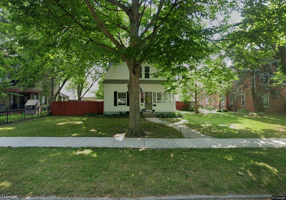
This home is located at 302 Monroe St, Delta, OH 43515 and is currently estimated at $185,344, approximately $94 per square foot. 302 Monroe St is a home located in Fulton County with nearby schools including Delta Elementary School, Pike-Delta-York Middle School, and Pike-Delta-York High School.
Ownership History
Date
Name
Owned For
Owner Type
Purchase Details
Closed on
Jan 9, 2004
Sold by
Mcvey Frank J and Mcvey Amy L
Bought by
Oberneder Anthony A and Oberneder Shelly J
Current Estimated Value
Home Financials for this Owner
Home Financials are based on the most recent Mortgage that was taken out on this home.
Original Mortgage
$60,000
Outstanding Balance
$28,410
Interest Rate
6.08%
Mortgage Type
Purchase Money Mortgage
Estimated Equity
$156,934
Purchase Details
Closed on
Feb 16, 1996
Sold by
Heath Robert A
Bought by
Mcvey Frank J
Purchase Details
Closed on
Jan 1, 1990
Bought by
Heath Robert A
Create a Home Valuation Report for This Property
The Home Valuation Report is an in-depth analysis detailing your home's value as well as a comparison with similar homes in the area
Home Values in the Area
Average Home Value in this Area
Purchase History
| Date | Buyer | Sale Price | Title Company |
|---|---|---|---|
| Oberneder Anthony A | $99,900 | -- | |
| Mcvey Frank J | $82,000 | -- | |
| Heath Robert A | -- | -- |
Source: Public Records
Mortgage History
| Date | Status | Borrower | Loan Amount |
|---|---|---|---|
| Open | Oberneder Anthony A | $60,000 |
Source: Public Records
Tax History
| Year | Tax Paid | Tax Assessment Tax Assessment Total Assessment is a certain percentage of the fair market value that is determined by local assessors to be the total taxable value of land and additions on the property. | Land | Improvement |
|---|---|---|---|---|
| 2024 | $2,302 | $49,810 | $6,340 | $43,470 |
| 2023 | $2,115 | $49,810 | $6,340 | $43,470 |
| 2022 | $2,155 | $38,720 | $5,290 | $33,430 |
| 2021 | $2,231 | $38,720 | $5,290 | $33,430 |
| 2020 | $2,217 | $38,720 | $5,290 | $33,430 |
| 2019 | $1,811 | $32,310 | $5,290 | $27,020 |
| 2018 | $1,699 | $32,310 | $5,290 | $27,020 |
| 2017 | $1,693 | $32,310 | $5,290 | $27,020 |
| 2016 | $1,611 | $27,620 | $5,290 | $22,330 |
| 2015 | $1,541 | $27,620 | $5,290 | $22,330 |
| 2014 | $1,538 | $27,620 | $5,290 | $22,330 |
| 2013 | $1,345 | $24,400 | $4,480 | $19,920 |
Source: Public Records
Map
Nearby Homes
- 207 Wood St
- 308 Monroe St
- 305 Mckinley St
- 518 Providence St
- 929 Linwood Ave
- 8069 Fulton County 7-2
- 8069 County Road 7
- 2049 Pear Tree Ln
- 318 Hidden Ridge Dr
- 2061 Redbud Ln
- 315 Cherrytree Ln
- 2158 Redbud Ln
- 320 Crabtree Ln
- 9136 County Road Ef
- 3088 County Road H
- 11470 County Rd E
- 3121 County Road Ef
- 7373 County Road 12
- 6881 County Road B
- 4465 County Road 3
Your Personal Tour Guide
Ask me questions while you tour the home.