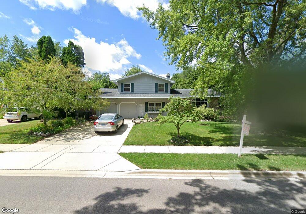
302 N Beck Rd Lindenhurst, IL 60046
Estimated Value: $309,000 - $351,000
3
Beds
2
Baths
1,560
Sq Ft
$207/Sq Ft
Est. Value
About This Home
This home is located at 302 N Beck Rd, Lindenhurst, IL 60046 and is currently estimated at $323,647, approximately $207 per square foot. 302 N Beck Rd is a home located in Lake County with nearby schools including Lakes Community High School.
Ownership History
Date
Name
Owned For
Owner Type
Purchase Details
Closed on
Sep 6, 2019
Sold by
Bernau William and Bernau Anna
Bought by
Jones Jaclyn and Jones Wesley G
Current Estimated Value
Home Financials for this Owner
Home Financials are based on the most recent Mortgage that was taken out on this home.
Original Mortgage
$179,193
Outstanding Balance
$159,435
Interest Rate
4.4%
Mortgage Type
FHA
Estimated Equity
$164,212
Create a Home Valuation Report for This Property
The Home Valuation Report is an in-depth analysis detailing your home's value as well as a comparison with similar homes in the area
Home Values in the Area
Average Home Value in this Area
Purchase History
| Date | Buyer | Sale Price | Title Company |
|---|---|---|---|
| Jones Jaclyn | $182,500 | First American Title |
Source: Public Records
Mortgage History
| Date | Status | Borrower | Loan Amount |
|---|---|---|---|
| Open | Jones Jaclyn | $179,193 |
Source: Public Records
Tax History Compared to Growth
Tax History
| Year | Tax Paid | Tax Assessment Tax Assessment Total Assessment is a certain percentage of the fair market value that is determined by local assessors to be the total taxable value of land and additions on the property. | Land | Improvement |
|---|---|---|---|---|
| 2024 | $7,344 | $83,787 | $13,431 | $70,356 |
| 2023 | $7,217 | $74,030 | $11,867 | $62,163 |
| 2022 | $7,217 | $69,206 | $11,016 | $58,190 |
| 2021 | $6,854 | $64,288 | $10,233 | $54,055 |
| 2020 | $6,695 | $62,228 | $9,905 | $52,323 |
| 2019 | $5,876 | $59,805 | $9,519 | $50,286 |
| 2018 | $5,827 | $59,384 | $13,934 | $45,450 |
| 2017 | $5,800 | $57,800 | $13,562 | $44,238 |
| 2016 | $5,841 | $55,460 | $13,013 | $42,447 |
| 2015 | $5,522 | $51,798 | $12,154 | $39,644 |
| 2014 | $5,907 | $50,047 | $12,210 | $37,837 |
| 2012 | $6,073 | $58,701 | $13,888 | $44,813 |
Source: Public Records
Map
Nearby Homes
- 418 Surrey Ln
- 422 Northgate Rd
- 59 Chestnut Cir
- 205 Countryside Ln
- 225 Ironwood Dr
- 527 Northgate Rd Unit 28
- 1900 Burr Oak Ln Unit 15
- 102 Hawthorne Dr
- 590 Oxford Ln
- 2308 E Sand Lake Rd
- 694 Monroe Dr
- 586 Harvard Ct
- 692 Monroe Dr
- 249 Jasmine Cir
- 4103 Neubauer Cir Unit 402
- 2726 Providence Ln
- 3707 Neubauer Cir
- 345 Kestrel Ln
- 19135 W Millburn Rd
- 691 N Autumn Cir
- 300 N Beck Rd
- 2324 Springhill Ln
- 2322 Springhill Ln Unit 26
- 2323 Green Tree Ct
- 2320 Spring Hill Ln
- 2321 Green Tree Ct
- 216 N Beck Rd Unit 26
- 2325 Springhill Ln Unit 26
- 2318 Springhill Ln
- 2323 Springhill Ln
- 2319 Green Tree Ct
- 2321 Springhill Ln
- 2316 Springhill Ln
- 2317 Green Tree Ct
- 2401 Mallard Dr
- 2319 Springhill Ln
- 2320 Green Tree Ct
- 2314 Springhill Ln
- 2390 Kelsey Ct
- 2413 Mallard Dr