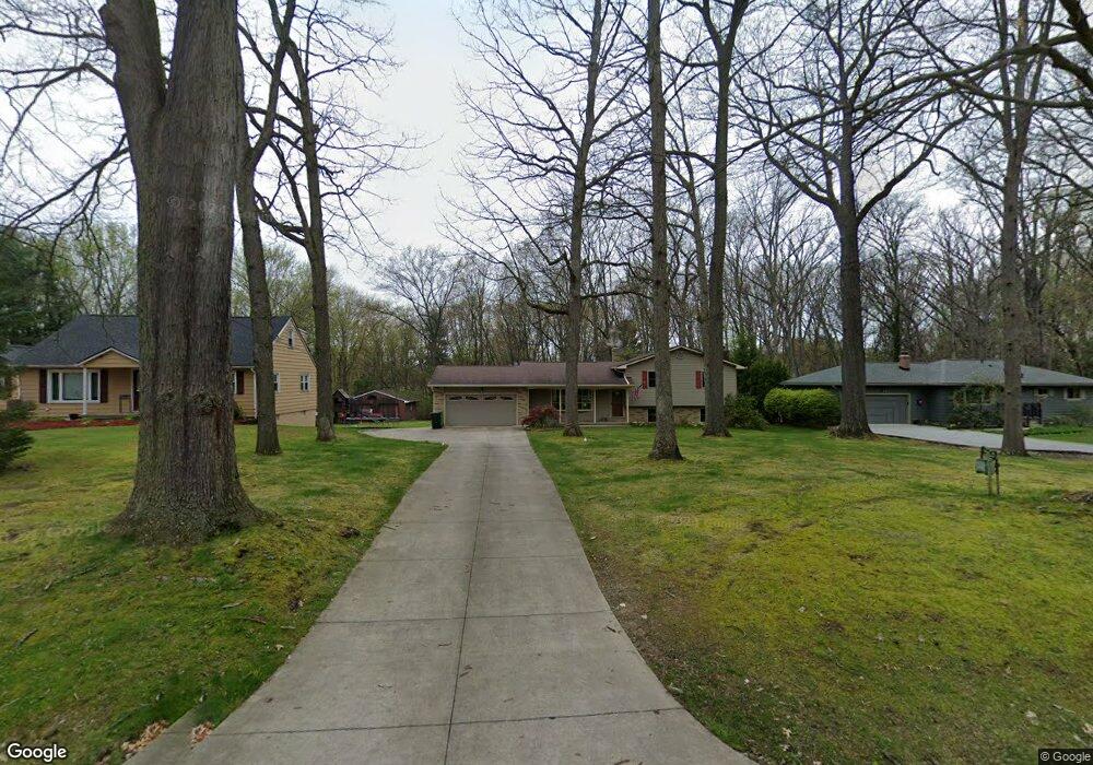
302 N Elm Ave Tallmadge, OH 44278
Estimated Value: $302,000 - $336,907
3
Beds
3
Baths
1,200
Sq Ft
$266/Sq Ft
Est. Value
About This Home
This home is located at 302 N Elm Ave, Tallmadge, OH 44278 and is currently estimated at $319,727, approximately $266 per square foot. 302 N Elm Ave is a home located in Summit County with nearby schools including Tallmadge Middle School, Tallmadge High School, and Steel Academy.
Ownership History
Date
Name
Owned For
Owner Type
Purchase Details
Closed on
Jun 15, 2023
Sold by
Pozuc Mark L and Pozuc Dawn E
Bought by
Groom Chadwick M and Groom Britney L
Current Estimated Value
Home Financials for this Owner
Home Financials are based on the most recent Mortgage that was taken out on this home.
Original Mortgage
$220,000
Outstanding Balance
$214,117
Interest Rate
6.39%
Mortgage Type
New Conventional
Estimated Equity
$105,610
Purchase Details
Closed on
May 30, 1995
Sold by
Carter Scott
Bought by
Pozuc Mark L and Pozuc Dawn E
Create a Home Valuation Report for This Property
The Home Valuation Report is an in-depth analysis detailing your home's value as well as a comparison with similar homes in the area
Home Values in the Area
Average Home Value in this Area
Purchase History
| Date | Buyer | Sale Price | Title Company |
|---|---|---|---|
| Groom Chadwick M | $310,000 | None Listed On Document | |
| Pozuc Mark L | $128,000 | -- |
Source: Public Records
Mortgage History
| Date | Status | Borrower | Loan Amount |
|---|---|---|---|
| Open | Groom Chadwick M | $220,000 |
Source: Public Records
Tax History Compared to Growth
Tax History
| Year | Tax Paid | Tax Assessment Tax Assessment Total Assessment is a certain percentage of the fair market value that is determined by local assessors to be the total taxable value of land and additions on the property. | Land | Improvement |
|---|---|---|---|---|
| 2025 | $3,398 | $71,558 | $15,040 | $56,518 |
| 2024 | $3,398 | $71,558 | $15,040 | $56,518 |
| 2023 | $3,398 | $68,058 | $15,040 | $53,018 |
| 2022 | $3,380 | $55,339 | $12,128 | $43,211 |
| 2021 | $3,395 | $55,339 | $12,128 | $43,211 |
| 2020 | $3,369 | $55,340 | $12,130 | $43,210 |
| 2019 | $3,199 | $47,010 | $9,330 | $37,680 |
| 2018 | $2,819 | $47,010 | $9,330 | $37,680 |
| 2017 | $2,645 | $47,010 | $9,330 | $37,680 |
| 2016 | $2,853 | $43,730 | $9,330 | $34,400 |
| 2015 | $2,645 | $43,730 | $9,330 | $34,400 |
| 2014 | $2,627 | $43,730 | $9,330 | $34,400 |
| 2013 | $2,397 | $40,620 | $9,330 | $31,290 |
Source: Public Records
Map
Nearby Homes
- 213 Green Hill Dr
- 288 S Munroe Rd
- 243 S Munroe Rd
- 353 Southeast Ave
- 185 Reserve Dr
- 331 Southeast Ave
- 786 Southeast Ave
- 313 Southeast Ave
- 523 S Munroe Rd
- 810 Norton Dr
- 821 Olde Orchard Dr
- 549 S Munroe Rd
- 206 Fawnwood Dr
- 130 Strecker Dr
- 0 East Ave
- 2333 Eastwood Ave
- 689 Alaho St
- 2330 Eastwood Ave
- 500 Dottie Ct Unit 109
- 758 Humble Rd
- 308 N Elm Ave
- 288 N Elm Ave
- 310 N Elm Ave
- 262 N Elm Ave
- 318 N Elm Ave
- 277 N Elm Ave
- 254 N Elm Ave
- 285 N Elm Ave
- 297 N Elm Ave
- 255 N Elm Ave
- 244 N Elm Ave
- 324 N Elm Ave
- 283 Green Hill Dr
- 275 Green Hill Dr
- 293 Green Hill Dr
- 267 Green Hill Dr
- 267 N Elm Ave
- 234 N Elm Ave
- 257 Green Hill Dr
- 299 Green Hill Dr