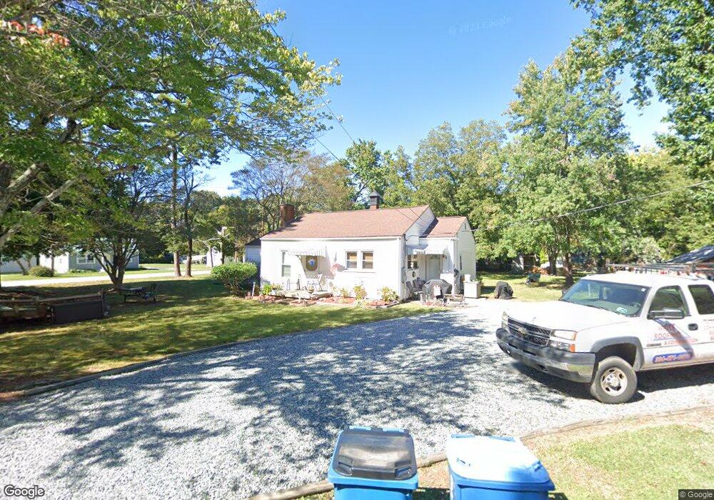
302 Ranch Dr High Point, NC 27263
Greater High Point NeighborhoodEstimated Value: $87,000 - $201,000
3
Beds
1
Bath
1,128
Sq Ft
$125/Sq Ft
Est. Value
About This Home
This home is located at 302 Ranch Dr, High Point, NC 27263 and is currently estimated at $141,475, approximately $125 per square foot. 302 Ranch Dr is a home located in Guilford County with nearby schools including Allen Jay Elementary School, Southern Guilford Middle, and Southern Guilford High School.
Ownership History
Date
Name
Owned For
Owner Type
Purchase Details
Closed on
Aug 11, 2000
Sold by
Vestal Neal R and Vestal Patsy A
Bought by
White Jonathan and White Christina
Current Estimated Value
Home Financials for this Owner
Home Financials are based on the most recent Mortgage that was taken out on this home.
Original Mortgage
$41,500
Interest Rate
8.23%
Mortgage Type
Seller Take Back
Create a Home Valuation Report for This Property
The Home Valuation Report is an in-depth analysis detailing your home's value as well as a comparison with similar homes in the area
Home Values in the Area
Average Home Value in this Area
Purchase History
| Date | Buyer | Sale Price | Title Company |
|---|---|---|---|
| White Jonathan | $41,500 | -- |
Source: Public Records
Mortgage History
| Date | Status | Borrower | Loan Amount |
|---|---|---|---|
| Closed | White Jonathan | $41,500 |
Source: Public Records
Tax History
| Year | Tax Paid | Tax Assessment Tax Assessment Total Assessment is a certain percentage of the fair market value that is determined by local assessors to be the total taxable value of land and additions on the property. | Land | Improvement |
|---|---|---|---|---|
| 2025 | $600 | $68,400 | $20,000 | $48,400 |
| 2024 | $600 | $68,400 | $20,000 | $48,400 |
| 2023 | $600 | $68,400 | $20,000 | $48,400 |
| 2022 | $600 | $68,400 | $20,000 | $48,400 |
| 2021 | $503 | $57,300 | $20,000 | $37,300 |
| 2020 | $503 | $57,300 | $20,000 | $37,300 |
| 2019 | $503 | $57,300 | $0 | $0 |
| 2018 | $500 | $57,300 | $0 | $0 |
| 2017 | $487 | $57,300 | $0 | $0 |
| 2016 | $505 | $57,700 | $0 | $0 |
| 2015 | $508 | $57,700 | $0 | $0 |
| 2014 | $514 | $57,700 | $0 | $0 |
Source: Public Records
Map
Nearby Homes
- 706 E Fairfield Rd
- 717 Belmont Dr
- 600 E Fairfield Rd
- 715 Baker Rd
- 914 Nance Ave
- 611 Liberty Rd
- 000 Liberty Rd
- 921 Norton St
- 126 Apollo Cir
- 1105 E Springfield Rd
- 10844 N Main St
- 312 Playground Rd
- 10812, 10822, 10828 N Main St
- 1535 E Fairfield Rd
- 1606 Chelsea Square
- 609 Martha Place
- 607 Martha Place
- 3813 Salisbury St
- 818 Westbrook Ct Unit 818
- 209 Purvis Ln
Your Personal Tour Guide
Ask me questions while you tour the home.