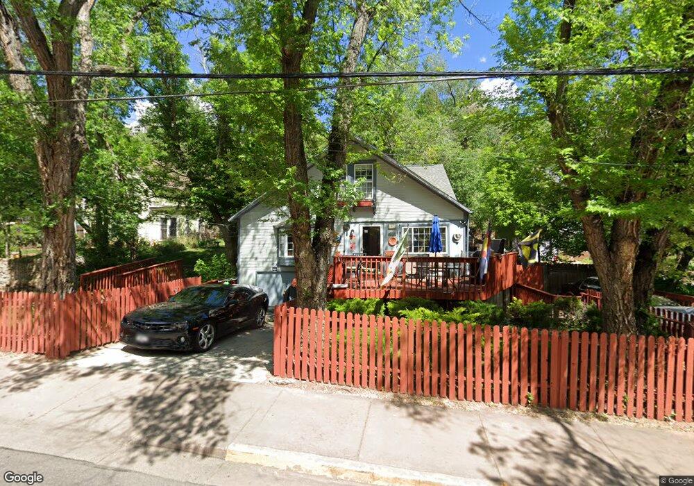
302 Ruxton Ave Manitou Springs, CO 80829
Estimated Value: $510,000 - $716,000
4
Beds
2
Baths
1,892
Sq Ft
$312/Sq Ft
Est. Value
About This Home
This home is located at 302 Ruxton Ave, Manitou Springs, CO 80829 and is currently estimated at $590,356, approximately $312 per square foot. 302 Ruxton Ave is a home located in El Paso County with nearby schools including Manitou Springs Elementary School, Manitou Springs Middle School, and Manitou Springs High School.
Ownership History
Date
Name
Owned For
Owner Type
Purchase Details
Closed on
Apr 20, 2023
Sold by
Owens Susan Jane
Bought by
Owens Sean T
Current Estimated Value
Purchase Details
Closed on
Sep 20, 2004
Sold by
Sample Alfred Wade
Bought by
Sample Susan Jane Owens
Purchase Details
Closed on
Sep 25, 1998
Sold by
Owens Susan J
Bought by
Owens Susan Jane and Sample Jay
Home Financials for this Owner
Home Financials are based on the most recent Mortgage that was taken out on this home.
Original Mortgage
$115,500
Interest Rate
6.92%
Purchase Details
Closed on
Nov 1, 1979
Bought by
Sample Jay
Create a Home Valuation Report for This Property
The Home Valuation Report is an in-depth analysis detailing your home's value as well as a comparison with similar homes in the area
Home Values in the Area
Average Home Value in this Area
Purchase History
| Date | Buyer | Sale Price | Title Company |
|---|---|---|---|
| Owens Sean T | -- | None Listed On Document | |
| Sample Susan Jane Owens | $10,000 | -- | |
| Owens Susan Jane | -- | -- | |
| Sample Jay | -- | -- |
Source: Public Records
Mortgage History
| Date | Status | Borrower | Loan Amount |
|---|---|---|---|
| Previous Owner | Owens Susan Jane | $115,500 |
Source: Public Records
Tax History Compared to Growth
Tax History
| Year | Tax Paid | Tax Assessment Tax Assessment Total Assessment is a certain percentage of the fair market value that is determined by local assessors to be the total taxable value of land and additions on the property. | Land | Improvement |
|---|---|---|---|---|
| 2025 | $2,071 | $37,170 | -- | -- |
| 2024 | $1,892 | $31,920 | $3,980 | $27,940 |
| 2022 | $1,201 | $23,200 | $3,750 | $19,450 |
| 2021 | $1,253 | $23,870 | $3,860 | $20,010 |
| 2020 | $1,003 | $19,910 | $3,220 | $16,690 |
| 2019 | $1,066 | $19,910 | $3,220 | $16,690 |
| 2018 | $907 | $17,510 | $2,500 | $15,010 |
| 2017 | $802 | $17,510 | $2,500 | $15,010 |
| 2016 | $712 | $17,110 | $2,510 | $14,600 |
| 2015 | $704 | $17,110 | $2,510 | $14,600 |
| 2014 | $567 | $15,690 | $2,220 | $13,470 |
Source: Public Records
Map
Nearby Homes
- 151 Ruxton Ave
- 153 Capitol Hill Ave
- 125 Ruxton Ave
- 206 Pine Ridge Ave
- 210 Mesa Ave
- 1117 Manitou Ave
- 1107 Manitou Ave
- 128 Cave Ave
- 0 Manitou Terrace
- 136 Cave Ave
- 140 Cave Ave
- 527 Canon Ave
- 529 Canon Ave
- 0 Charcas Rd Unit REC3377987
- 0 Charcas Rd Unit 1024513
- 105 Pawnee Ave
- 103 Deer Path Ave
- 34 Fountain Place
- 135 South Path
- 1096 Laguna Point
- 1 Brook St
- 312 Ruxton Ave
- 312 Ruxton Ave Unit 1
- 9 Brook St
- 333 Pilot Knob Ave
- 11 Brook St
- 301 Ruxton Ave
- 318 Ruxton Ave
- 339 Pilot Knob Ave
- 329 Pilot Knob Ave
- 223 Ruxton Ave
- 320 Ruxton Ave
- 345 Pilot Knob Ave
- 325 Pilot Knob Ave
- 17 Brook St
- 347 Pilot Knob Ave
- 328 Spring St
- 323 Pilot Knob Ave
- 324 Ruxton Ave
- 349 Pilot Knob Ave