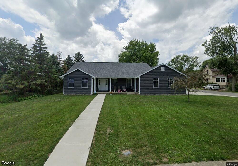
302 S Adams St Middle Point, OH 45863
Estimated Value: $199,000 - $248,000
3
Beds
3
Baths
1,560
Sq Ft
$142/Sq Ft
Est. Value
About This Home
This home is located at 302 S Adams St, Middle Point, OH 45863 and is currently estimated at $221,061, approximately $141 per square foot. 302 S Adams St is a home with nearby schools including Lincolnview Elementary School and Lincolnview Junior/Senior High School.
Ownership History
Date
Name
Owned For
Owner Type
Purchase Details
Closed on
Aug 3, 2020
Sold by
Van Wert County Land Reutlization Corp
Bought by
Sellers Tina
Current Estimated Value
Purchase Details
Closed on
Feb 14, 2018
Sold by
T3 Properties Llc
Bought by
Van Wert County Land Reutilization Corpo
Purchase Details
Closed on
Sep 30, 2016
Sold by
Johns Ricky and Johns Amy
Bought by
T3 Properties Llc
Purchase Details
Closed on
Jul 16, 2013
Sold by
Snyder Frederick L
Bought by
Johns Ricky and Johns Amy
Purchase Details
Closed on
Nov 6, 1994
Bought by
Venderley Jeffrey S and Venderley De
Create a Home Valuation Report for This Property
The Home Valuation Report is an in-depth analysis detailing your home's value as well as a comparison with similar homes in the area
Home Values in the Area
Average Home Value in this Area
Purchase History
| Date | Buyer | Sale Price | Title Company |
|---|---|---|---|
| Sellers Tina | -- | None Available | |
| Van Wert County Land Reutilization Corpo | $4,500 | None Available | |
| T3 Properties Llc | $3,000 | Maumee Valley Title Agency | |
| Johns Ricky | $2,000 | Attorney | |
| Venderley Jeffrey S | $28,000 | -- | |
| Venderley Jeffrey S | $28,000 | -- |
Source: Public Records
Tax History Compared to Growth
Tax History
| Year | Tax Paid | Tax Assessment Tax Assessment Total Assessment is a certain percentage of the fair market value that is determined by local assessors to be the total taxable value of land and additions on the property. | Land | Improvement |
|---|---|---|---|---|
| 2024 | $1,969 | $59,910 | $4,950 | $54,960 |
| 2023 | $1,969 | $59,910 | $4,950 | $54,960 |
| 2022 | $2,118 | $46,310 | $3,810 | $42,500 |
| 2021 | $171 | $3,810 | $3,810 | $0 |
| 2020 | $171 | $3,810 | $3,810 | $0 |
| 2019 | $7 | $3,360 | $3,360 | $0 |
| 2018 | $145 | $10,850 | $3,360 | $7,490 |
| 2017 | $483 | $10,850 | $3,360 | $7,490 |
| 2016 | $223 | $5,960 | $2,240 | $3,720 |
| 2015 | $254 | $6,860 | $2,890 | $3,970 |
| 2014 | $263 | $6,860 | $2,890 | $3,970 |
| 2013 | $390 | $8,650 | $2,890 | $5,760 |
Source: Public Records
Map
Nearby Homes
- 104 W South St
- 104 W Railroad St
- 112 W Railroad St
- TBD Dog Creek Rd
- 8951 Brickner Rd
- 11630 Clearview Dr
- 19083 Venedocia Eastern Rd
- 18906 Bebb St
- 15044 Main St
- 19059 Wittington St
- 616 W 5th St
- 604 W 6th St
- 409 N Bredeick St
- 503 W 6th St
- 606 S Cass St
- 634 S Clay St
- 14162 Overholt Rd
- 424 S Canal St
- 221 S Main St
- 610 N Washington St