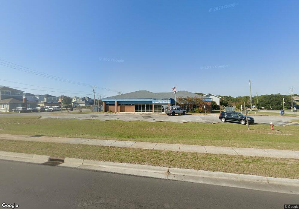
302 S Croatan Hwy Kill Devil Hills, NC 27948
Estimated Value: $1,876,399
--
Bed
2
Baths
6,610
Sq Ft
$284/Sq Ft
Est. Value
About This Home
This home is located at 302 S Croatan Hwy, Kill Devil Hills, NC 27948 and is currently estimated at $1,876,399, approximately $283 per square foot. 302 S Croatan Hwy is a home located in Dare County with nearby schools including First Flight Elementary School, First Flight Middle School, and First Flight High School.
Ownership History
Date
Name
Owned For
Owner Type
Purchase Details
Closed on
Jul 27, 2021
Sold by
Kdhpo Llc
Bought by
Southern Postal Realty Holdings Llc
Current Estimated Value
Purchase Details
Closed on
Sep 11, 2013
Sold by
Heller Margaret and Heller Martin
Bought by
Kdhpo Llc
Home Financials for this Owner
Home Financials are based on the most recent Mortgage that was taken out on this home.
Original Mortgage
$950,000
Interest Rate
4.37%
Mortgage Type
Credit Line Revolving
Purchase Details
Closed on
Oct 5, 2005
Sold by
Leary Milton T and Mccown Linda H
Bought by
Heller Margaret
Create a Home Valuation Report for This Property
The Home Valuation Report is an in-depth analysis detailing your home's value as well as a comparison with similar homes in the area
Home Values in the Area
Average Home Value in this Area
Purchase History
| Date | Buyer | Sale Price | Title Company |
|---|---|---|---|
| Southern Postal Realty Holdings Llc | $1,505,000 | Pro National Title Agency | |
| Kdhpo Llc | -- | None Available | |
| Kdhpo Llc | $950,000 | None Available | |
| Heller Margaret | $1,075,000 | None Available |
Source: Public Records
Mortgage History
| Date | Status | Borrower | Loan Amount |
|---|---|---|---|
| Previous Owner | Kdhpo Llc | $950,000 |
Source: Public Records
Tax History Compared to Growth
Tax History
| Year | Tax Paid | Tax Assessment Tax Assessment Total Assessment is a certain percentage of the fair market value that is determined by local assessors to be the total taxable value of land and additions on the property. | Land | Improvement |
|---|---|---|---|---|
| 2025 | $10,595 | $1,950,400 | $1,080,800 | $869,600 |
| 2024 | $8,749 | $1,158,000 | $615,600 | $542,400 |
| 2023 | $8,749 | $1,158,000 | $615,600 | $542,400 |
| 2022 | $8,343 | $1,158,000 | $615,600 | $542,400 |
| 2021 | $8,343 | $1,158,000 | $615,600 | $542,400 |
| 2020 | $8,816 | $1,158,000 | $615,600 | $542,400 |
| 2019 | $8,816 | $1,013,300 | $538,700 | $474,600 |
| 2018 | $0 | $1,013,300 | $538,700 | $474,600 |
| 2017 | $8,622 | $1,013,300 | $538,700 | $474,600 |
| 2016 | $8,217 | $1,013,300 | $538,700 | $474,600 |
| 2014 | $7,913 | $1,013,300 | $538,700 | $474,600 |
Source: Public Records
Map
Nearby Homes
- 105 E Aviation Ave Unit 15
- 113 E Aviation Ave
- 113 E Aviation Ave Unit Lot 19
- 505 S Virginia Dare Trail Unit 2
- 503 N Virginia Dare Trail Unit 5
- 804 S Memorial Blvd Unit 2B
- 804 S Memorial Blvd Unit 1-E
- 701 S Virginia Dare Trail Unit 1
- 902 S Virginia Dare Trail Unit 102
- 815 S Virginia Dare Trail Unit 202
- 111 Baker Ave Unit Lot18Pt17
- 1014 S Virginia Dare Trail Unit 301
- 1014 S Virginia Dare Trail Unit 402
- 110 Baker Ave Unit Lot:7 & PT 6
- 803 6th Ave Unit Lot 9
- 302 W Clark St Unit Lot 6
- 200 E Martin St Unit 202
- 1209 Wrightsville Blvd Unit Lot 26
- 1205 S Virginia Dare Trail Unit Lot 3
- 1221 S Virginia Dare Trail Unit B-4
- 0 Holly St Unit Lot 1 120061
- 0 Holly St
- 111 W Oregon Ave
- 400 S Croatan Hwy
- 100 E Meadowlark St
- 101 E Oregon Ave Unit 13
- 101 E Oregon Ave
- 114 E Oregon Ave
- 102 E Meadowlark St
- 114 W Oregon Ave
- 108 W Saint Clair St
- 111 W Carlton Ave
- 103 E Oregon Ave
- 101 E Meadowlark St
- 100 E Oregon Ave
- 110 W Saint Clair St
- 115 S Mustian St
- 104 E Meadowlark St
- 112 W Saint Clair St Unit 12
- 102 E Oregon Ave