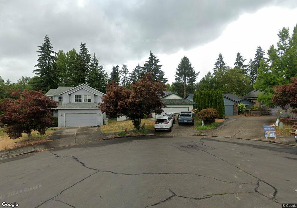
302 SE 68th Ave Hillsboro, OR 97123
Southeast Hillsboro NeighborhoodEstimated Value: $496,000 - $541,821
--
Bed
2
Baths
1,470
Sq Ft
$356/Sq Ft
Est. Value
About This Home
This home is located at 302 SE 68th Ave, Hillsboro, OR 97123 and is currently estimated at $523,205, approximately $355 per square foot. 302 SE 68th Ave is a home located in Washington County with nearby schools including Imlay Elementary School, R.A. Brown Middle School, and Century High School.
Ownership History
Date
Name
Owned For
Owner Type
Purchase Details
Closed on
Apr 26, 2016
Sold by
Fullmer Mark E and Fullmer Nora
Bought by
Fullmer Living Trust
Current Estimated Value
Purchase Details
Closed on
Aug 17, 1995
Sold by
Parsons Jeffrey R
Bought by
Fullmer Mark E and Fullmer Nora
Home Financials for this Owner
Home Financials are based on the most recent Mortgage that was taken out on this home.
Original Mortgage
$143,106
Interest Rate
7.71%
Mortgage Type
Assumption
Create a Home Valuation Report for This Property
The Home Valuation Report is an in-depth analysis detailing your home's value as well as a comparison with similar homes in the area
Home Values in the Area
Average Home Value in this Area
Purchase History
| Date | Buyer | Sale Price | Title Company |
|---|---|---|---|
| Fullmer Living Trust | -- | None Available | |
| Fullmer Mark E | $140,300 | Oregon Title Insurance Co |
Source: Public Records
Mortgage History
| Date | Status | Borrower | Loan Amount |
|---|---|---|---|
| Closed | Fullmer Mark E | $143,106 |
Source: Public Records
Tax History Compared to Growth
Tax History
| Year | Tax Paid | Tax Assessment Tax Assessment Total Assessment is a certain percentage of the fair market value that is determined by local assessors to be the total taxable value of land and additions on the property. | Land | Improvement |
|---|---|---|---|---|
| 2025 | $4,252 | $260,110 | -- | -- |
| 2024 | $4,131 | $252,540 | -- | -- |
| 2023 | $4,131 | $245,190 | $0 | $0 |
| 2022 | $4,019 | $245,190 | $0 | $0 |
| 2021 | $3,938 | $231,120 | $0 | $0 |
| 2020 | $3,853 | $224,390 | $0 | $0 |
| 2019 | $3,742 | $217,860 | $0 | $0 |
| 2018 | $3,582 | $211,520 | $0 | $0 |
| 2017 | $3,452 | $205,360 | $0 | $0 |
| 2016 | $3,358 | $199,380 | $0 | $0 |
| 2015 | $3,223 | $193,580 | $0 | $0 |
| 2014 | $3,204 | $187,950 | $0 | $0 |
Source: Public Records
Map
Nearby Homes
- 155 NE Woodsong St
- 146 NE Woodsong St
- 6538 NE Forest Ln
- 154 NE Danbury Ave
- 6461 SE Maple St
- 6874 SE Ariel St
- 0 NE 69th Ave
- 6417 SE Maple St
- 6641 SE Wrenfield St
- 818 SE 68th Place
- 7307 NE Nelly St
- 7259 SE Harnish St
- 7200 SE Harnish St
- 6209 NE Dereck Ln
- 569 NE Natalie St
- 7082 SE Lois St
- 6194 SE Maple St
- 279 NE Natalie St
- 7281 NE Rockridge Place
- 6204 SE Sigrid St
- 303 SE 68th Ave
- 326 SE 68th Ave
- 338 SE 68th Ave
- 321 SE 68th Ave
- 335 SE 68th Ave
- 352 SE 68th Ave
- 22520 W Baseline Rd
- 349 SE 68th Ave
- 319 SE 69th Ave
- 325 SE 69th Ave
- 337 SE 69th Ave
- 357 SE 68th Ave
- 353 SE 69th Ave
- 363 SE 68th Ave
- 364 SE 68th Ave
- 22600 W Baseline Rd
- 375 SE 68th Ave
- 6771 SE Patricia Ln
- 361 SE 69th Ave
- 376 SE 68th Ave