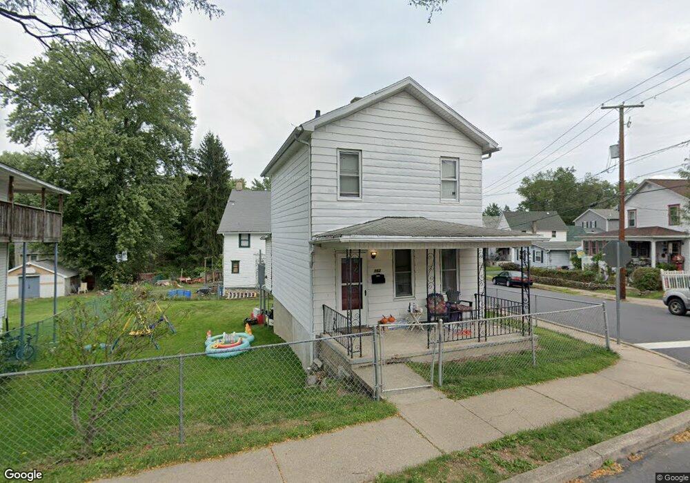
302 Spring St Scranton, PA 18508
Providence NeighborhoodEstimated Value: $113,186 - $155,000
Studio
--
Bath
--
Sq Ft
4,617
Sq Ft Lot
About This Home
This home is located at 302 Spring St, Scranton, PA 18508 and is currently estimated at $140,047. 302 Spring St is a home located in Lackawanna County with nearby schools including Neil Armstrong Elementary School, Northeast Scranton Intermediate School, and Scranton High School.
Ownership History
Date
Name
Owned For
Owner Type
Purchase Details
Closed on
Nov 18, 2024
Sold by
Garan Robert W and Garan Alicia
Bought by
Garan Kyle
Current Estimated Value
Home Financials for this Owner
Home Financials are based on the most recent Mortgage that was taken out on this home.
Original Mortgage
$73,625
Outstanding Balance
$72,892
Interest Rate
6.12%
Mortgage Type
New Conventional
Estimated Equity
$67,155
Purchase Details
Closed on
Jul 18, 2008
Sold by
Hobbs George and Hobbs Sandra
Bought by
Garen Robert W
Home Financials for this Owner
Home Financials are based on the most recent Mortgage that was taken out on this home.
Original Mortgage
$50,000
Interest Rate
6.35%
Mortgage Type
New Conventional
Create a Home Valuation Report for This Property
The Home Valuation Report is an in-depth analysis detailing your home's value as well as a comparison with similar homes in the area
Home Values in the Area
Average Home Value in this Area
Purchase History
| Date | Buyer | Sale Price | Title Company |
|---|---|---|---|
| Garan Kyle | $77,500 | None Listed On Document | |
| Garen Robert W | $60,000 | None Available |
Source: Public Records
Mortgage History
| Date | Status | Borrower | Loan Amount |
|---|---|---|---|
| Open | Garan Kyle | $73,625 | |
| Previous Owner | Garen Robert W | $50,000 |
Source: Public Records
Tax History
| Year | Tax Paid | Tax Assessment Tax Assessment Total Assessment is a certain percentage of the fair market value that is determined by local assessors to be the total taxable value of land and additions on the property. | Land | Improvement |
|---|---|---|---|---|
| 2025 | $2,367 | $7,000 | $1,700 | $5,300 |
| 2024 | $2,171 | $7,000 | $1,700 | $5,300 |
| 2023 | $2,171 | $7,000 | $1,700 | $5,300 |
| 2022 | $2,124 | $7,000 | $1,700 | $5,300 |
| 2021 | $2,124 | $7,000 | $1,700 | $5,300 |
| 2020 | $2,086 | $7,000 | $1,700 | $5,300 |
| 2019 | $1,965 | $7,000 | $1,700 | $5,300 |
| 2018 | $1,965 | $7,000 | $1,700 | $5,300 |
| 2017 | $1,932 | $7,000 | $1,700 | $5,300 |
| 2016 | $663 | $7,000 | $1,700 | $5,300 |
| 2015 | $1,142 | $7,000 | $1,700 | $5,300 |
| 2014 | -- | $7,000 | $1,700 | $5,300 |
Source: Public Records
Map
Nearby Homes
- 2009-2011 Margaret Ave
- 214 William St
- 2105 Belmont Terrace
- 418 Leggett St
- 2089 N Main Ave
- 193 W Parker St
- 2141 N Main Ave
- 1804 N Main Ave
- 463 Oak St
- 510 Oak St
- 2402 N Main Ave
- 194 Charles St
- 131 Throop St
- 63-65 E Parker St
- 1720 Mcdonough Ave
- 511 Race St
- 328 Ferdinand St
- 309 Ferdinand St
- 2706 N Main Ave
- 2724 N Main Ave
- 306 Spring St Unit 308
- 2135 Wayne Ave Unit 2137
- 310 Spring St
- 2123 Wayne Ave
- 2128 Wayne Ave
- 2141 Wayne Ave
- 2126 Wayne Ave
- 2121 Wayne Ave
- 2130 Wayne Ave
- 2136 Wayne Ave
- 314 Spring St
- 2154 Brick Ave
- 2138 Wayne Ave
- 2119 Wayne Ave
- 2148 Brick Ave
- 2158 Brick Ave
- 2146 2148 Brick Ave
- 2118 Wayne Ave
- 2142 Wayne Ave
Your Personal Tour Guide
Ask me questions while you tour the home.