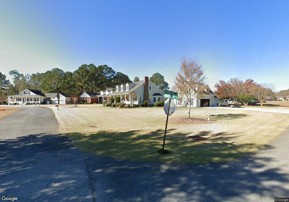
302 Sting Ray Ct Guyton, GA 31312
Estimated Value: $462,000 - $498,000
4
Beds
3
Baths
2,980
Sq Ft
$159/Sq Ft
Est. Value
About This Home
This home is located at 302 Sting Ray Ct, Guyton, GA 31312 and is currently estimated at $472,819, approximately $158 per square foot. 302 Sting Ray Ct is a home located in Effingham County with nearby schools including South Effingham Elementary School, South Effingham Middle School, and South Effingham High School.
Ownership History
Date
Name
Owned For
Owner Type
Purchase Details
Closed on
Jul 15, 2010
Sold by
Parr John F
Bought by
Hart Michael W and Hart Tara A
Current Estimated Value
Home Financials for this Owner
Home Financials are based on the most recent Mortgage that was taken out on this home.
Original Mortgage
$288,267
Outstanding Balance
$190,256
Interest Rate
4.74%
Mortgage Type
VA
Estimated Equity
$282,563
Purchase Details
Closed on
Apr 5, 2010
Sold by
Parr John F
Bought by
Hart Michael W and Hart Tara A
Purchase Details
Closed on
Dec 2, 2005
Sold by
Parr John F
Bought by
Parr John F and Parr Patricia L
Home Financials for this Owner
Home Financials are based on the most recent Mortgage that was taken out on this home.
Original Mortgage
$174,000
Interest Rate
5.25%
Mortgage Type
New Conventional
Create a Home Valuation Report for This Property
The Home Valuation Report is an in-depth analysis detailing your home's value as well as a comparison with similar homes in the area
Home Values in the Area
Average Home Value in this Area
Purchase History
| Date | Buyer | Sale Price | Title Company |
|---|---|---|---|
| Hart Michael W | $282,200 | -- | |
| Hart Michael W | $282,200 | -- | |
| Parr John F | -- | -- | |
| Parr John F | $305,000 | -- |
Source: Public Records
Mortgage History
| Date | Status | Borrower | Loan Amount |
|---|---|---|---|
| Open | Hart Michael W | $288,267 | |
| Previous Owner | Parr John F | $174,000 |
Source: Public Records
Tax History Compared to Growth
Tax History
| Year | Tax Paid | Tax Assessment Tax Assessment Total Assessment is a certain percentage of the fair market value that is determined by local assessors to be the total taxable value of land and additions on the property. | Land | Improvement |
|---|---|---|---|---|
| 2025 | $4,389 | $143,669 | $30,000 | $113,669 |
| 2024 | $4,389 | $141,172 | $30,000 | $111,172 |
| 2023 | $3,223 | $133,721 | $20,800 | $112,921 |
| 2022 | $3,838 | $132,921 | $20,000 | $112,921 |
| 2021 | $3,736 | $120,345 | $20,000 | $100,345 |
| 2020 | $3,519 | $113,770 | $18,000 | $95,770 |
| 2019 | $3,541 | $113,770 | $18,000 | $95,770 |
| 2018 | $3,403 | $107,357 | $18,000 | $89,357 |
| 2017 | $3,438 | $107,357 | $18,000 | $89,357 |
| 2016 | $3,187 | $104,032 | $16,000 | $88,032 |
| 2015 | -- | $104,032 | $16,000 | $88,032 |
| 2014 | -- | $109,232 | $21,200 | $88,032 |
| 2013 | -- | $109,231 | $21,200 | $88,031 |
Source: Public Records
Map
Nearby Homes
- 2410 Hodgeville Rd
- 310 Keen Way
- 203 Orchard Dr
- 124 Breaklands Ct
- 116 Breaklands Ct
- 109 Claystone Ct
- 74 Winslow Cir
- 86 Winslow Cir
- 123 Telford St
- 201 Antigua Place
- 105 Telford St
- 58 Winslow Cir
- 167 Whitehaven Rd
- 158 Troupe Dr
- 75 Redwall Cir
- 460 Kolic Helmey Rd
- 9 Saddle St N
- The Aspen Plan at Savannah Highlands
- The Brookhaven Plan at Savannah Highlands
- The Wilmington Plan at Savannah Highlands
- 116 Lakewood Dr
- 304 Sting Ray Ct
- 201 Lakewood Cir
- 301 Sting Ray Ct
- 114 Lakewood Dr
- 120 Lakewood Dr
- 306 Sting Ray Ct
- 303 Sting Ray Ct
- 203 Lakewood Cir
- 308 Sting Ray Ct
- 113 Lakewood Dr
- 112 Lakewood Dr
- 115 Lakewood Dr
- 122 Lakewood Dr
- 111 Lakewood Dr
- 109 Lakewood Dr
- 305 Sting Ray Ct
- 205 Lakewood Cir
- 117 Lakewood Dr
- 110 Lakewood Dr