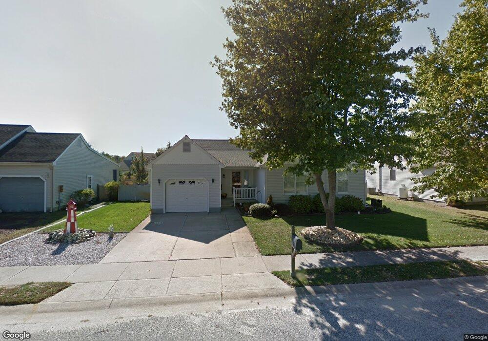
302 Tahoe Dr Villas, NJ 08251
Estimated Value: $480,484 - $673,000
--
Bed
--
Bath
1,606
Sq Ft
$372/Sq Ft
Est. Value
About This Home
This home is located at 302 Tahoe Dr, Villas, NJ 08251 and is currently estimated at $596,871, approximately $371 per square foot. 302 Tahoe Dr is a home located in Cape May County with nearby schools including David C. Douglass Veterans Memorial School, Carl T. Mitnick School, and Maud Abrams School.
Ownership History
Date
Name
Owned For
Owner Type
Purchase Details
Closed on
Oct 25, 1985
Bought by
Ainsworth Donald J and Ainsworth Marie A
Current Estimated Value
Create a Home Valuation Report for This Property
The Home Valuation Report is an in-depth analysis detailing your home's value as well as a comparison with similar homes in the area
Home Values in the Area
Average Home Value in this Area
Purchase History
| Date | Buyer | Sale Price | Title Company |
|---|---|---|---|
| Ainsworth Donald J | $74,400 | -- |
Source: Public Records
Tax History Compared to Growth
Tax History
| Year | Tax Paid | Tax Assessment Tax Assessment Total Assessment is a certain percentage of the fair market value that is determined by local assessors to be the total taxable value of land and additions on the property. | Land | Improvement |
|---|---|---|---|---|
| 2025 | $5,078 | $250,900 | $115,000 | $135,900 |
| 2024 | $5,078 | $250,900 | $115,000 | $135,900 |
| 2023 | $4,998 | $250,900 | $115,000 | $135,900 |
| 2022 | $4,699 | $250,900 | $115,000 | $135,900 |
| 2021 | $4,699 | $250,900 | $115,000 | $135,900 |
| 2020 | $4,622 | $250,900 | $115,000 | $135,900 |
| 2019 | $4,511 | $250,900 | $115,000 | $135,900 |
| 2018 | $4,408 | $250,900 | $115,000 | $135,900 |
| 2017 | $4,408 | $250,900 | $115,000 | $135,900 |
| 2016 | $4,348 | $250,900 | $115,000 | $135,900 |
| 2015 | $4,210 | $250,900 | $115,000 | $135,900 |
| 2014 | $4,057 | $250,900 | $115,000 | $135,900 |
Source: Public Records
Map
Nearby Homes
- 118 Shadeland Ave
- 2710 Bybrook Dr
- 203 Shadeland Ave
- 2988 Bybrook Dr
- 9 Cedardale Ct
- BRISTOL Plan at Shawmount Village
- 14 Cedardale Ct
- 12 Cedardale Ct
- 3 Cedardale Ct
- 221 Cedardale Ave
- 110 Oakdale Ave
- 15 Cedardale Ct
- 17 Cedardale Ct
- 8 Cedardale Ct
- 23 Cedardale Ct
- 1 Cedardale Ct
- 13 Cedardale Ct
- 100 Oakdale Ave
- 21 Cedardale Ct
- 19 Cedardale Ct