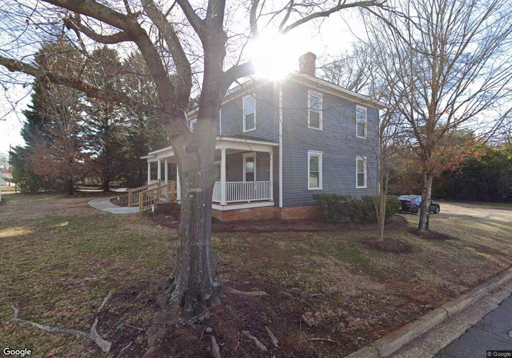
302 Tom Hall St Unit 6 Fort Mill, SC 29715
Estimated Value: $342,000 - $606,000
--
Bed
--
Bath
2,964
Sq Ft
$154/Sq Ft
Est. Value
About This Home
This home is located at 302 Tom Hall St Unit 6, Fort Mill, SC 29715 and is currently estimated at $456,695, approximately $154 per square foot. 302 Tom Hall St Unit 6 is a home located in York County with nearby schools including Riverview Elementary School, Banks Trail Middle School, and Catawba Ridge High School.
Ownership History
Date
Name
Owned For
Owner Type
Purchase Details
Closed on
Dec 5, 2013
Sold by
Neighborhood Housing Group Llc
Bought by
Carolina Blue Sky Property Llc and Zcm Real Estate Llc
Current Estimated Value
Home Financials for this Owner
Home Financials are based on the most recent Mortgage that was taken out on this home.
Original Mortgage
$130,000
Outstanding Balance
$97,089
Interest Rate
4.19%
Mortgage Type
New Conventional
Estimated Equity
$359,606
Purchase Details
Closed on
May 6, 2013
Sold by
Patterson James Kirby and Collins Frances Ernestine P
Bought by
Neighborhood Housing Group Llc
Create a Home Valuation Report for This Property
The Home Valuation Report is an in-depth analysis detailing your home's value as well as a comparison with similar homes in the area
Home Values in the Area
Average Home Value in this Area
Purchase History
| Date | Buyer | Sale Price | Title Company |
|---|---|---|---|
| Carolina Blue Sky Property Llc | $95,000 | -- | |
| Neighborhood Housing Group Llc | $75,000 | -- |
Source: Public Records
Mortgage History
| Date | Status | Borrower | Loan Amount |
|---|---|---|---|
| Open | Carolina Blue Sky Property Llc | $130,000 |
Source: Public Records
Tax History Compared to Growth
Tax History
| Year | Tax Paid | Tax Assessment Tax Assessment Total Assessment is a certain percentage of the fair market value that is determined by local assessors to be the total taxable value of land and additions on the property. | Land | Improvement |
|---|---|---|---|---|
| 2024 | $4,742 | $8,384 | $4,470 | $3,914 |
| 2023 | $4,513 | $8,384 | $4,470 | $3,914 |
| 2022 | $4,169 | $8,383 | $4,476 | $3,907 |
| 2021 | -- | $8,383 | $4,476 | $3,907 |
| 2020 | $4,013 | $8,383 | $0 | $0 |
| 2019 | $3,788 | $7,290 | $0 | $0 |
| 2018 | $3,786 | $7,290 | $0 | $0 |
| 2017 | $3,644 | $7,290 | $0 | $0 |
| 2016 | $3,558 | $7,290 | $0 | $0 |
| 2014 | $1,062 | $7,290 | $3,600 | $3,690 |
| 2013 | $1,062 | $7,470 | $3,600 | $3,870 |
Source: Public Records
Map
Nearby Homes
- 116 E Hill St
- 114 Lazenby Dr
- 114 Country Club Dr
- 101 Randolph St
- 220 Avery St
- 408 Joe Louis St
- 2026 Bonds Ln
- 1177 Doby Ct
- 925 Cobbled Way
- 2133 Bowie Stone Ct
- 4211 Skyboat Cir
- 147 Morning Gap Pkwy
- 224 Grier St
- 406 Williamson St
- 810 Springs St
- 2081 Bonds Ln Unit 27
- 127 Phil Ct Unit 50
- 2085 Bonds Ln Unit 26
- 2087 Bonds Ln
- 122 Leonidas St
- 302 Tom Hall St
- 302 Tom Hall St Unit 3
- 310 Tom Hall St
- 108 Forrest St
- 112 Forrest St
- 105 Allison St
- 314 Tom Hall St
- 114 Forrest St
- .32 acre Morgan St
- 117 Forrest St
- 109 Allison St
- 6517 Adrenne Way Unit 83
- 145 Po Box
- 119 Forrest St
- 112 Allison St
- 108 Allison St
- 126 Forrest St
- 121 Forrest St
- 110 Allison St
- 108 Phifer St