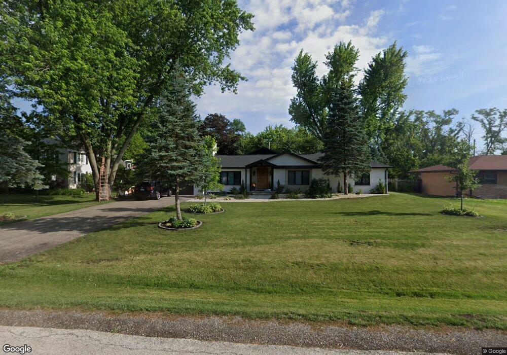
302 Viola Ln Prospect Heights, IL 60070
Estimated Value: $523,000 - $572,000
3
Beds
2
Baths
1,698
Sq Ft
$324/Sq Ft
Est. Value
About This Home
This home is located at 302 Viola Ln, Prospect Heights, IL 60070 and is currently estimated at $549,379, approximately $323 per square foot. 302 Viola Ln is a home located in Cook County with nearby schools including Dwight D Eisenhower Elementary School, Anne Sullivan Elementary School, and Betsy Ross Elementary School.
Ownership History
Date
Name
Owned For
Owner Type
Purchase Details
Closed on
Jun 12, 2021
Sold by
Strzzewski Randy P and The Carole M Allestto Revocabl
Bought by
Pop Ligia
Current Estimated Value
Home Financials for this Owner
Home Financials are based on the most recent Mortgage that was taken out on this home.
Original Mortgage
$361,000
Outstanding Balance
$328,327
Interest Rate
3.6%
Mortgage Type
New Conventional
Estimated Equity
$221,052
Purchase Details
Closed on
Oct 29, 2009
Sold by
Schmoeller Joan B and Schmoeller Carole M
Bought by
Alletto Carole M and Carole M Alletto Revocable Trust
Create a Home Valuation Report for This Property
The Home Valuation Report is an in-depth analysis detailing your home's value as well as a comparison with similar homes in the area
Home Values in the Area
Average Home Value in this Area
Purchase History
| Date | Buyer | Sale Price | Title Company |
|---|---|---|---|
| Pop Ligia | $380,000 | Old Republic Natl Ttl Ins Co | |
| Alletto Carole M | -- | None Available |
Source: Public Records
Mortgage History
| Date | Status | Borrower | Loan Amount |
|---|---|---|---|
| Open | Pop Ligia | $361,000 |
Source: Public Records
Tax History
| Year | Tax Paid | Tax Assessment Tax Assessment Total Assessment is a certain percentage of the fair market value that is determined by local assessors to be the total taxable value of land and additions on the property. | Land | Improvement |
|---|---|---|---|---|
| 2025 | $14,765 | $56,000 | $10,120 | $45,880 |
| 2024 | $14,765 | $45,069 | $8,096 | $36,973 |
| 2023 | $10,144 | $49,129 | $8,096 | $41,033 |
| 2022 | $10,144 | $36,000 | $8,096 | $27,904 |
| 2021 | $6,170 | $24,813 | $7,084 | $17,729 |
| 2020 | $6,106 | $24,813 | $7,084 | $17,729 |
| 2019 | $6,117 | $27,755 | $7,084 | $20,671 |
| 2018 | $8,092 | $33,048 | $6,072 | $26,976 |
| 2017 | $5,846 | $33,048 | $6,072 | $26,976 |
| 2016 | $8,185 | $33,048 | $6,072 | $26,976 |
| 2015 | $7,377 | $28,045 | $5,060 | $22,985 |
| 2014 | $7,148 | $28,045 | $5,060 | $22,985 |
| 2013 | $7,137 | $28,045 | $5,060 | $22,985 |
Source: Public Records
Map
Nearby Homes
- 307 Anne Ct
- 2012 N Silver Lake Rd Unit 105
- 802 Andover Ct
- 2014 N Stillwater Rd Unit 108
- 13 W Kenilworth Ave
- 1831 N Rolling Ln
- 2454 E Hunter Dr Unit 93
- 2005 N Woodland Ln
- 2207 E Michael Manor Ln
- 206 Elm St
- 2019 E Avon Ln
- 16 Robert Ave
- 214 N Elmhurst Rd
- 1525 Sander Ct Unit 113
- 1525 Sander Ct Unit 108
- 1525 Sander Ct Unit 103
- 1201 Pleasant Run Dr Unit 312
- 1450 Sandpebble Dr Unit 333
- 2515 E Olive St Unit 1C
- 2515 E Olive St Unit 4H
Your Personal Tour Guide
Ask me questions while you tour the home.