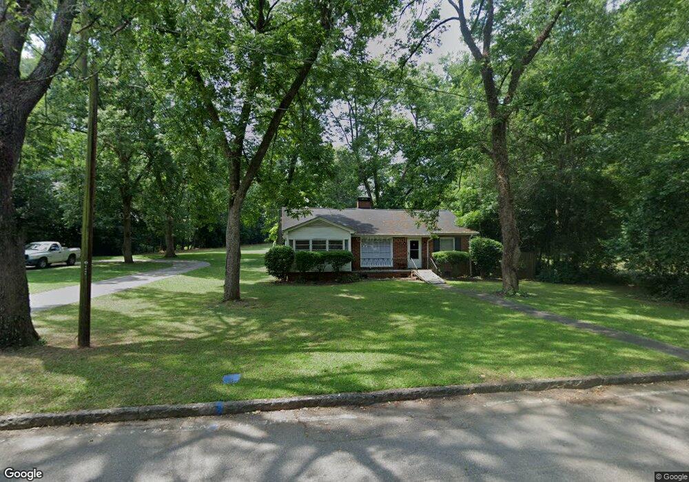
302 W Greene St Greensboro, GA 30642
Estimated Value: $172,247 - $261,000
--
Bed
--
Bath
1,182
Sq Ft
$169/Sq Ft
Est. Value
About This Home
This home is located at 302 W Greene St, Greensboro, GA 30642 and is currently estimated at $200,062, approximately $169 per square foot. 302 W Greene St is a home with nearby schools including Greene County High School.
Ownership History
Date
Name
Owned For
Owner Type
Purchase Details
Closed on
Dec 31, 2006
Sold by
Thornton Terri Temple
Bought by
Thornton David A
Current Estimated Value
Purchase Details
Closed on
Nov 4, 1996
Sold by
Mcelhannon Bertha
Bought by
Thornton David A and Thornton Terri T
Purchase Details
Closed on
May 28, 1996
Sold by
Mcelhannon Bertha Marie
Bought by
Mcelhannon Bertha
Purchase Details
Closed on
Jan 1, 1979
Sold by
Mcelhannon Tommy and Mcelhannon Bertha
Bought by
Mcelhannon Bertha Marie
Purchase Details
Closed on
Jan 1, 1954
Bought by
Mcelhannon Tommy and Mcelhannon Bertha
Create a Home Valuation Report for This Property
The Home Valuation Report is an in-depth analysis detailing your home's value as well as a comparison with similar homes in the area
Home Values in the Area
Average Home Value in this Area
Purchase History
| Date | Buyer | Sale Price | Title Company |
|---|---|---|---|
| Thornton David A | -- | -- | |
| Thornton David A | $45,000 | -- | |
| Mcelhannon Bertha | -- | -- | |
| Mcelhannon Bertha Marie | -- | -- | |
| Mcelhannon Tommy | -- | -- |
Source: Public Records
Tax History Compared to Growth
Tax History
| Year | Tax Paid | Tax Assessment Tax Assessment Total Assessment is a certain percentage of the fair market value that is determined by local assessors to be the total taxable value of land and additions on the property. | Land | Improvement |
|---|---|---|---|---|
| 2024 | $1,204 | $46,960 | $7,840 | $39,120 |
| 2023 | $898 | $43,960 | $7,840 | $36,120 |
| 2022 | $800 | $36,720 | $3,920 | $32,800 |
| 2021 | $770 | $33,080 | $3,920 | $29,160 |
| 2020 | $471 | $15,240 | $3,040 | $12,200 |
| 2019 | $485 | $15,240 | $3,040 | $12,200 |
| 2018 | $463 | $15,240 | $3,040 | $12,200 |
| 2017 | $442 | $15,270 | $3,060 | $12,210 |
| 2016 | $456 | $15,965 | $3,060 | $12,905 |
| 2015 | $424 | $15,964 | $3,060 | $12,905 |
| 2014 | $431 | $15,883 | $3,060 | $12,823 |
Source: Public Records
Map
Nearby Homes
- 314 W South St
- 15 South St Unit Siloam Road
- 301 N East St
- 0 Maple Cir
- 1061 Grimes St
- 504 Martin Luther King Junior Dr
- 0 Canaan St
- 805 S West St
- 1020 Horton Dr
- 0 Railroad St Unit 218854
- 0 Railroad St Unit 10578007
- 0 Railroad St Unit 531919
- 109 Reynolds Dr
- 105 Wilson St
- 1531 E Broad St
- 1060 Twin Pines Cir
- 1141 Armour Cir
- 1311 Lighthouse Cir
- 1131 Planing Mill Rd
- 1141 Planing Mill Rd
- 301 W Greene St
- 301 W Broad St
- 0 Chestnut St Unit 7243630
- 0 Chestnut St Unit 8585889
- 0 Chestnut St Unit 3232132
- 0 Chestnut St
- 303 W Broad St
- 305 W Greene St
- 402 W Greene St
- W W Greene St
- 205 W Broad St
- 208 W Broad St
- 401 W Broad St
- 401 W Broad St
- 404 W Greene St
- 0 Rockport Ln Unit LOT 4 3137324
- 406 W Greene St
- 405 W Broad St
- 201 W Greene St
- 302 W Broad St