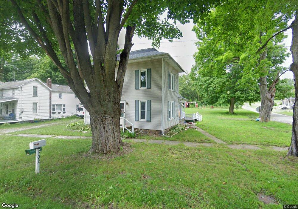
302 W Main St Unit 300 & 304 Addison, MI 49220
Estimated Value: $122,000 - $153,713
3
Beds
6
Baths
1,546
Sq Ft
$90/Sq Ft
Est. Value
About This Home
This home is located at 302 W Main St Unit 300 & 304, Addison, MI 49220 and is currently estimated at $138,678, approximately $89 per square foot. 302 W Main St Unit 300 & 304 is a home located in Lenawee County with nearby schools including Addison Elementary School, Addison Middle School, and Addison High School.
Ownership History
Date
Name
Owned For
Owner Type
Purchase Details
Closed on
Jul 15, 2019
Sold by
Jodoin Paula and Jodoin Clifford
Bought by
Yannott Raymond
Current Estimated Value
Home Financials for this Owner
Home Financials are based on the most recent Mortgage that was taken out on this home.
Original Mortgage
$83,737
Outstanding Balance
$73,361
Interest Rate
3.82%
Mortgage Type
New Conventional
Estimated Equity
$65,317
Purchase Details
Closed on
Oct 23, 2006
Sold by
Pelt Marjorie E and Pelt Howard O
Bought by
Pelt Steve J
Purchase Details
Closed on
Nov 21, 1995
Bought by
Jodoin Clifford and Jodoin Paula
Create a Home Valuation Report for This Property
The Home Valuation Report is an in-depth analysis detailing your home's value as well as a comparison with similar homes in the area
Home Values in the Area
Average Home Value in this Area
Purchase History
| Date | Buyer | Sale Price | Title Company |
|---|---|---|---|
| Yannott Raymond | $82,900 | Prestige Title Insurance Age | |
| Pelt Steve J | -- | None Available | |
| Jodoin Clifford | $19,000 | -- |
Source: Public Records
Mortgage History
| Date | Status | Borrower | Loan Amount |
|---|---|---|---|
| Open | Yannott Raymond | $83,737 |
Source: Public Records
Tax History Compared to Growth
Tax History
| Year | Tax Paid | Tax Assessment Tax Assessment Total Assessment is a certain percentage of the fair market value that is determined by local assessors to be the total taxable value of land and additions on the property. | Land | Improvement |
|---|---|---|---|---|
| 2025 | $1,063 | $64,300 | $0 | $0 |
| 2024 | $1,730 | $56,300 | $0 | $0 |
| 2023 | -- | $45,000 | $0 | $0 |
| 2022 | $974 | $44,600 | $0 | $0 |
| 2021 | $2,334 | $37,900 | $0 | $0 |
| 2020 | $1,420 | $40,400 | $0 | $0 |
| 2019 | $61,861 | $40,400 | $0 | $0 |
| 2018 | $745 | $34,210 | $0 | $0 |
| 2017 | $720 | $34,465 | $0 | $0 |
| 2016 | $714 | $33,865 | $0 | $0 |
| 2014 | -- | $48,997 | $0 | $0 |
Source: Public Records
Map
Nearby Homes
- 135 S Steer St
- 236 S Steer St
- 305 N Steer St
- 6482 Sorby Hwy
- 5875 U S 127
- 13820 N Adams Rd
- 9010 U S 127
- 0
- VL Manitou Beach Road Proposed
- 0 Manitou Beach Rd Lot B
- 9254 Cherry Point Rd
- 360 Park St
- 8484 N Rollin Hwy
- 348 Lenawee St
- 9265 Devils Lake Hwy
- 8676 Cherry Point Dr
- 1100 Elm Blk St
- 15858 Lelah Ln
- 17475 U S 223
- 6000 Devils Lake Hwy
- 300 W Main St Unit BLK
- 312 W Main St
- 306 W Main St
- 318 W Main St
- 324 W Main St
- 326 W Main St
- 315 W Main St
- 309 W Main St
- 319 W Main St
- 321 W Main St
- 0 Mill Rd
- 252 W Main St St N
- 252 W West Main St St N
- 117 Mill St
- 300 E Main St Unit BLK
- 200 Saunders St Unit BLK
- 15000 Heath Rd
- 259 W Main St
- 255 W Main St
- 255 W Main St