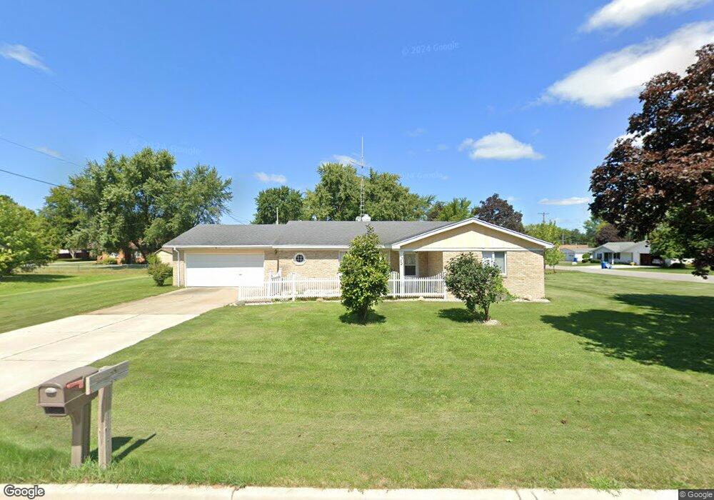
302 W Maple Ave Scottville, MI 49454
Estimated Value: $214,000 - $285,552
3
Beds
2
Baths
1,888
Sq Ft
$137/Sq Ft
Est. Value
About This Home
This home is located at 302 W Maple Ave, Scottville, MI 49454 and is currently estimated at $257,888, approximately $136 per square foot. 302 W Maple Ave is a home located in Mason County with nearby schools including Mason County Central Upper Elementary School, Scottville Elementary School, and Mason County Central Middle School.
Ownership History
Date
Name
Owned For
Owner Type
Purchase Details
Closed on
Jan 19, 2016
Sold by
Maki Richard L and Maki Sylvia A
Bought by
Maki Richard L and Maki Sylvia A
Current Estimated Value
Purchase Details
Closed on
Apr 1, 2004
Sold by
Merrill Rodney D and Merrill Janice L
Bought by
Maki Richard L and Maki Sylvia A
Home Financials for this Owner
Home Financials are based on the most recent Mortgage that was taken out on this home.
Original Mortgage
$80,000
Outstanding Balance
$37,621
Interest Rate
5.65%
Estimated Equity
$220,267
Create a Home Valuation Report for This Property
The Home Valuation Report is an in-depth analysis detailing your home's value as well as a comparison with similar homes in the area
Home Values in the Area
Average Home Value in this Area
Purchase History
| Date | Buyer | Sale Price | Title Company |
|---|---|---|---|
| Maki Richard L | -- | None Available | |
| Maki Richard L | $119,678 | Lakeshore Land & Title |
Source: Public Records
Mortgage History
| Date | Status | Borrower | Loan Amount |
|---|---|---|---|
| Open | Maki Richard L | $80,000 |
Source: Public Records
Tax History Compared to Growth
Tax History
| Year | Tax Paid | Tax Assessment Tax Assessment Total Assessment is a certain percentage of the fair market value that is determined by local assessors to be the total taxable value of land and additions on the property. | Land | Improvement |
|---|---|---|---|---|
| 2025 | $3,521 | $131,200 | $131,200 | $0 |
| 2024 | -- | $111,300 | $111,300 | $0 |
| 2023 | -- | $108,700 | $108,700 | $0 |
| 2022 | -- | $99,000 | $0 | $0 |
| 2021 | $2,359 | $84,900 | $0 | $0 |
| 2020 | $2,359 | $76,700 | $0 | $0 |
| 2019 | -- | -- | $0 | $0 |
| 2018 | -- | -- | $0 | $0 |
| 2017 | -- | -- | $0 | $0 |
| 2016 | -- | -- | $0 | $0 |
| 2015 | -- | -- | $0 | $0 |
| 2013 | -- | -- | $0 | $0 |
Source: Public Records
Map
Nearby Homes
- 124 W Beryl St
- 309 N Main St
- 111 W Broadway Ave
- 508 N Main St
- 511 Thomas St
- 5.26 Acres Highway 10 NW
- 1892 Highway 10 NW
- 107 Evans Way Unit 23
- 106 Evans Way Unit 22
- 105 Evans Way Unit 24
- 0 S Columbia Ave
- 103 Evans Way Unit 25
- 102 Evans Way Unit 20
- 409 E Broadway Ave
- 101 Evans Way Unit 26
- 203 Crowley St
- Multiple Taylors Court & Evans Way
- 17 Taylors Court & Evans Way
- VL E 2nd St
- 301 Crowley St