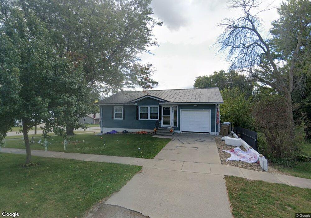
302 W Spring St Strawberry Point, IA 52076
Estimated Value: $143,000 - $182,000
3
Beds
3
Baths
1,120
Sq Ft
$137/Sq Ft
Est. Value
About This Home
This home is located at 302 W Spring St, Strawberry Point, IA 52076 and is currently estimated at $153,394, approximately $136 per square foot. 302 W Spring St is a home located in Clayton County with nearby schools including Starmont Elementary School, Starmont Middle School, and Starmont High School.
Ownership History
Date
Name
Owned For
Owner Type
Purchase Details
Closed on
Oct 27, 2025
Sold by
Neal Nicholas Ray
Bought by
Neal Marci L
Current Estimated Value
Home Financials for this Owner
Home Financials are based on the most recent Mortgage that was taken out on this home.
Original Mortgage
$81,501
Outstanding Balance
$80,629
Interest Rate
5.62%
Mortgage Type
FHA
Estimated Equity
$72,765
Purchase Details
Closed on
Oct 3, 2005
Sold by
The Estate Of Alfred B Streicher
Bought by
Farmer Marci L
Home Financials for this Owner
Home Financials are based on the most recent Mortgage that was taken out on this home.
Original Mortgage
$68,400
Interest Rate
9.37%
Mortgage Type
Adjustable Rate Mortgage/ARM
Create a Home Valuation Report for This Property
The Home Valuation Report is an in-depth analysis detailing your home's value as well as a comparison with similar homes in the area
Purchase History
| Date | Buyer | Sale Price | Title Company |
|---|---|---|---|
| Neal Marci L | -- | Servicelink | |
| Farmer Marci L | $72,000 | None Available |
Source: Public Records
Mortgage History
| Date | Status | Borrower | Loan Amount |
|---|---|---|---|
| Open | Neal Marci L | $81,501 | |
| Previous Owner | Farmer Marci L | $68,400 |
Source: Public Records
Tax History
| Year | Tax Paid | Tax Assessment Tax Assessment Total Assessment is a certain percentage of the fair market value that is determined by local assessors to be the total taxable value of land and additions on the property. | Land | Improvement |
|---|---|---|---|---|
| 2025 | $1,936 | $138,597 | $11,933 | $126,664 |
| 2024 | $1,810 | $119,055 | $10,376 | $108,679 |
| 2023 | $1,790 | $119,055 | $10,376 | $108,679 |
| 2022 | $1,664 | $99,259 | $9,399 | $89,860 |
| 2021 | $1,696 | $99,259 | $9,399 | $89,860 |
| 2020 | $1,696 | $96,448 | $9,399 | $87,049 |
| 2019 | $1,742 | $96,448 | $9,399 | $87,049 |
| 2018 | $1,742 | $95,005 | $9,399 | $85,606 |
| 2017 | $1,738 | $95,005 | $9,399 | $85,606 |
| 2015 | $1,862 | $96,853 | $9,145 | $87,708 |
| 2014 | $1,940 | $96,853 | $9,145 | $87,708 |
Source: Public Records
Map
Nearby Homes
- 210 Park Ave
- 125 W Mission St
- TBD Prospect St
- 423 Commercial St
- 519 Westwood Ave
- 221 E Mission St
- 36654 Belgian Rd
- 36648 Crystal Rd
- 2582 30th St
- 108 S Center St
- 306 & 400 N Chestnut St
- 206 E Union St
- 825 Prospect St
- 682 Fulton St
- 520 High St
- 1673 Firefly Rd
- 6835 80th St
- 1097 Slater Ave
- 1729 162nd Ave
- 100 Hawkeye St
- 304 W Spring St
- 306 W Spring St
- 209 Locust St
- 307 Buffalo St
- 107 Locust St
- 208 Locust St
- 308 W Spring St
- 216 W Spring St
- 110 Locust St
- 305 W Spring St
- 309 Buffalo St
- 105 Locust St
- 217 Buffalo St
- 310 W Spring St
- 307 W Spring St
- 214 W Spring St
- 108 Locust St
- 311 Buffalo St
- 306 Buffalo St
- 103 Locust St
Your Personal Tour Guide
Ask me questions while you tour the home.