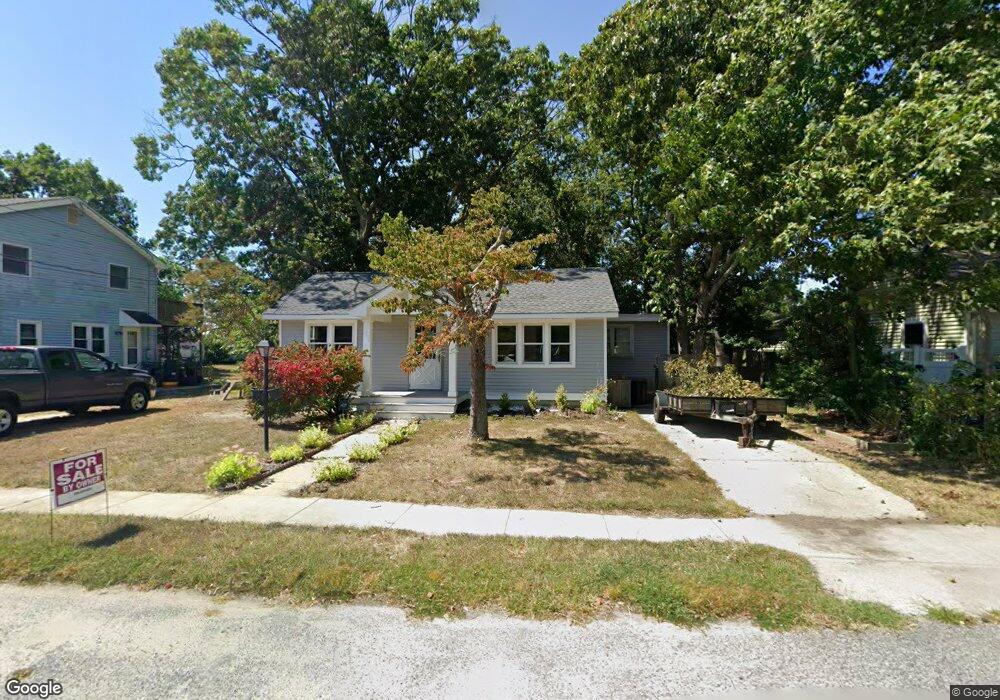
302 Whildam Ave Cape May, NJ 08204
Estimated Value: $353,387 - $510,000
--
Bed
--
Bath
888
Sq Ft
$515/Sq Ft
Est. Value
About This Home
This home is located at 302 Whildam Ave, Cape May, NJ 08204 and is currently estimated at $457,597, approximately $515 per square foot. 302 Whildam Ave is a home located in Cape May County with nearby schools including Carl T. Mitnick School, David C. Douglass Veterans Memorial School, and Maud Abrams School.
Ownership History
Date
Name
Owned For
Owner Type
Purchase Details
Closed on
Feb 19, 2010
Sold by
Hard Pine Investors L L C
Bought by
Franco Mario A and Franco Margaret A
Current Estimated Value
Purchase Details
Closed on
Nov 7, 2003
Sold by
Jordan Donald C
Bought by
Hard Pine Investors Llc
Purchase Details
Closed on
Aug 29, 1997
Sold by
Est Donald G Jordan
Bought by
Jordan Donald C and Jordan Tillie
Home Financials for this Owner
Home Financials are based on the most recent Mortgage that was taken out on this home.
Original Mortgage
$35,000
Interest Rate
7.47%
Create a Home Valuation Report for This Property
The Home Valuation Report is an in-depth analysis detailing your home's value as well as a comparison with similar homes in the area
Home Values in the Area
Average Home Value in this Area
Purchase History
| Date | Buyer | Sale Price | Title Company |
|---|---|---|---|
| Franco Mario A | -- | None Available | |
| Hard Pine Investors Llc | $159,000 | -- | |
| Jordan Donald C | $70,000 | -- |
Source: Public Records
Mortgage History
| Date | Status | Borrower | Loan Amount |
|---|---|---|---|
| Previous Owner | Jordan Donald C | $35,000 |
Source: Public Records
Tax History Compared to Growth
Tax History
| Year | Tax Paid | Tax Assessment Tax Assessment Total Assessment is a certain percentage of the fair market value that is determined by local assessors to be the total taxable value of land and additions on the property. | Land | Improvement |
|---|---|---|---|---|
| 2025 | $3,253 | $160,400 | $116,400 | $44,000 |
| 2024 | $3,253 | $160,400 | $116,400 | $44,000 |
| 2023 | $3,206 | $160,400 | $116,400 | $44,000 |
| 2022 | $3,109 | $160,400 | $116,400 | $44,000 |
| 2021 | $3,016 | $160,400 | $116,400 | $44,000 |
| 2020 | $2,967 | $160,400 | $116,400 | $44,000 |
| 2019 | $2,894 | $160,400 | $116,400 | $44,000 |
| 2018 | $2,825 | $160,400 | $116,400 | $44,000 |
| 2017 | $2,828 | $160,400 | $116,400 | $44,000 |
| 2016 | $2,785 | $160,400 | $116,400 | $44,000 |
| 2015 | $2,695 | $160,400 | $116,400 | $44,000 |
| 2014 | $2,607 | $160,400 | $116,400 | $44,000 |
Source: Public Records
Map
Nearby Homes
- 305 Whildam Ave
- 402 Whildam Ave
- 506 Scotty Blvd Unit 1204
- 507 Scotty Blvd Unit 12
- 702 Gordon Terrace
- 602 Gorham Ave
- 105 Orchard Dr
- 712 Gorham Ave
- 118 Old Mill Dr
- 215 Roseann Ave
- 219 Town Bank Rd
- 66 Beachhurst Dr
- 207 Old Mill Dr
- 236 Roseann Ave
- 1310 Browning Ave
- 508 Adriatic Ave
- 1400 Franklin Ave
- 217 Mindy Ave
- 113 Heidi Ave
- 319 Roseann Ave
- 300 Whildam Ave
- 304 Whildam Ave
- 303 Eldredge Ave
- 305 Eldredge Ave
- 301 Eldredge Ave
- 401 Whittier Ave
- 400 Scott Ave
- 402 Scott Ave
- 403 Whittier Ave
- 404 Scott Ave
- 303 Whildam Ave
- 301 Whildam Ave
- 405 Whittier Ave
- 306 Scott Ave
- 305 Whittier Ave
- 406 Scott Ave
- 304 Scott Ave
- 303 Whittier Ave
- 400 Whittier Ave
- 402 Whittier Ave