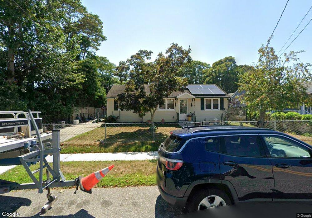
302 Whittier Ave Cape May, NJ 08204
Estimated Value: $347,876 - $586,000
--
Bed
--
Bath
908
Sq Ft
$523/Sq Ft
Est. Value
About This Home
This home is located at 302 Whittier Ave, Cape May, NJ 08204 and is currently estimated at $474,969, approximately $523 per square foot. 302 Whittier Ave is a home located in Cape May County with nearby schools including Carl T. Mitnick School, David C. Douglass Veterans Memorial School, and Maud Abrams School.
Ownership History
Date
Name
Owned For
Owner Type
Purchase Details
Closed on
Apr 2, 2015
Sold by
Brighter Lisa
Bought by
Mcgraw Andrew F and Brighter Mcgraw Lisa
Current Estimated Value
Purchase Details
Closed on
Dec 10, 1999
Sold by
Schultz John
Bought by
Brighter Lisa
Home Financials for this Owner
Home Financials are based on the most recent Mortgage that was taken out on this home.
Original Mortgage
$70,200
Outstanding Balance
$21,893
Interest Rate
7.81%
Estimated Equity
$453,076
Purchase Details
Closed on
Apr 5, 1999
Sold by
Huff Helen
Bought by
Werink Donna and Schultz John
Create a Home Valuation Report for This Property
The Home Valuation Report is an in-depth analysis detailing your home's value as well as a comparison with similar homes in the area
Home Values in the Area
Average Home Value in this Area
Purchase History
| Date | Buyer | Sale Price | Title Company |
|---|---|---|---|
| Mcgraw Andrew F | -- | None Available | |
| Brighter Lisa | $78,000 | -- | |
| Werink Donna | $35,000 | -- |
Source: Public Records
Mortgage History
| Date | Status | Borrower | Loan Amount |
|---|---|---|---|
| Open | Brighter Lisa | $70,200 |
Source: Public Records
Tax History Compared to Growth
Tax History
| Year | Tax Paid | Tax Assessment Tax Assessment Total Assessment is a certain percentage of the fair market value that is determined by local assessors to be the total taxable value of land and additions on the property. | Land | Improvement |
|---|---|---|---|---|
| 2025 | $3,338 | $164,600 | $117,200 | $47,400 |
| 2024 | $3,338 | $164,600 | $117,200 | $47,400 |
| 2023 | $3,290 | $164,600 | $117,200 | $47,400 |
| 2022 | $3,190 | $164,600 | $117,200 | $47,400 |
| 2021 | $3,094 | $164,600 | $117,200 | $47,400 |
| 2020 | $3,045 | $164,600 | $117,200 | $47,400 |
| 2019 | $2,969 | $164,600 | $117,200 | $47,400 |
| 2018 | $2,899 | $164,600 | $117,200 | $47,400 |
| 2017 | $2,902 | $164,600 | $117,200 | $47,400 |
| 2016 | $2,857 | $164,600 | $117,200 | $47,400 |
| 2015 | $2,765 | $164,600 | $117,200 | $47,400 |
| 2014 | -- | $164,600 | $117,200 | $47,400 |
Source: Public Records
Map
Nearby Homes
- 305 Whildam Ave
- 402 Whildam Ave
- 506 Scotty Blvd Unit 1204
- 507 Scotty Blvd Unit 1301
- 507 Scotty Blvd Unit 12
- 602 Gorham Ave
- 702 Gordon Terrace
- 105 Orchard Dr
- 712 Gorham Ave
- 118 Old Mill Dr
- 207 Old Mill Dr
- 215 Roseann Ave
- 219 Town Bank Rd
- 66 Beachhurst Dr
- 236 Roseann Ave
- 508 Adriatic Ave
- 3911 Bayshore Rd
- 1400 Franklin Ave
- 217 Mindy Ave
- 1310 Browning Ave
- 300 Whittier Ave
- 400 Gorham Ave
- 306 Whittier Ave
- 401 Whildam Ave
- 402 Gorham Ave
- 303 Whittier Ave
- 301 Whittier Ave
- 403 Whildam Ave
- 202 Whittier Ave
- 305 Whittier Ave
- 403 Gorham Ave
- 404 Gorham Ave
- 405 Gorham Ave
- 405 Whildam Ave
- 304 Gorham Ave
- 203 Whittier Ave
- 400 Whittier Ave
- 407 Gorham Ave
- 400 Whildam Ave
- 303 Holmes Ave