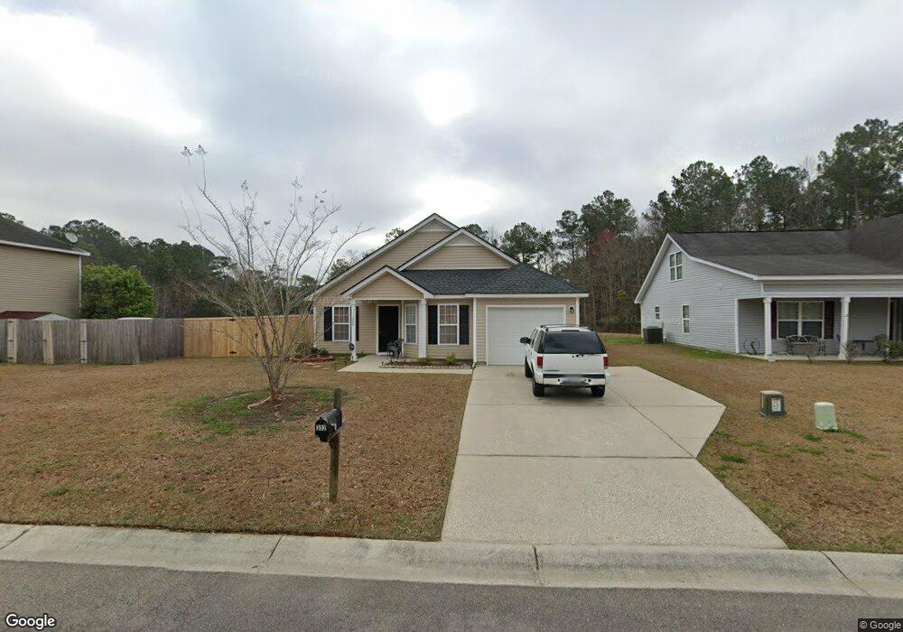
302 Winford Ct Moncks Corner, SC 29461
Estimated Value: $266,000 - $295,000
3
Beds
2
Baths
1,135
Sq Ft
$245/Sq Ft
Est. Value
About This Home
This home is located at 302 Winford Ct, Moncks Corner, SC 29461 and is currently estimated at $278,576, approximately $245 per square foot. 302 Winford Ct is a home located in Berkeley County with nearby schools including Whitesville Elementary School, Berkeley Middle School, and Berkeley High School.
Ownership History
Date
Name
Owned For
Owner Type
Purchase Details
Closed on
Sep 16, 2009
Sold by
Bfh Builders Llc
Bought by
Taylor Albert
Current Estimated Value
Home Financials for this Owner
Home Financials are based on the most recent Mortgage that was taken out on this home.
Original Mortgage
$132,551
Outstanding Balance
$86,335
Interest Rate
5.11%
Mortgage Type
Future Advance Clause Open End Mortgage
Estimated Equity
$192,241
Create a Home Valuation Report for This Property
The Home Valuation Report is an in-depth analysis detailing your home's value as well as a comparison with similar homes in the area
Home Values in the Area
Average Home Value in this Area
Purchase History
| Date | Buyer | Sale Price | Title Company |
|---|---|---|---|
| Taylor Albert | $129,900 | -- | |
| Bfh Builders Llc | $35,700 | -- |
Source: Public Records
Mortgage History
| Date | Status | Borrower | Loan Amount |
|---|---|---|---|
| Open | Bfh Builders Llc | $132,551 | |
| Closed | Taylor Albert | $132,551 |
Source: Public Records
Tax History Compared to Growth
Tax History
| Year | Tax Paid | Tax Assessment Tax Assessment Total Assessment is a certain percentage of the fair market value that is determined by local assessors to be the total taxable value of land and additions on the property. | Land | Improvement |
|---|---|---|---|---|
| 2025 | $774 | $162,006 | $45,920 | $116,086 |
| 2024 | $734 | $6,480 | $1,837 | $4,643 |
| 2023 | $734 | $6,480 | $1,837 | $4,643 |
| 2022 | $736 | $5,635 | $1,492 | $4,143 |
| 2021 | $754 | $5,630 | $1,492 | $4,143 |
| 2020 | $763 | $5,635 | $1,492 | $4,143 |
| 2019 | $758 | $5,635 | $1,492 | $4,143 |
| 2018 | $699 | $4,900 | $1,200 | $3,700 |
| 2017 | $700 | $4,900 | $1,200 | $3,700 |
| 2016 | $715 | $4,900 | $1,200 | $3,700 |
| 2015 | $2,131 | $4,900 | $1,200 | $3,700 |
| 2014 | $654 | $4,900 | $1,200 | $3,700 |
| 2013 | -- | $4,900 | $1,200 | $3,700 |
Source: Public Records
Map
Nearby Homes
- 607 Lazy Hill Rd
- 220 New Oak Ln
- 240 Groomsville Rd
- Emerson Plan at High Point at Foxbank
- 426 Treeline Dr
- 508 Eagleview Dr
- 519 Eagleview Dr
- 117 Forest Springs Rd
- 221 Old Grove Ave
- 312 Red Leaf Blvd
- 420 Eagleview Dr
- 327 Hillman Trail Dr
- 661 Black Pine Rd
- 659 Black Pine Rd
- 655 Black Pine Rd
- 293 Red Leaf Blvd
- 408 Treeline Dr
- 332 Southern Sugar Ave
- 627 Black Pine Rd
- 342 Silverleaf Ln
- 304 Winford Ct
- 200 Blackstone Dr
- 300 Winford Ct
- 306 Winford Ct
- 303 Winford Ct
- 196 Blackstone Dr
- 305 Winford Ct
- 199 Blackstone Dr
- 309 Winford Ct
- 308 Winford Ct
- 194 Blackstone Dr
- 201 Blackstone Dr
- 197 Blackstone Dr
- 203 Blackstone Dr
- 195 Blackstone Dr
- 310 Winford Ct
- 192 Blackstone Dr
- 313 Winford Ct
- 193 Blackstone Dr
- 312 Winford Ct