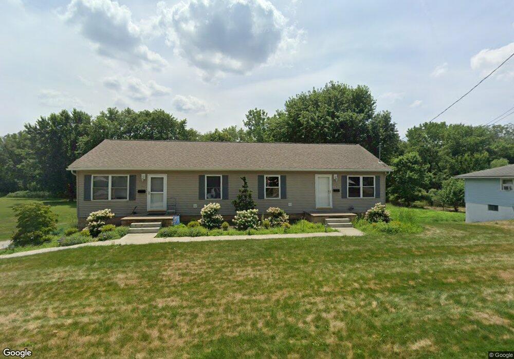
302 Woodard Ave Louisville, OH 44641
Estimated Value: $203,000 - $234,000
4
Beds
2
Baths
1,560
Sq Ft
$137/Sq Ft
Est. Value
About This Home
This home is located at 302 Woodard Ave, Louisville, OH 44641 and is currently estimated at $214,403, approximately $137 per square foot. 302 Woodard Ave is a home located in Stark County with nearby schools including Louisville High School and St. Thomas Aquinas High School & Middle School.
Ownership History
Date
Name
Owned For
Owner Type
Purchase Details
Closed on
Dec 7, 2010
Sold by
Ohio Legacy Bank Na
Bought by
Davis Mark W
Current Estimated Value
Home Financials for this Owner
Home Financials are based on the most recent Mortgage that was taken out on this home.
Original Mortgage
$65,600
Outstanding Balance
$43,363
Interest Rate
4.23%
Mortgage Type
New Conventional
Estimated Equity
$171,040
Purchase Details
Closed on
Sep 9, 2009
Sold by
Foltz Property & Investment Inc
Bought by
Ohio Legacy Bank Na
Purchase Details
Closed on
Mar 7, 2001
Sold by
Starr George D
Bought by
Foltz Property & Investment Inc
Create a Home Valuation Report for This Property
The Home Valuation Report is an in-depth analysis detailing your home's value as well as a comparison with similar homes in the area
Home Values in the Area
Average Home Value in this Area
Purchase History
| Date | Buyer | Sale Price | Title Company |
|---|---|---|---|
| Davis Mark W | $82,000 | Cornerstone Real Estate Titl | |
| Ohio Legacy Bank Na | $90,000 | Attorney | |
| Foltz Property & Investment Inc | $24,500 | Mk Title Agency Of Stark Cou |
Source: Public Records
Mortgage History
| Date | Status | Borrower | Loan Amount |
|---|---|---|---|
| Open | Davis Mark W | $65,600 |
Source: Public Records
Tax History Compared to Growth
Tax History
| Year | Tax Paid | Tax Assessment Tax Assessment Total Assessment is a certain percentage of the fair market value that is determined by local assessors to be the total taxable value of land and additions on the property. | Land | Improvement |
|---|---|---|---|---|
| 2025 | -- | $60,940 | $17,990 | $42,950 |
| 2024 | -- | $60,940 | $17,990 | $42,950 |
| 2023 | $2,112 | $47,990 | $12,670 | $35,320 |
| 2022 | $2,118 | $47,990 | $12,670 | $35,320 |
| 2021 | $2,124 | $47,990 | $12,670 | $35,320 |
| 2020 | $1,703 | $41,650 | $11,410 | $30,240 |
| 2019 | $1,712 | $45,090 | $15,230 | $29,860 |
| 2018 | $1,846 | $45,090 | $15,230 | $29,860 |
| 2017 | $1,710 | $40,290 | $12,850 | $27,440 |
| 2016 | $1,745 | $40,290 | $12,850 | $27,440 |
| 2015 | $1,750 | $40,290 | $12,850 | $27,440 |
| 2014 | $1,816 | $38,890 | $12,390 | $26,500 |
| 2013 | $912 | $38,890 | $12,390 | $26,500 |
Source: Public Records
Map
Nearby Homes
- 300 Kennedy St
- 428 Honeycrisp Dr NE
- 3047 Mcintosh Dr NE
- 432 Honeycrisp Dr NE
- 2962 Mcintosh Dr NE
- 2963 Mcintosh Dr NE
- 430 Honeycrisp Dr NE
- 2957 Mcintosh Dr NE
- 325 Lincoln Ave
- 614 Reno Dr
- 316 E Reno Dr
- 524 Glenbar St
- 910 Crosswyck Cir
- 1170 Winding Ridge Ave
- 1149 Sturbridge Dr
- 1175 Sturbridge Dr
- 107 E Broad St
- 0 Glenbar St
- 5474 Ravenna Ave
- 204 E Broad St
- 312 Woodard Ave
- 210 Woodard Ave
- 316Woodard Ave
- 212 Woodard Ave
- 404 Woodard Ave
- 215 Woodard Ave
- 309 Woodard Ave
- 211 Woodard Ave
- 203 Woodard Ave
- 315 Woodard Ave
- 403 Woodard Ave
- 418 Woodward Ave
- 803 N Chapel St
- 409 Woodard Ave
- 807 N Chapel St
- 815 N Chapel St
- 413 Woodard Ave
- 419 Woodard Ave
- 130 Frana Clara St
- 150 Frana Clara St Unit 8