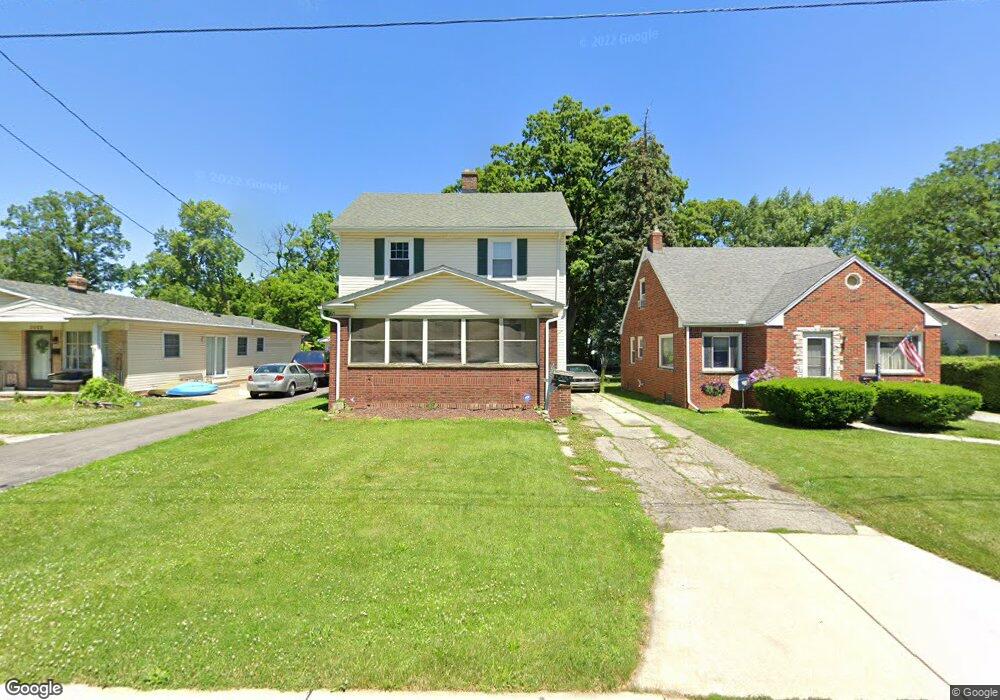
3020 Colby Dr Toledo, OH 43614
Beverly NeighborhoodEstimated Value: $164,000 - $195,000
3
Beds
1
Bath
1,415
Sq Ft
$126/Sq Ft
Est. Value
About This Home
This home is located at 3020 Colby Dr, Toledo, OH 43614 and is currently estimated at $178,228, approximately $125 per square foot. 3020 Colby Dr is a home located in Lucas County with nearby schools including Beverly Elementary School, Bowsher High School, and Our Lady of Perpetual Help School.
Ownership History
Date
Name
Owned For
Owner Type
Purchase Details
Closed on
Oct 12, 2007
Sold by
Semproch David J and Mcguckin Kathryn
Bought by
Niedbalski Michael R
Current Estimated Value
Home Financials for this Owner
Home Financials are based on the most recent Mortgage that was taken out on this home.
Original Mortgage
$119,500
Outstanding Balance
$75,069
Interest Rate
6.33%
Mortgage Type
Purchase Money Mortgage
Estimated Equity
$103,159
Purchase Details
Closed on
Sep 27, 1996
Sold by
Moon Mark A
Bought by
Otto Dave J and Otto Martine M
Home Financials for this Owner
Home Financials are based on the most recent Mortgage that was taken out on this home.
Original Mortgage
$75,510
Interest Rate
7.97%
Mortgage Type
New Conventional
Purchase Details
Closed on
Dec 29, 1989
Sold by
Thomasson James and Thomasson Susan G
Create a Home Valuation Report for This Property
The Home Valuation Report is an in-depth analysis detailing your home's value as well as a comparison with similar homes in the area
Home Values in the Area
Average Home Value in this Area
Purchase History
| Date | Buyer | Sale Price | Title Company |
|---|---|---|---|
| Niedbalski Michael R | $119,500 | Chicago Title Insurance Co | |
| Otto Dave J | $83,900 | -- | |
| -- | $60,900 | -- |
Source: Public Records
Mortgage History
| Date | Status | Borrower | Loan Amount |
|---|---|---|---|
| Open | Niedbalski Michael R | $119,500 | |
| Previous Owner | Otto Dave J | $75,510 |
Source: Public Records
Tax History Compared to Growth
Tax History
| Year | Tax Paid | Tax Assessment Tax Assessment Total Assessment is a certain percentage of the fair market value that is determined by local assessors to be the total taxable value of land and additions on the property. | Land | Improvement |
|---|---|---|---|---|
| 2024 | $1,357 | $45,360 | $6,405 | $38,955 |
| 2023 | $2,342 | $37,380 | $5,915 | $31,465 |
| 2022 | $2,344 | $37,380 | $5,915 | $31,465 |
| 2021 | $2,405 | $37,380 | $5,915 | $31,465 |
| 2020 | $2,263 | $31,080 | $4,935 | $26,145 |
| 2019 | $2,204 | $31,080 | $4,935 | $26,145 |
| 2018 | $2,174 | $31,080 | $4,935 | $26,145 |
| 2017 | $2,170 | $28,945 | $6,510 | $22,435 |
| 2016 | $2,159 | $82,700 | $18,600 | $64,100 |
| 2015 | $2,138 | $82,700 | $18,600 | $64,100 |
| 2014 | $1,821 | $28,950 | $6,510 | $22,440 |
| 2013 | $1,821 | $28,950 | $6,510 | $22,440 |
Source: Public Records
Map
Nearby Homes
- 4113 S Detroit Ave
- 3054 S Byrne Rd
- 4213 Rugby Dr
- 4320 Beverly Dr
- 4224 Beverly Dr
- 2930 S Byrne Rd
- 3128 Penrose Ave
- 3111 Astor Ave
- 3214 Escott Ave
- 3626 Greenlawn Ct
- 4669 S Detroit Ave
- 3264 Escott Ave
- 2134 Tedrow Rd
- 3157 Dorian Dr
- 3619 Prairie Ave
- 4232 River Rd
- 3148 Glanzman Rd
- 3627 Golfgate Dr
- 4215 River Rd
- 2651 Tully Ave
- 3016 Colby Dr
- 3022 Colby Dr
- 4136 S Detroit Ave
- 4142 S Detroit Ave
- 4132 S Detroit Ave
- 3036 Colby Dr
- 4130 S Detroit Ave
- 4206 S Detroit Ave
- 3015 Colby Dr
- 2935 Copland Blvd
- 2931 Copland Blvd
- 3003 Copland Blvd
- 4212 S Detroit Ave
- 2927 Copland Blvd
- 3042 Colby Dr
- 3027 Colby Dr
- 3009 Copland Blvd
- 2923 Copland Blvd
- 4126 S Detroit Ave
- 3015 Copland Blvd