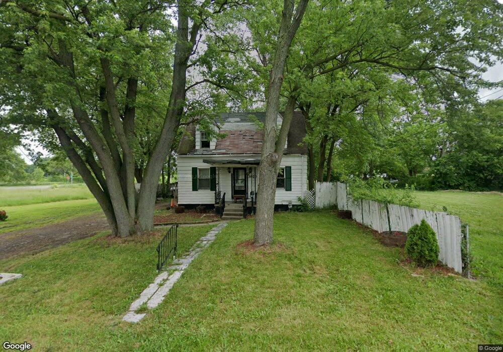
3020 E St Toledo, OH 43608
Lagrange NeighborhoodEstimated Value: $62,570 - $83,000
4
Beds
2
Baths
1,266
Sq Ft
$58/Sq Ft
Est. Value
About This Home
This home is located at 3020 E St, Toledo, OH 43608 and is currently estimated at $73,143, approximately $57 per square foot. 3020 E St is a home located in Lucas County with nearby schools including Spring Elementary School, Woodward High School, and Imagine Environmental Science Academy.
Ownership History
Date
Name
Owned For
Owner Type
Purchase Details
Closed on
Sep 8, 2021
Sold by
Davis Mayshyia
Bought by
Cole Leticia
Current Estimated Value
Purchase Details
Closed on
Sep 4, 2021
Sold by
Pinson Mark
Bought by
Davis Mayshiya
Purchase Details
Closed on
Aug 5, 1992
Sold by
Clark Keith E
Purchase Details
Closed on
Jan 21, 1988
Sold by
Clark Keith E
Purchase Details
Closed on
Jan 7, 1988
Sold by
Clark Keith E
Purchase Details
Closed on
Dec 30, 1987
Sold by
Clark Madelane M
Create a Home Valuation Report for This Property
The Home Valuation Report is an in-depth analysis detailing your home's value as well as a comparison with similar homes in the area
Home Values in the Area
Average Home Value in this Area
Purchase History
| Date | Buyer | Sale Price | Title Company |
|---|---|---|---|
| Cole Leticia | -- | None Available | |
| Davis Mayshiya | $300 | None Available | |
| -- | $2,000 | -- | |
| -- | -- | -- | |
| -- | -- | -- | |
| -- | -- | -- |
Source: Public Records
Tax History
| Year | Tax Paid | Tax Assessment Tax Assessment Total Assessment is a certain percentage of the fair market value that is determined by local assessors to be the total taxable value of land and additions on the property. | Land | Improvement |
|---|---|---|---|---|
| 2025 | $15,507 | $12,355 | $1,925 | $10,430 |
| 2024 | $14,231 | $12,355 | $1,925 | $10,430 |
| 2023 | $589 | $7,035 | $1,190 | $5,845 |
| 2022 | $569 | $7,035 | $1,190 | $5,845 |
| 2021 | $181 | $7,035 | $1,190 | $5,845 |
| 2020 | $208 | $6,510 | $1,085 | $5,425 |
| 2019 | $195 | $6,510 | $1,085 | $5,425 |
| 2018 | $198 | $6,510 | $1,085 | $5,425 |
| 2017 | $4,556 | $4,865 | $1,855 | $3,010 |
| 2016 | $3,903 | $13,900 | $5,300 | $8,600 |
| 2015 | $202 | $13,900 | $5,300 | $8,600 |
| 2014 | $23 | $4,870 | $1,860 | $3,010 |
| 2013 | $15 | $4,870 | $1,860 | $3,010 |
Source: Public Records
Map
Nearby Homes
- 1016 E Central Ave
- 3220 Maher St
- 1101 Ketcham Ave
- 3233 Jeannette Ave
- 3225 Maher St
- 1027 Ketcham Ave
- 1102 Woodward Ave
- 3256 Jeannette Ave
- 3250 Brigham St
- 2816 A St
- 915 Ketcham Ave
- 910 Woodward Ave
- 3333 Beaumont Dr
- 2927 Stickney Ave
- 1817 Ridgewood Ave
- 1821 Ridgewood Ave
- 1548 Booth Ave
- 1816 Clay Ave
- 815 Woodward Ave
- 735 Maywood Ave
- 3016 E St
- 1307 Bronson Ave
- 1301 Bronson Ave
- 1311 Bronson Ave
- 1315 Bronson Ave
- 3019 F St
- 3015 F St
- 1319 Bronson Ave
- 1323 Bronson Ave
- 3021 E St
- 3015 E St
- 1231 Bronson Ave
- 1327 Bronson Ave
- 1225 Bronson Ave
- 1331 Bronson Ave
- 1233 E Central Ave
- 1221 Bronson Ave
- 1307 E Central Ave
- 1303 E Central Ave
- 1235 E Central Ave
Your Personal Tour Guide
Ask me questions while you tour the home.