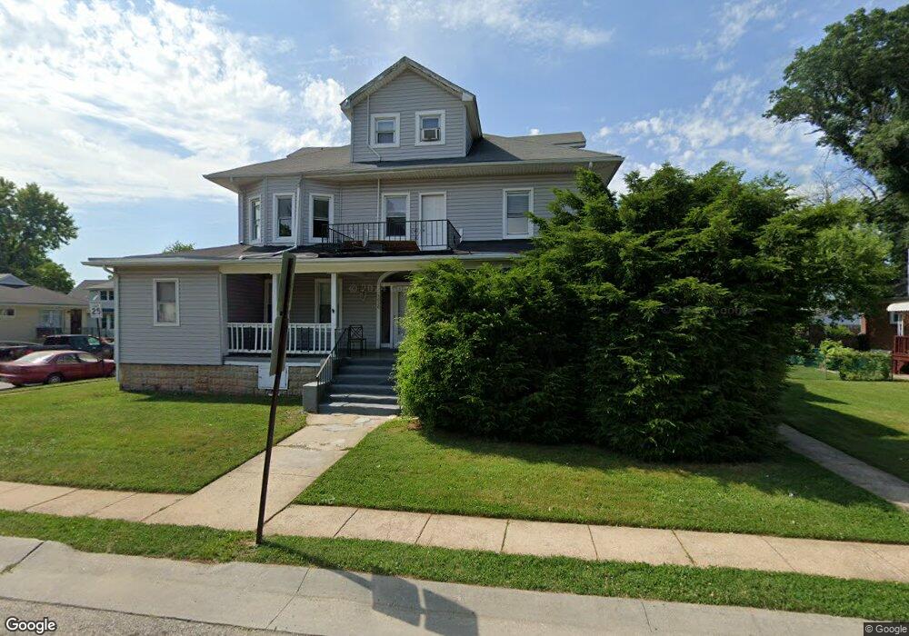
3020 Manhattan Ave Unit 1 Baltimore, MD 21215
Glen NeighborhoodEstimated Value: $373,169 - $544,000
3
Beds
1
Bath
3,438
Sq Ft
$136/Sq Ft
Est. Value
About This Home
This home is located at 3020 Manhattan Ave Unit 1, Baltimore, MD 21215 and is currently estimated at $468,042, approximately $136 per square foot. 3020 Manhattan Ave Unit 1 is a home located in Baltimore City with nearby schools including Cross Country Elementary School, Booker T. Washington Middle School, and Forest Park High School.
Ownership History
Date
Name
Owned For
Owner Type
Purchase Details
Closed on
Apr 15, 2025
Sold by
Abler Steve and Abler Lisa
Bought by
3020 Manhattan Partners Llc
Current Estimated Value
Purchase Details
Closed on
Jan 20, 2022
Sold by
Steve Abler
Bought by
3020 Manhattan Partners Llc
Purchase Details
Closed on
Feb 22, 2010
Sold by
Mccallum Delano R
Bought by
Abler Steve and Abler Lisa
Home Financials for this Owner
Home Financials are based on the most recent Mortgage that was taken out on this home.
Original Mortgage
$108,281
Interest Rate
5.17%
Mortgage Type
New Conventional
Create a Home Valuation Report for This Property
The Home Valuation Report is an in-depth analysis detailing your home's value as well as a comparison with similar homes in the area
Home Values in the Area
Average Home Value in this Area
Purchase History
| Date | Buyer | Sale Price | Title Company |
|---|---|---|---|
| 3020 Manhattan Partners Llc | -- | Abode Settlement Group | |
| 3020 Manhattan Partners Llc | -- | Abode Settlement Group | |
| 3020 Manhattan Partners Llc | $75,000 | None Listed On Document | |
| 3020 Manhattan Partners Llc | $75,000 | None Listed On Document | |
| Abler Steve | $144,375 | -- |
Source: Public Records
Mortgage History
| Date | Status | Borrower | Loan Amount |
|---|---|---|---|
| Previous Owner | Abler Steve | $108,281 |
Source: Public Records
Tax History Compared to Growth
Tax History
| Year | Tax Paid | Tax Assessment Tax Assessment Total Assessment is a certain percentage of the fair market value that is determined by local assessors to be the total taxable value of land and additions on the property. | Land | Improvement |
|---|---|---|---|---|
| 2025 | $6,119 | $265,733 | -- | -- |
| 2024 | $6,119 | $260,500 | $63,200 | $197,300 |
| 2023 | $6,017 | $256,167 | $0 | $0 |
| 2022 | $5,943 | $251,833 | $0 | $0 |
| 2021 | $5,841 | $247,500 | $63,200 | $184,300 |
| 2020 | $5,841 | $247,500 | $63,200 | $184,300 |
| 2019 | $5,813 | $247,500 | $63,200 | $184,300 |
| 2018 | $5,841 | $247,500 | $63,200 | $184,300 |
| 2017 | $5,671 | $240,300 | $0 | $0 |
| 2016 | $3,394 | $233,100 | $0 | $0 |
| 2015 | $3,394 | $225,900 | $0 | $0 |
| 2014 | $3,394 | $198,367 | $0 | $0 |
Source: Public Records
Map
Nearby Homes
- 5715 Simmonds Ave
- 5710 Highgate Dr
- 2905 Whitney Ave
- 5805 Key Ave
- 5609 Woodcrest Ave
- 5804 Woodcrest Ave
- 5709 Woodcrest Ave
- 5823 Ethelbert Ave
- 3318 Avondale Ave
- 3403 W Rogers Ave
- 5904 Winner Ave
- 3310 Glen Ave
- 3411 Glen Ave
- 3312 Glen Ave
- 3408 Avondale Ave
- 5309 Ethelbert Ave
- 5306 Ethelbert Ave
- 5919 Winner Ave
- 5313 Hamlin Ave
- 3111 Parkington Ave
- 3020 Manhattan Ave
- 3020 Manhattan Ave Unit 3
- 3020 Manhattan Ave Unit 2B
- 3020 Manhattan Ave Unit 2A
- 3016 Manhattan Ave
- 5703 Bland Ave
- 3014 Manhattan Ave
- 5611 Bland Ave
- 5705 Bland Ave
- 5702 Bland Ave
- 5700 Bland Ave
- 5704 Bland Ave
- 5708 Simmonds Ave
- 3012 Manhattan Ave
- 5609 Bland Ave
- 5710 Simmonds Ave
- 5706 Bland Ave
- 5707 Bland Ave
- 3013 Manhattan Ave
- 5610 Bland Ave