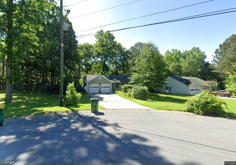
3020 River Station Dr Unit 4 Woodstock, GA 30188
Union Hill NeighborhoodEstimated Value: $344,000 - $385,529
3
Beds
2
Baths
1,412
Sq Ft
$258/Sq Ft
Est. Value
About This Home
This home is located at 3020 River Station Dr Unit 4, Woodstock, GA 30188 and is currently estimated at $364,765, approximately $258 per square foot. 3020 River Station Dr Unit 4 is a home located in Cherokee County with nearby schools including Arnold Mill Elementary School, Mill Creek Middle School, and River Ridge High School.
Ownership History
Date
Name
Owned For
Owner Type
Purchase Details
Closed on
Jan 31, 2017
Sold by
Macris Bobby J
Bought by
464 Michael Road Llc
Current Estimated Value
Purchase Details
Closed on
Nov 15, 2016
Sold by
Billy J
Bought by
Macris Bobby J and Macris Dorothy M
Purchase Details
Closed on
Aug 30, 1996
Sold by
Dalton Paulette Sue Freeman
Bought by
Marshall Billy J Nina
Create a Home Valuation Report for This Property
The Home Valuation Report is an in-depth analysis detailing your home's value as well as a comparison with similar homes in the area
Home Values in the Area
Average Home Value in this Area
Purchase History
| Date | Buyer | Sale Price | Title Company |
|---|---|---|---|
| 464 Michael Road Llc | -- | -- | |
| Macris Bobby J | $175,000 | -- | |
| Marshall Billy J Nina | $102,900 | -- |
Source: Public Records
Mortgage History
| Date | Status | Borrower | Loan Amount |
|---|---|---|---|
| Closed | Marshall Billy J Nina | $0 |
Source: Public Records
Tax History Compared to Growth
Tax History
| Year | Tax Paid | Tax Assessment Tax Assessment Total Assessment is a certain percentage of the fair market value that is determined by local assessors to be the total taxable value of land and additions on the property. | Land | Improvement |
|---|---|---|---|---|
| 2025 | $3,795 | $144,496 | $38,400 | $106,096 |
| 2024 | $3,539 | $136,176 | $36,480 | $99,696 |
| 2023 | $3,485 | $134,096 | $34,560 | $99,536 |
| 2022 | $3,277 | $124,696 | $28,320 | $96,376 |
| 2021 | $2,742 | $96,576 | $21,600 | $74,976 |
| 2020 | $2,406 | $84,672 | $16,800 | $67,872 |
| 2019 | $2,268 | $79,800 | $16,800 | $63,000 |
| 2018 | $2,047 | $71,600 | $16,800 | $54,800 |
| 2017 | $1,970 | $170,900 | $16,800 | $51,560 |
| 2016 | $511 | $141,800 | $14,880 | $41,840 |
| 2015 | $511 | $135,700 | $14,880 | $39,400 |
| 2014 | $465 | $123,400 | $13,920 | $35,440 |
Source: Public Records
Map
Nearby Homes
- 585 Arnold Mill Rd
- 4006 N Arnold Mill Rd
- 4020 N Arnold Mill Rd
- 414 Spring View Dr
- 624 Arnold Mill Rd
- 124 Riverside Ln
- 338 Westover Dr
- 202 Little River Way
- 632 Arnold Mill Rd
- 436 Silver Brook Dr
- 321 Burdock Trace
- 636 Arnold Mill Rd
- 200 Dahlia Dr
- 236 Persimmon Dr
- 427 Silver Brook Dr
- 112 Sunnybrook Ln
- 499 Bishop Ln
- 522 Watercress Dr
- 907 Andover Ct
- 3022 River Station Dr
- 2303 River Station Terrace Unit 4
- 3025 River Station Dr
- 2202 River Woods Way
- 3023 River Station Dr Unit Lot 276
- 3023 River Station Dr
- 3018 River Station Dr
- 2305 River Station Terrace
- 3021 River Station Dr
- 2204 River Woods Way Unit 4
- 1624 Barnes Rd
- 3019 River Station Dr Unit 4
- 2108 Tranquility Ct
- 3016 River Station Dr
- 2307 River Station Terrace Unit 269
- 2307 River Station Terrace
- 2304 River Station Terrace
- 2106 Tranquility Ct Unit 4
- 2206 River Woods Way
- 2110 Tranquility Ct