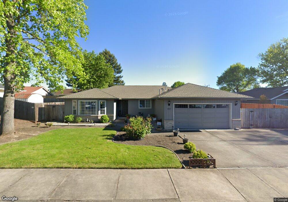
3021 Adams Cir Medford, OR 97504
Estimated Value: $440,291 - $493,000
4
Beds
2
Baths
1,953
Sq Ft
$235/Sq Ft
Est. Value
About This Home
This home is located at 3021 Adams Cir, Medford, OR 97504 and is currently estimated at $458,073, approximately $234 per square foot. 3021 Adams Cir is a home located in Jackson County with nearby schools including Abraham Lincoln Elementary School, Hedrick Middle School, and North Medford High School.
Ownership History
Date
Name
Owned For
Owner Type
Purchase Details
Closed on
Feb 26, 2025
Sold by
Taylor Linda K
Bought by
Linda Kay Taylor Revocable Trust and Taylor
Current Estimated Value
Purchase Details
Closed on
Aug 11, 2009
Sold by
Taylor Robert F and Taylor Linda K
Bought by
Taylor Linda K
Home Financials for this Owner
Home Financials are based on the most recent Mortgage that was taken out on this home.
Original Mortgage
$196,000
Interest Rate
4.25%
Mortgage Type
New Conventional
Create a Home Valuation Report for This Property
The Home Valuation Report is an in-depth analysis detailing your home's value as well as a comparison with similar homes in the area
Home Values in the Area
Average Home Value in this Area
Purchase History
| Date | Buyer | Sale Price | Title Company |
|---|---|---|---|
| Linda Kay Taylor Revocable Trust | -- | None Listed On Document | |
| Taylor Linda K | -- | None Available |
Source: Public Records
Mortgage History
| Date | Status | Borrower | Loan Amount |
|---|---|---|---|
| Previous Owner | Taylor Linda K | $196,000 |
Source: Public Records
Tax History Compared to Growth
Tax History
| Year | Tax Paid | Tax Assessment Tax Assessment Total Assessment is a certain percentage of the fair market value that is determined by local assessors to be the total taxable value of land and additions on the property. | Land | Improvement |
|---|---|---|---|---|
| 2025 | $3,907 | $269,370 | $80,340 | $189,030 |
| 2024 | $3,907 | $261,530 | $78,010 | $183,520 |
| 2023 | $3,787 | $253,920 | $75,740 | $178,180 |
| 2022 | $3,695 | $253,920 | $75,740 | $178,180 |
| 2021 | $3,599 | $246,530 | $73,540 | $172,990 |
| 2020 | $3,523 | $239,350 | $71,400 | $167,950 |
| 2019 | $3,440 | $225,620 | $67,300 | $158,320 |
| 2018 | $3,352 | $219,050 | $65,330 | $153,720 |
| 2017 | $3,291 | $219,050 | $65,330 | $153,720 |
| 2016 | $3,313 | $206,480 | $61,570 | $144,910 |
| 2015 | $3,184 | $206,480 | $61,570 | $144,910 |
| 2014 | $3,128 | $194,640 | $58,040 | $136,600 |
Source: Public Records
Map
Nearby Homes
- 3024 Adams Cir
- 2965 Bailey Ave
- 3050 Delta Waters Rd
- 2995 Bedford Cir
- 2769 Stonebrook Dr
- 2738 Stonebrook Dr
- 3018 Sky Lakes Dr
- 3056 Umpqua Dr
- 3054 Levi Cir
- 3069 Milhoan Dr
- 3358 Viewpoint Dr
- 3362 Viewpoint Dr
- 2966 Delta Waters Rd
- 3129 Monaco Ct
- 3321 Oneida Cir
- 3137 Monaco Ct
- 2616 Stonebrook Dr
- 3093 Paul Cir
- 2583 Newmar Ln
- 3145 Monaco Ct
- 3023 Adams Cir
- 3015 Adams Cir
- 2911 Bailey Ave
- 2863 Leonard Ave
- 2841 Leonard Ave
- 3018 Adams Cir
- 2871 Leonard Ave
- 2825 Leonard Ave
- 3030 Adams Cir
- 3016 Adams Cir
- 3025 Adams Cir
- 3029 Adams Cir
- 3034 Adams Cir
- 3031 Adams Cir
- 2941 Bailey Ave
- 2811 Leonard Ave
- 2955 Bailey Ave
- 2939 Bailey Ave
- 2854 Leonard Ave
- 2947 Bailey Ave