3021 Highway 52 E Bethpage, TN 37022
Bethpage NeighborhoodEstimated Value: $356,000 - $582,000
About This Home
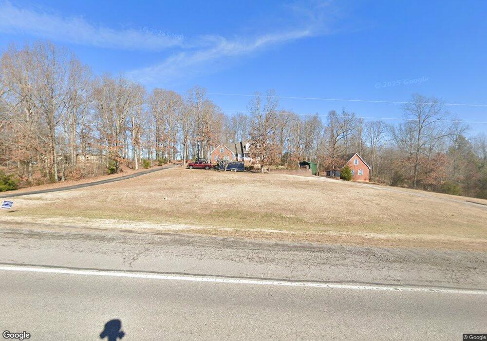
This home is located at 3021 Highway 52 E, Bethpage, TN 37022 and is currently estimated at $480,000, approximately $232 per square foot. 3021 Highway 52 E is a home located in Sumner County with nearby schools including North Sumner Elementary School, Westmoreland Middle School, and Westmoreland High School.
Ownership History
We collect this data history from publicly available records. To have your information removed, we recommend requesting removal directly through your county’s website.
Purchase Details
Purchase Details
Purchase Details
Purchase Details
Home Financials for this Owner
Home Financials are based on the most recent Mortgage that was taken out on this home.Purchase Details
Home Values in the Area
Average Home Value in this Area
Purchase History
We collect this data history from publicly available records. To have your information removed, we recommend requesting removal directly through your county’s website.
| Date | Buyer | Sale Price | Title Company |
|---|---|---|---|
| -- | None Available | ||
| -- | None Available | ||
| $28,000 | -- | ||
| $171,000 | -- | ||
| $25,000 | -- |
Mortgage History
We collect this data history from publicly available records. To have your information removed, we recommend requesting removal directly through your county’s website.
| Date | Status | Borrower | Loan Amount |
|---|---|---|---|
| Open | $559,170 | ||
| Previous Owner | $126,000 |
Tax History
We collect this data history from publicly available records. To have your information removed, we recommend requesting removal directly through your county’s website.
| Year | Tax Paid | Tax Assessment Tax Assessment Total Assessment is a certain percentage of the fair market value that is determined by local assessors to be the total taxable value of land and additions on the property. | Land | Improvement |
|---|---|---|---|---|
| 2025 | $1,912 | $134,525 | $32,275 | $102,250 |
| 2024 | $1,912 | $134,525 | $32,275 | $102,250 |
| 2023 | $1,566 | $69,550 | $9,825 | $59,725 |
| 2022 | $1,573 | $69,550 | $9,825 | $59,725 |
| 2021 | $1,573 | $69,550 | $9,825 | $59,725 |
| 2020 | $1,573 | $69,550 | $9,825 | $59,725 |
| 2019 | $1,573 | $0 | $0 | $0 |
| 2018 | $1,300 | $0 | $0 | $0 |
| 2017 | $1,300 | $0 | $0 | $0 |
| 2016 | $1,302 | $0 | $0 | $0 |
| 2015 | -- | $0 | $0 | $0 |
| 2014 | -- | $0 | $0 | $0 |
Map
- 160 Blackey Bandy Rd
- 2995 Oak Grove Church Rd
- 435 Blackey Bandy Rd
- 450 Paul Thompson Rd
- 3358 Hwy 52 E
- 405 Fairfield Rd
- 4161 Dobbins Pike
- 0 Mt Vernon Rd W Unit 5
- 0 Mt Vernon Rd W Unit 3
- 0 Mt Vernon Rd W Unit 1
- 0 Mt Vernon Rd W Unit 6
- 0 Mt Vernon Rd W Unit 2
- 0 Mt Vernon Rd W Unit 4
- 1212 Mount Vernon Rd
- 3883 Dobbins Pike
- 0 Bob Perry Rd Unit 8
- 0 Bob Perry Rd Unit 9
- 0 Bob Perry Rd Unit 7
- 1129 Reese Rd Unit 1
- 1141 Reese Rd Unit 2
- 3027 Highway 52 E
- 3002 Highway 52 E
- 156 Blackey Bandy Rd
- 140 Blackey Bandy Rd
- 136 Blackey Bandy Rd
- 170 Blackey Bandy Rd
- 3030 Highway 52 E
- 3030 Highway 52 E
- 3053 Highway 52 E
- 210 Blackey Bandy Rd
- 3082 Highway 52 E
- 127 Blackey Bandy Rd
- 120 Blackey Bandy Rd
- 123 Blackey Bandy Rd
- 119 Blackey Bandy Rd
- 3041 Oak Grove Church Rd
- 3025 Oak Grove Church Rd
- 3019 Oak Grove Church Rd
- 115 Blackey Bandy Rd
- 135 Blackey Bandy Rd
Ask me questions while you tour the home.