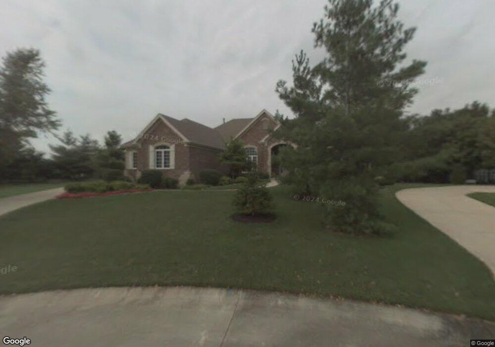
3021 Sandy Point Ct Lake Saint Louis, MO 63367
Estimated Value: $705,000 - $781,751
4
Beds
4
Baths
2,510
Sq Ft
$298/Sq Ft
Est. Value
About This Home
This home is located at 3021 Sandy Point Ct, Lake Saint Louis, MO 63367 and is currently estimated at $748,250, approximately $298 per square foot. 3021 Sandy Point Ct is a home located in St. Charles County with nearby schools including Green Tree Elementary School, Wentzville South Middle School, and Timberland High School.
Ownership History
Date
Name
Owned For
Owner Type
Purchase Details
Closed on
Oct 15, 2012
Sold by
Cook Ronald D and Cook Karen L
Bought by
Simpson Charles W and Simpson Lori L
Current Estimated Value
Home Financials for this Owner
Home Financials are based on the most recent Mortgage that was taken out on this home.
Original Mortgage
$396,000
Outstanding Balance
$274,734
Interest Rate
3.55%
Mortgage Type
New Conventional
Estimated Equity
$473,516
Purchase Details
Closed on
Mar 24, 2012
Sold by
Cook Ronald D and Cook Karen L
Bought by
Cook Ronald D and Cook Karen L
Purchase Details
Closed on
Aug 26, 1998
Sold by
Cross Homes Inc
Bought by
Cook Ronald D
Home Financials for this Owner
Home Financials are based on the most recent Mortgage that was taken out on this home.
Original Mortgage
$227,000
Interest Rate
6.9%
Create a Home Valuation Report for This Property
The Home Valuation Report is an in-depth analysis detailing your home's value as well as a comparison with similar homes in the area
Home Values in the Area
Average Home Value in this Area
Purchase History
| Date | Buyer | Sale Price | Title Company |
|---|---|---|---|
| Simpson Charles W | $495,000 | Ust | |
| Cook Ronald D | -- | Integrity Land Title Co Inc | |
| Cook Ronald D | -- | -- |
Source: Public Records
Mortgage History
| Date | Status | Borrower | Loan Amount |
|---|---|---|---|
| Open | Simpson Charles W | $396,000 | |
| Previous Owner | Cook Ronald D | $227,000 |
Source: Public Records
Tax History Compared to Growth
Tax History
| Year | Tax Paid | Tax Assessment Tax Assessment Total Assessment is a certain percentage of the fair market value that is determined by local assessors to be the total taxable value of land and additions on the property. | Land | Improvement |
|---|---|---|---|---|
| 2025 | $8,271 | $134,115 | -- | -- |
| 2023 | $8,269 | $120,540 | $0 | $0 |
| 2022 | $6,496 | $94,227 | $0 | $0 |
| 2021 | $6,503 | $94,227 | $0 | $0 |
| 2020 | $6,590 | $91,824 | $0 | $0 |
| 2019 | $6,113 | $91,824 | $0 | $0 |
| 2018 | $5,948 | $85,203 | $0 | $0 |
| 2017 | $5,919 | $85,203 | $0 | $0 |
| 2016 | $5,548 | $78,515 | $0 | $0 |
| 2015 | $5,390 | $78,515 | $0 | $0 |
| 2014 | $4,745 | $71,008 | $0 | $0 |
Source: Public Records
Map
Nearby Homes
- 740 High Point Dr
- 732 High Hill Ct
- 1007 Bridle Spur Ln
- 908 Bridle Spur Ln
- 1
- Waverly Plan at Chateau De Fond Du Lac
- Bridgeport Plan at Chateau De Fond Du Lac
- Bradford Plan at Chateau De Fond Du Lac
- Kingston Plan at Chateau De Fond Du Lac
- Nottingham Plan at Chateau De Fond Du Lac
- Monaco Plan at Chateau De Fond Du Lac
- 1
- 1 Monaco @ Chateau de Fond Du Lac
- 1003 Hunter Ln
- 1 Waverly @ Chateau de Fond Du Lac
- 1
- 34 Saint Cloud Ct
- 6 Sailor Ct
- 2 Royale Dr
- 0 Unknown Unit MIS22063871
- 3031 Sandy Point Ct
- 3011 Sandy Point Ct
- 4040 Key Harbour Dr
- 3023 N Fox Hound Dr
- 7 Log Cabin Ln
- 4030 Key Harbour Dr
- 3001 Sandy Point Ct
- 8 Log Cabin Ln
- 6 Log Cabin Ln
- 4050 Key Harbour Dr
- 3032 Sandy Point Ct
- 3022 Sandy Point Ct
- 3012 Sandy Point Ct
- 9 Log Cabin Ln
- 4020 Key Harbour Dr
- 4010 Key Harbour Dr
- 10 Log Cabin Ln
- 3002 Sandy Point Ct
- 4 Oakmont Ct
- 2 Oakmont Ct